 The
Dixie Highway was a 1910s and 1920s network of roads that connected the
Midwest to the South, running from Sault Sainte Marie, Michigan to Miami,
Florida. In a day where good roads were not a given, the Dixie was formed
to pave the way, literally, to bring tourists to the South. To learn more,
please see Robert V. Droz’s
outstanding Dixie Highway site, which includes
a
1923 map of the route. The
Dixie Highway was a 1910s and 1920s network of roads that connected the
Midwest to the South, running from Sault Sainte Marie, Michigan to Miami,
Florida. In a day where good roads were not a given, the Dixie was formed
to pave the way, literally, to bring tourists to the South. To learn more,
please see Robert V. Droz’s
outstanding Dixie Highway site, which includes
a
1923 map of the route.
The Dixie neatly crossed Indiana, entering from the north at South Bend
and from the west near Covington, converging at Indianapolis, and then
exiting to the east at Richmond and to the south at New Albany. Indiana
folded all of the Dixie into its state highway network in the 1920s. Later
road improvements have left a few old alignments behind, but you can drive
almost all of the original Dixie Highway in Indiana today.
I’ve covered a lot of Indiana’s Dixie on past road trips. The segment from
South Bend to Indianapolis followed the
Michigan Road, which I explored in 2008. The segment from Indianapolis
to Richmond followed the
National Road, which I explored in 2009. And when I explored
State Road 37 from Indianapolis to Bloomington in 2007, I was
unwittingly also following the Dixie Highway. So it seems only natural
that I finish driving Indiana’s Dixie.
In the Dixie’s heyday, the section between the Illinois line and
Indianapolis was part of the western “mainline” that began in Chicago.
Indiana erected
State Road 34 signs along the route in 1927, but took them all down in
1953 and erected
US 136 signs instead. Naturally, over the years the road was improved,
occasionally leaving old alignments behind. And then in the 1960s I-74 was
built along the same corridor, forever relegating US 136 simply to connect
the small towns along it.
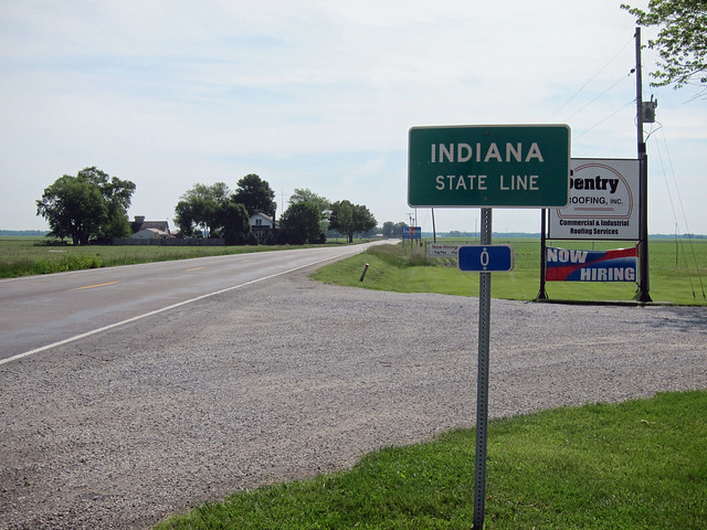
Small towns and old alignments always entice me, so on a pleasant Saturday
in June I drove out to where US 136 enters Indiana and headed back east,
exploring all the way.
You can follow along by using the navigation links at the bottom of the
page. Click Next to begin, or click the link for the county that interests
you.
|