The Michigan Road |
||||
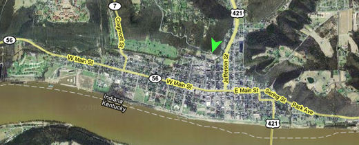
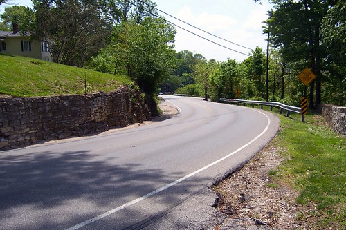
Jefferson CountyMadison is Indiana's first city. It is said to have been founded in 1809, although the first white settler came in 1808, the city was laid out in 1810, and lots were first sold in 1811. This is also the year Jefferson County was founded. Madison rose to prominence between the 1830s and 1850s because of river, road, and rail. Advances in steamboat technology, the building of the Michigan Road, and the building of the state's first railroad from Madison through Indianapolis to Lafayette made Madison a hub of commerce. Much of old Madison was built during these boom years. But as the railroad overtook river and road as the best way to move goods and people, other rail lines appeared in Indiana and neighboring states. Madison ceased to be a hub, and started to decline in the 1850s. With no significant new industries, and the new construction that goes with it, coming to Madison, the city maintained the buildings it had. This has left the old city nearly intact today, with most of downtown and many other homes and businesses around the city listed on the National Historic Register. Sources: To see historic Madison, follow this side trip. The Michigan Road begins along the north edge of old Madison, about six blocks north of the Ohio River. It begins at West Street's north end, at the green arrowhead on the map below. The Michigan Road is the curvy road that runs west from the arrowhead.
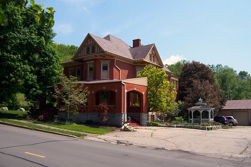
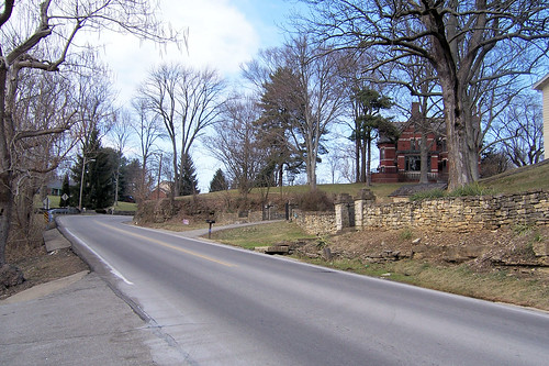
This house, on the southeast corner where West St. meets the Michigan Road, seems to anchor the road.
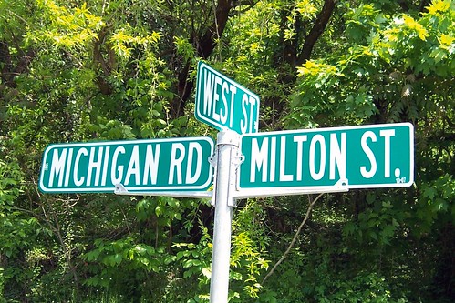
Many who followed the Michigan Road to northern Indiana's opportunities did so by following West St. north from the river to where it ended and the Michigan Road began.
And so begins the Michigan Road.
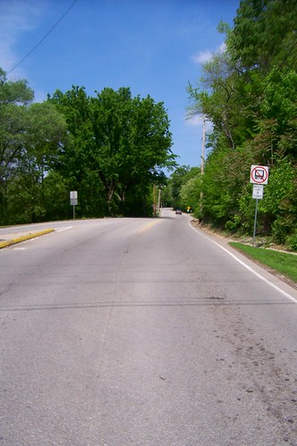
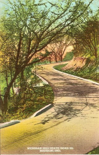
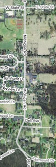
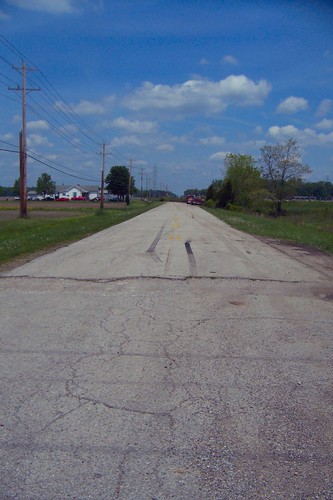
The Michigan Road is straight and flat over most of its course – but it sure doesn't start out that way, as this map shows.
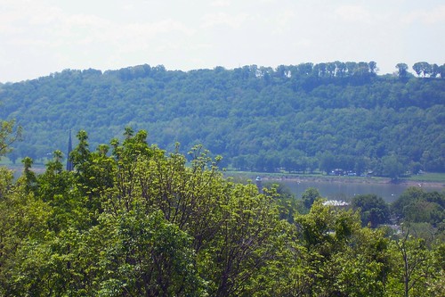
This shaky video captures what it's like to drive this segment of the Michigan Road. What the video doesn't show is how spectacular the views are along this segment. Beyond the first set of curves, where the road turns to head north, you can pull over and take in the view of the river. The trees obscure old Madison.
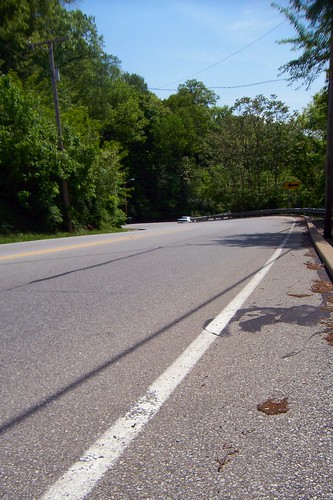
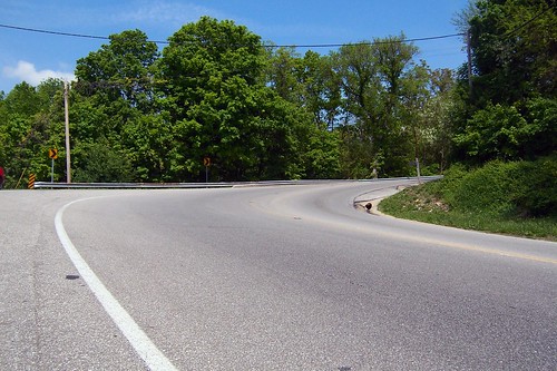
From this lookout, here's the Michigan Road southbound.
And here's the road northbound from the same spot.
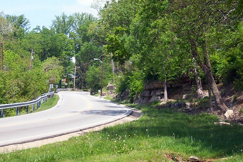
After making that curve, if you look closely, you'll see a wall of rock behind the trees on the right.
This postcard from the 1940s looks to be from about the same spot.
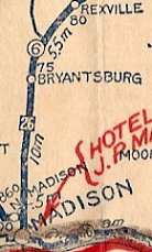
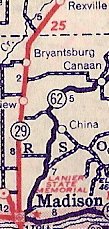
The state began maintaining some of the Michigan Road as a highway no later than about 1921. This segment was first called State Road 6, but in a 1928 renumbering it became State Road 29. Except for a detour through Versailles and Osgood, State Road 29 followed the Michigan Road all the way to Logansport. When US 421 was extended into Indiana in 1951, it took over State Road 29's route to 31 miles south of Logansport. Those 31 miles of the Michigan Road are still State Road 29 today. After US 421 was rebuilt as four lanes in eastern Madison, the first four miles of the Michigan Road became just a city and county road. Sources: This excerpt from a Rand McNally map of no later than 1921 shows the Michigan Road marked State Road 6. The dark square with the number 26 in it corresponds to the Michigan Road in a legend of named auto trails that appears on the map. Next to it is a 1937 Rand McNally (Standard Oil) map excerpt that shows the same segment marked State Road 29, and then a 1959 State Highway Department of Indiana map excerpt showing it labeled US 421. On all three maps, as the highway veers east from Bryantsburg, halfway to Rexville the original Michigan Road turns left off the highway.
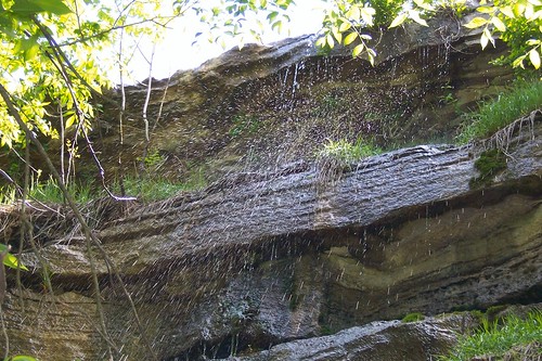
Back to the rock wall. At several spots along the wall, water sprays from the rock.
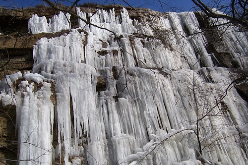
In the winter, this water freezes, as this photo shows.
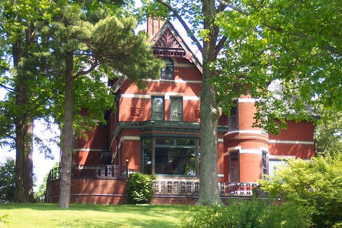
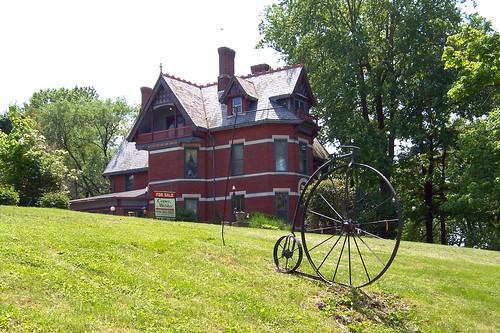
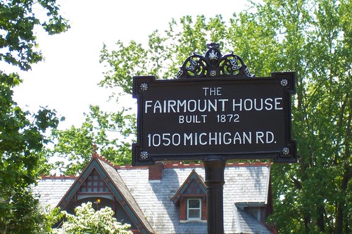
Just around the curve from here stands the Fairmount House, built in 1872.
The house is currently for sale! (Here's what it looked like in the 1930s.)
I was taken by this imposing structure and lingered here for quite a while.
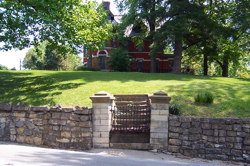
When this house was built, which was before automobiles, visitors might have walked up the hill and approached the house using these steps and a path that once surely led from there to the front door. Today, walking along the Michigan Road here is dangerous. Cars routinely exceed the speed limit along this narrow and winding segment, as I learned walking it to take all these photographs. I could feel a rush of air as each one whizzed by while I took these photos. A fellow on a moped even stopped to tell me he thought I was nuts for being on foot here.
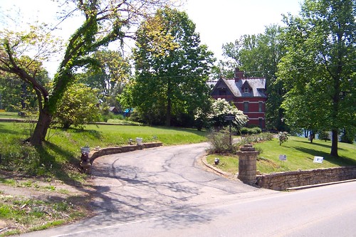
Today, visitors drive in along this driveway.
Along the driveway, a small sign announces the house.
This photo shows the Michigan Road southbound from in front of the Fairmount House. Notice the retaining wall; it looks very old. It is present in this 1930s photo, which was taken about where the guardrail ends in the photo below. The driveway in the 1930s photo leads to the yellow house in the photo below.
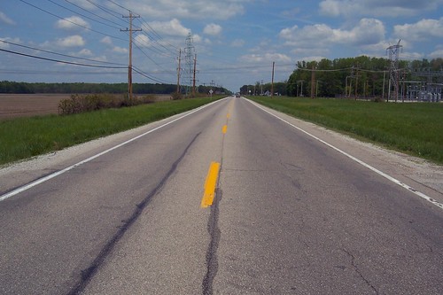
Beyond the Fairmount House, the Michigan Road straightens and heads straight north for the next few miles.
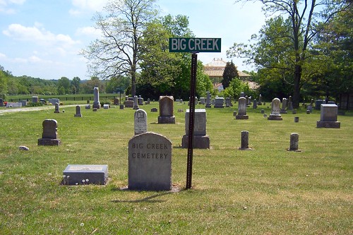
Many cemeteries lie along the Michigan Road. It's not surprising; the road brought people who built towns on it or farmed near it; these people lived and died near the road and so it's appropriate that they're buried along it. But the first graves encountered today along the road are of people who lived and died as far as 10 miles away from the road. In 1940, the US Army built the Jefferson Proving Ground on 55,000 acres of land that had, until then, held farms and towns. Homes, churches, and schools were simply left behind, but the Army moved every cemetery within the JPG to a spot along the Michigan Road not quite four miles south of JPG's south border. Each has a short sign, like what you'd see on a street corner, announcing the place from where these graves came.
Can you imagine the job of moving all these graves?
Everyone here has been at rest for at least 58 years, but flowers are still being left on many of these graves. Somebody still remembers.
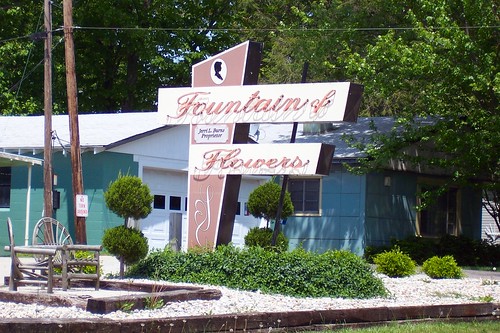
Conveniently located across from these cemeteries is the Fountain of Flowers shop and its neon sign.
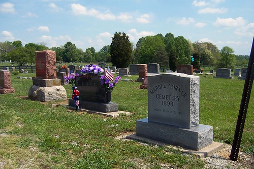
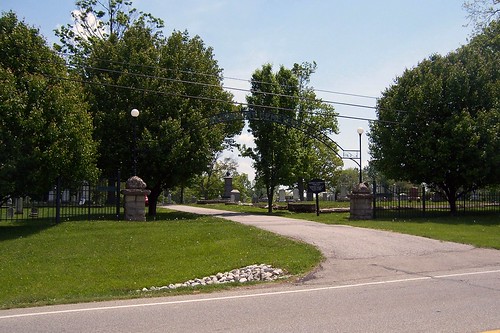
Just north of the displaced JPG cemeteries is the Fairmount Cemetery, on this site since 1846.
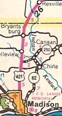
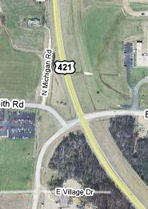
North of the cemetery, the road intersects with State Road 62. Until the mid 1990s, this was State Road 107, which turned north and followed the Michigan Road until US 421 merged with it. On the map below, the Michigan Road is the north-south road on the left. Source:
This photo shows the Michigan Road curving to where it meets US 421.
The Michigan Road, of course, originally went straight through. You can see remnants of the old road on this map.
This is what the abandoned section looks like today. It provides access to the building on the left. Notice how the utility poles follow the old road.
This is US 421 just north of where it merges into the Michigan Road's path.
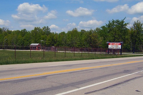
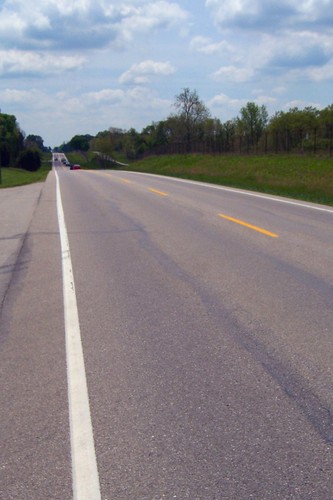
Shortly, a fence appears on the west side of the road. It is the boundary of a former army installation, the Jefferson Proving Ground, which consumes 55,000 acres in Jefferson, Ripley, and Jennings Counties. Established in 1940 as World War II loomed, the facility tested ammunition, firing its first round in 1941 and its last in 1995. Until the government moved in, this land had been farmed by four generations of Hoosiers. These farmers had little, but built towns and schools and churches and cemeteries. The counties, presumably, built roads and bridges to connect them. And so they lived, but when the Army moved them off their land almost all of this infrastructure was left behind. Some of it still stands, such as this school and this stone bridge. Sources: This is JPG's main gate. Today, most of the facility has been repurposed as the Big Oaks National Wildlife Refuge and you can visit it. Plenty of "munitions and explosives of concern" – that is, unexploded bombs, bullets, shells, etc. – remain within, so you'll need to watch a safety video and sign a release before you can go in.
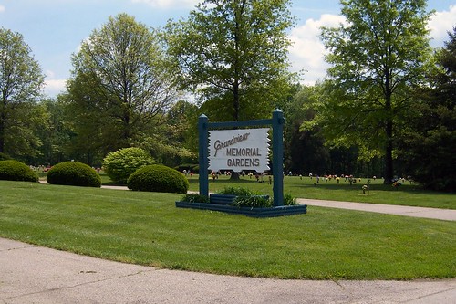
The Grandview Memorial Gardens is just north of the JPG gate. All of its markers are flush with the ground.
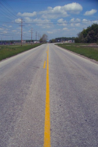
Looking southbound from this cemetery, US 421 rolls gently. JPG's rusted fence is hard to make out along the west side of the road.
| ||||
|
||||
|
Created 5 June 2008. Updated 28 February 2009, 2 January 2012. |
||||


