The Michigan Road |
||||
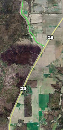
Ripley CountyRipley County, named for War of 1812 General Eleazer Wheelock Ripley, was formed in 1818. Source: Most of the Michigan Road in Ripley County was never added to the modern state highway system. US 421 leaves the Michigan Road shortly after entering Ripley County and doesn't rejoin it until shortly before leaving the county. Just before the road leaves Jefferson County, it curves to the east a bit; just after it enters Ripley County, to stay on the Michigan Road you have to follow a side road, as this map shows. I highlighted the Michigan Road as a green line on the map.
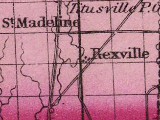
This excerpt from an 1870 atlas suggests that a fork once existed where the road now curves east, and the Michigan Road ran straight north and briefly through what is now the Jefferson Proving Ground. The map shows the east fork, now US 421, running through Rexville and the west fork, the Michigan Road, running more northerly. The only hitch is that the fork actually would have been just south of the county line in Jefferson County. But if this is a simple matter of mapmaker error in locating the fork, then that at some point about two miles of the original route were abandoned for the current configuration. If you view an aerial map of this area at maximum zoom, you can see spots of what might have been the road along the line where the road would have been.
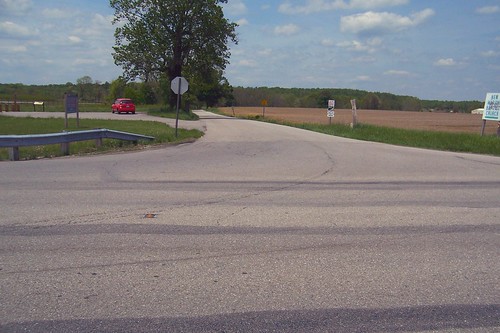
Source: US 421 continues straight towards Versailles and Osgood. During the early 20th century, somehow the US 421 route became the modern Michigan Road, and was even signed as such. The real Michigan Road gets very little notice today as it provides an intimate view to a great deal of farmland and passes through a very small town. To see the Michigan Road auto trail through Versailles and Osgood, follow this side trip. Here's where the Michigan Road turns off US 421.
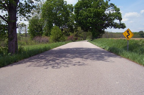
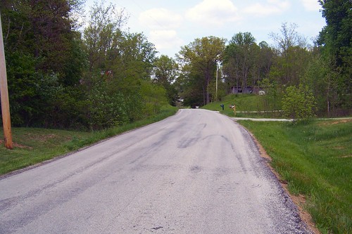
Turning onto the "old" Michigan Road, you immediately feel like you've stepped out into the country. Except for the road having been widened to two lanes and paved, this landscape has probably changed little in 100 years.
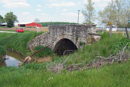
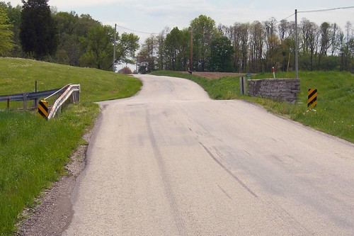
Shortly after turning onto this segment, but before the Michigan Road turns north, a stone one-lane bridge appears, as this video shows. I found nothing on the bridge that tells when it was built, but I guess late 1800s.
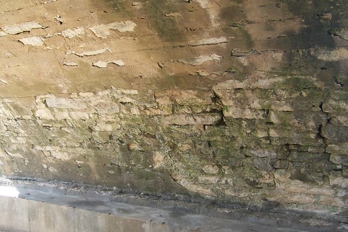
The bridge looks good for its age, although the bridge footers show obvious modern repair work. Under the bridge, it's obvious a sealant was applied at some point, but it did not seem to help much.
The bridge's deck appeared solid. I wonder whether the deck was originally stone.
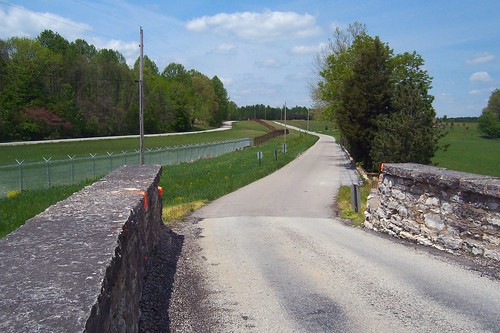
Here's the view from the bridge. Notice JPG's perimeter road just inside its fence. This photo is a bit misleading that it makes the road look as wide as the bridge. In reality, two cars can pass on the road, but would more than rub elbows on the bridge.
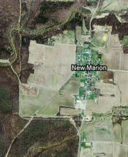
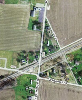
About five miles north of the bridge, the JPG fence pulls away and disappears, and then the road enters little New Marion, as this map shows.
This old house stands on the southwest corner of 4th and Main.
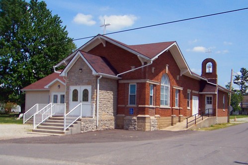
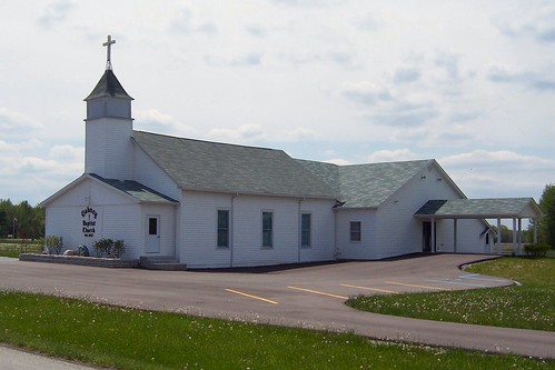
On the northeast corner of 3rd and Main stands the St. Magdalene Catholic Church. Its original building stood a few miles away inside what is now the Jefferson Proving Ground. When the Army took over in 1941, the church's cemetery moved to the Michigan Road north of Madison, while the congregation rebuilt here.
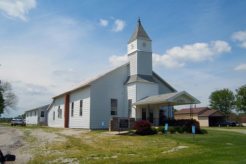
This interview with a woman who lived in New Marion during World War II tells of when the church was moved: There was a big catholic church, it was St. Magdalene and they moved that, all the cemetery, all the plots, dug them all up, the stone and everything, and the people had no say so, they were just told we'll give you so much money for your land and you get out, and you had a certain amount of time to do it, and so neighbors, who had knew each other for years and generations were scattered everywhere. She also talked about what it was like living next to JPG during the war: When we were in high school, and when we, after the war started, and they used this area, this Jefferson Proving Ground to test ammunition. They dropped bombs from airplanes, so it was a very noisy time. It was uh, we could sit on our back step at home and it was like fireworks all the time, and you could see them dropping the bombs, and flares would go up, and the noise was so bad that it would break windows in our house and in the town where we lived, and it would knock flowers out of windows, and you could hear the bombs go off, so you were always aware that there was a war going on... Just north of 1st St. stands the New Marion Baptist Church. Its building has two dates on it, 1835 and 1868.
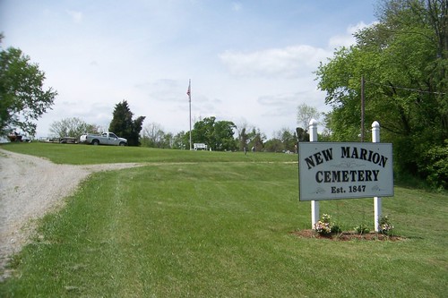
Just north of town lies the New Marion Cemetery, which some sources say is associated with the Baptist Church.
After driving so many miles in the country, it's a bit of a surprise to come upon US 50, one of the original U.S. highways running over 3,000 miles from Maryland to California. A Michigan Road historical marker stands on the southeast corner of the intersection. It needs to be restored.
Just past US 50 the Michigan Road crosses the Ohio and Mississippi railroad track, where the town of Dabney once stood.
A bit north of the tracks is the Dabney Baptist Church, the only reminder of the old town. The church started in nearby Otter Village in 1852, but moved here in 1854 to be near the railroad. This building was completed in 1885. Sources:
Here's a southbound shot of the road just north of Dabney.
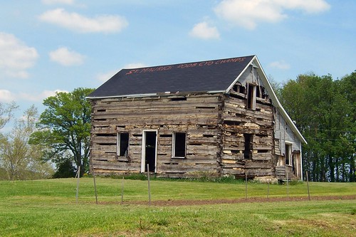
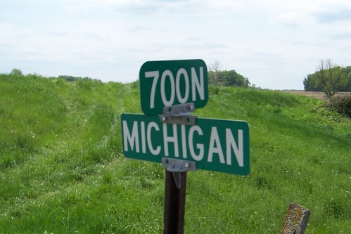
As the road nears Napoleon, somebody spray-painted "St. Maurice 2008 CYO Champs" on the roof of this curious building, which stands on the southeast corner of 700N.
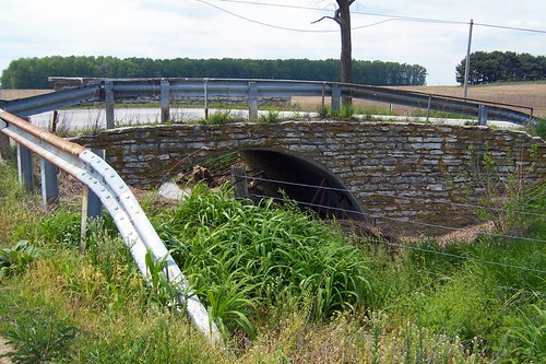
This stone culvert (or is it a very small bridge?) is just beyond 700N.
I wonder if this side used to be as tall as the other, but the stones above roadway level were removed at some point.
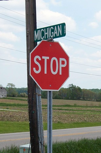
Even this far out in the country, the signs faithfully remember the road's heritage.
Here's a southbound shot of the road over the stone culvert.
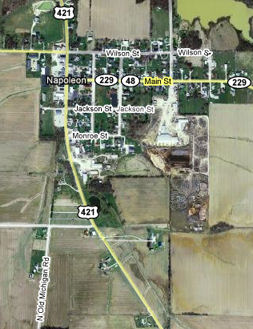
When the Michigan Road reaches the south end of Napoleon, it makes a hard right and quickly ends at US 421. The map labels the road as 850N, but it is signed Michigan Road. Notice that if you follow the Michigan Road's path straight north, it meets US 421 somewhere north of Jackson St. My guess is that it used to do just that, but was abandoned after the road that is now US 421 was built.
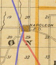
This excerpt from an 1856 Indiana atlas in the David Rumsey collection, supports my theory. I've highlighted the Michigan Road in blue and the road from Versailles and Osgood that became US 421 in red.
Source: North of the turn, the road becomes a gravel path briefly, as this southbound photo shows.
It provides access to the Lutheran Cemetery. Past the cemetery's north edge, the gravel becomes two-track briefly and then the road disappears. I would like someday to explore along this corridor for clues.
Here's where the road ends at US 421.
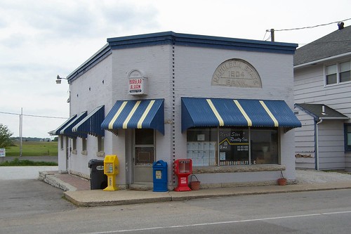
Napoleon was platted in 1820 with an east-west main street that is State Road 229 today. The Michigan Road is Madison St. Source: Check out the burglar alarm above the door of the 1904 Napoleon State Bank building on the northwest corner of Main and Madison.
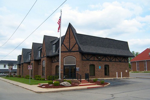
The current Napoleon State Bank stands on the southeast corner. This bank has four branches in nearby towns and has managed to stay independent, which is no mean feat today. Source:
I ducked down Main Street for a minute, where I found the 1838 Central House, a former stop for people driving hogs from Indianapolis to Cincinnati along an early stagecoach route. It is used today for the occasional play or musical. Sources:
Back on the Michigan Road, this building houses the Bonaparte's Retreat restaurant.
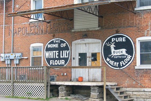
On the southwest corner of Wilson St. stands this flour mill, about which I have so far been able to find out nothing.
What's really interesting about this building is seeing the two new signs painted on it with all the old ones long fading.
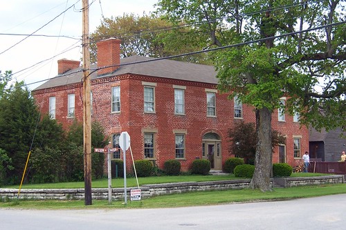
The only White Lily flour I have been able to find information about is pretty much a Southern institution, well known for making the most tender biscuits. But that White Lily flour was, until 2006, made exclusively in Knoxville, Tennessee. On the northwest corner of Wilson St. is this very large old house.
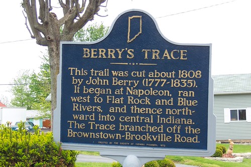
The old house stands at the east end of Berry's Trace, later known as Brownstown Road. It ran west to at least the east fork of the White River, where it joined a "three-notch" road that ran from Indianapolis to the falls of the Ohio River. I haven't been able to figure out Berry's Trace's route for certain. Sources:
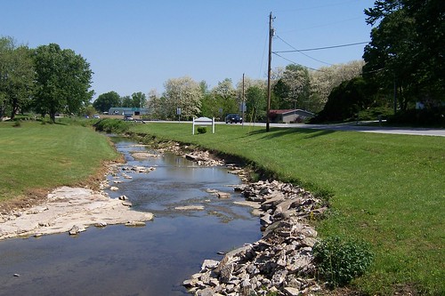
Heading north out of Napoleon, this little creek comes out from behind a gas station and runs alongside the Michigan Road.
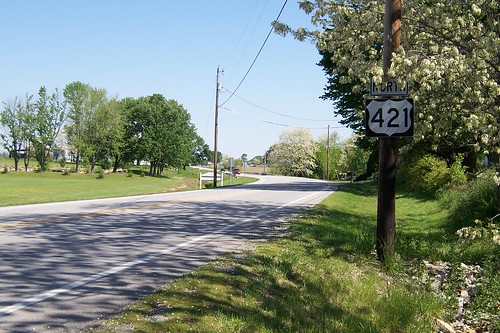
Directly across the street, drivers are reassured they're still on US 421 as they leave town.
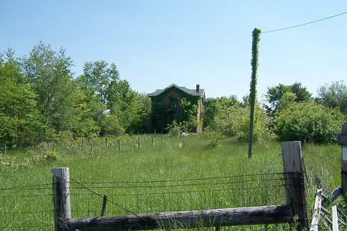
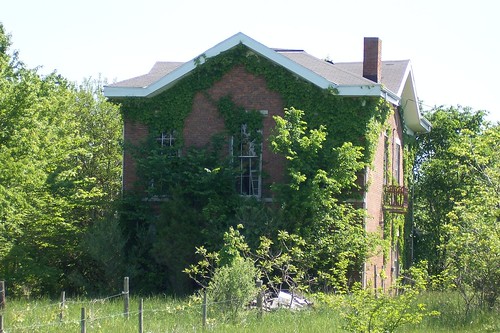
From Napoleon, it's a short distance to the Decatur County line. Just before you get there, if you don't keep your eyes peeled you'll miss this old house on the right. It appears to be abandoned.
Here's a closer look at the house.
|
||||
|
||||
|
Created 18 June 2008. Updated 13 March 2009, 2 January 2012. |
||||


