The Michigan Road |
||||
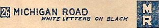
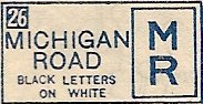
Side trip: The Michigan Road Auto TrailAt the turn of the 20th century, many roads were dirt and wide enough only for a horse and buggy. They washed out and became impassable in the rain. But large portions, perhaps all, of the Michigan Road had been bought by gravel companies after 1850, which surfaced them in gravel and charged a toll for traveling on them through at least the 1890s. Source: By 1880, bicyclists nationwide began to organize and agitate for improved roads that would let them enjoy their bicycles more. By the early 1900s, as the automobile became popular, the drive for good roads intensified. Private associations formed to build or, more commonly, link existing good roads. The associations gave them names, posted signs along them, and promoted them. The best known auto trail is arguably the Lincoln Highway, which stretched from New York to San Francisco, but there were many others, national, regional, and local. Towns wanted to be on these "auto trails" because of the commerce they'd bring. Source: Given that the gravel companies had improved the Michigan Road, and given that it still provided access from south to north, coast to coast across Indiana, it was a natural to become an auto trail. Signs went up along the route, probably attached to utility poles as was the custom then. My 1921 Rand McNally Indiana map (left image below) says the signs were white on black; my 1922 (right image below) and 1925 Rand McNally Indiana maps say black on white. Either way, seeing an MR sign reassured you of your route.
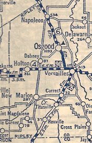
Auto-trails maps show the Michigan Road bypassing the original route through most of Ripley County in favor of a route that went through Versailles (pronounced ver-SAILS) and Osgood. It was common in these days for towns and cities to lobby hard for auto trails to be routed through them for the commerce they would bring. So it is very likely that Versailles and Osgood successfully pushed for this rerouting. And so the improved road went to Versailles and Osgood. According to the 1922 Rand McNally Indiana map excerpted below, all of the bypassed route was a dirt road, while only a small portion of the Versailles-Osgood route was not gravel or paved. On the map below, a solid black line is a road paved in concrete, brick, or macadam; a dashed line is an "improved" road of gravel, crushed stone, or oiled dirt; and all other lines indicate dirt roads.
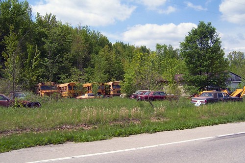
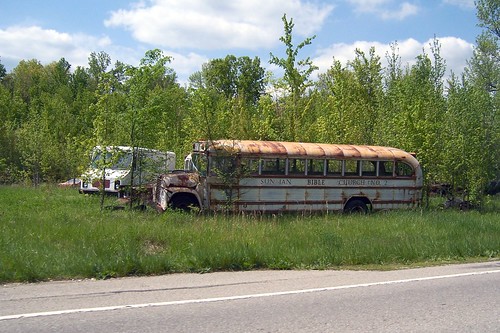
For completeness' sake, I followed the auto-trails route too. Rexville is little more than a sprinkling of houses today. But just north of there is this junkyard of sorts. Guess which I found more interesting.
There seem to be as many school buses as cars here.
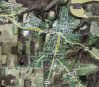
The first big town on the auto-trails route is Versailles. Strangely, none of the three highways that cross this town reach downtown. US 421 enters from the south, just left of center at the bottom of the map below. At Perry St., which is US 50, it turns left and follows 50 west out of town.
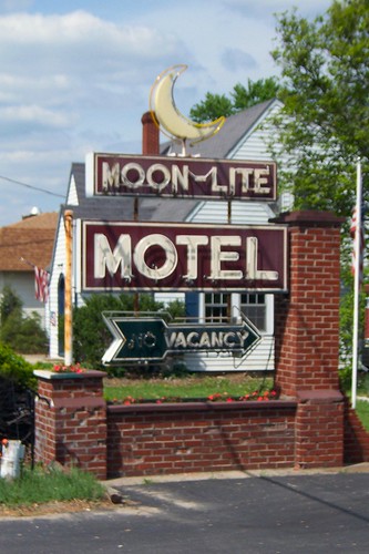
The first, and it turns out the only, interesting sight along the way is the Moon-Lite Motel.
The Moon-Lite even has a pool!
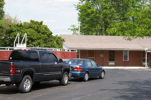
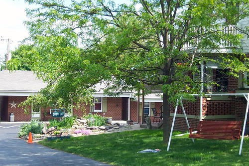
A house stands in front of the motel; it appears to serve as the office and the manager's residence.
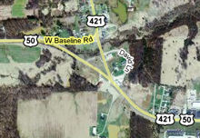
Shortly after leaving Versailles, US 421 splits from US 50 and heads north. The map below incorrectly shows 421 following the left fork of this split:
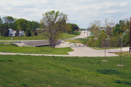
But since the map photo was taken, your tax dollars reconfigured this intersection. The fork is gone; US 421 is now a right turn off US 50. This northbound photo shows a tiny stub of old US 421 that provides access to to David Ln.
After you leave US 50, Kelley's Bel-Air Drive-In appears at the top of the hill. It opened in 1957, so why the '56 Chevy on the sign?
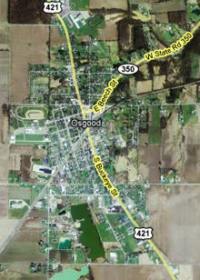
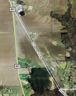
Osgood is the next town on the Michigan Road auto trail. It was laid out in 1856 along the Ohio and Mississippi Railroad. The original town lay entirely south of the railroad. US 421 in Osgood is Buckeye St.; it was part of a plank road of oak that stretched from Napoleon south to Versailles. (Buckeye St. was paved with stone in 1898 and with brick in 1914 and 1915. The Indiana State Highway Commission later covered the bricks with asphalt.) Source:
While US 421 between Osgood and Napoleon is almost certainly the descendant of that plank road, it seems likely to me that the plank road followed US 421 south of town only as far as Hasmer Hill Road, which I believe was planked to downtown Versailles. In the map below of US 421 south of Osgood, notice how Hasmer Hill Road follows straight from Buckeye St,. while US 421 curves more southerly.
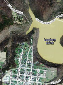
Hasmer Hill Road dead-ends today at the lake inside Versailles State Park.
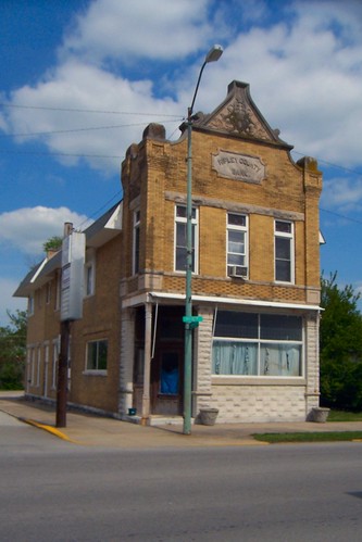
But before 1955, when this lake was created by damming a creek, Hasmer Hill Road appears to have connected to Main St. in Versailles. You would think that US 421 would have followed the Main St./Hasmer Hill Rd. route to Osgood, given how highways love to go through downtowns, but my maps show US 421 and its predecessors, State Road 29 and State Road 6, following US 421's present downtown-skipping route as far back as 1921. Source: The Ripley County Bank stands on the southeast corner of Buckeye and Ripley Sts in Osgood. This photo shows this corner probably no later than the 1910s. This photo shows the bank (front, right), Buckeye St., and the block north of it from about the same time.
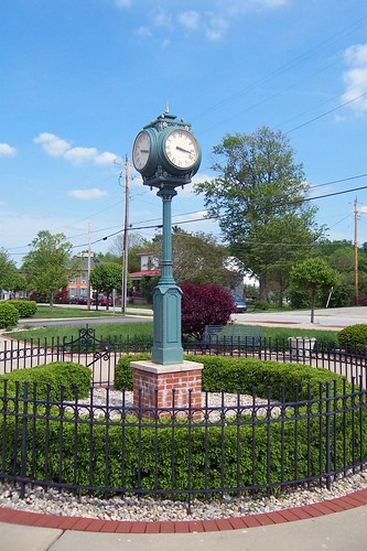
Just across Ripley St. stands this clock.
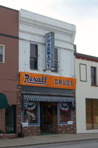
Across the street stands this great Rexall Drug Store. The building to the right is the Damm Theater. I had no way of knowing that, of course, since its sign was off the building, which was undergoing restoration. This page shows the theater in 2004 and tells its history. This page chronicles the restoration.
This photo shows the east side of Buckeye St. as it approaches the railroad tracks.
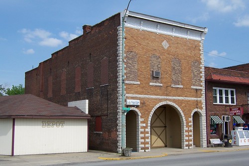
This building is interesting not just because of its great neon sign, but because of its balcony. The original Osgood fire station is to its left; this photo shows it in 1911, which was before the Tourist Liquors building was built.
Here's a tight shot of the Tourist Liquors sign.
On the way out of Osgood, I photographed the firehouse from a different angle to show more of it.
|
||||
|
||||
|
Created 19 July 2008. Updated 1 March 2009. |
||||