The Michigan Road |
||||
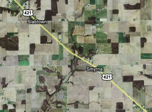
Decatur CountyDecatur County was organized in 1821 and many of its towns, including Greensburg, the county seat, were formed before the Michigan Road came through. Just because the map shows a name and a dot doesn't mean there's a town there, as evidenced by Smyrna and Slabtown, the first two alleged towns in Decatur County.
This older home stands near where the dot for Slabtown persists.
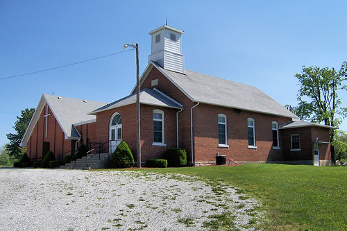
Just north of Slabtown stands the 1883 Sand Creek Baptist Church with its 1972 addition at right.
Just north of the church, the view north across the creek is lovely.
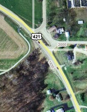
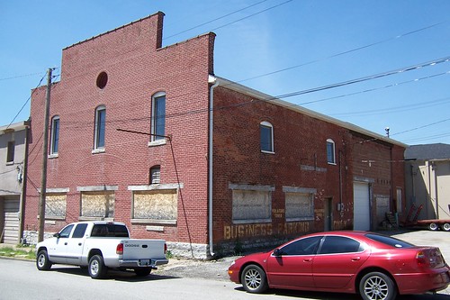
A house and what looks like a former store and gas station are all that stand at Knarr Corner. Both buildings stand on a brief former alignment left when the curve here was made smoother.
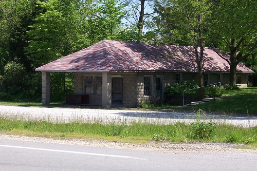
This is the former gas station and store. The gas pumps likely stood at the road between the two posts. Motorists would have pulled over to the curb to fuel up.
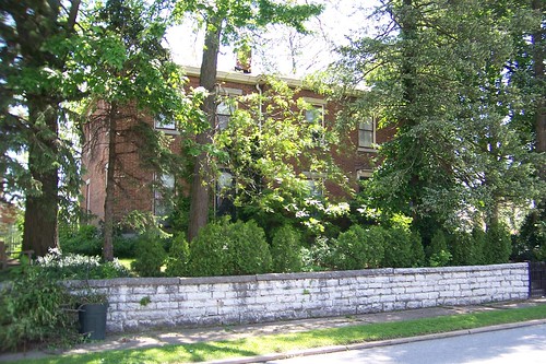
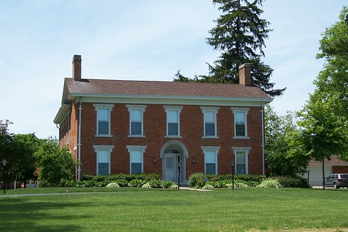
Just south of Greensburg stands this grand old house.
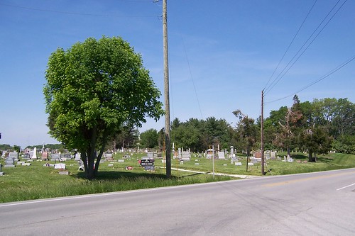
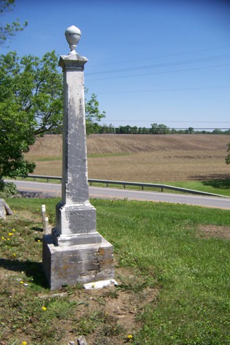
The Sand Creek Cemetery is on the outskirts of Greensburg. Sand Creek appears to have several forks.
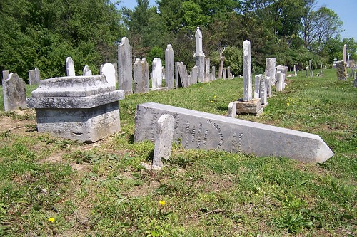
The broken and crooked tombstones in the oldest portions of the cemetery reminded me of a set of bad teeth.
No matter how deep into the cemetery you go, the road remains nearby.
This little house is on the south side of Greensburg. It has many of the architectural cues of other 19th-century homes along the route, except that it has only one story.
The road is Michigan Ave. in Greensburg.
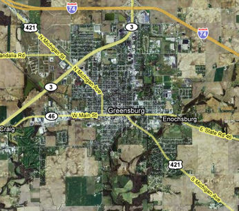
The Michigan Road enters Greensburg from the southeast, where it meets Main St. This is State Road 46, which falls just seven miles short of crossing the entire state. It begins just two miles away from the Ohio state line and extends to the eastern edge of Terre Haute, about five miles from Illinois. The Michigan Road exits town along the same line on which it entered.
Greensburg was formed in 1822 to be the seat of Decatur County. The wife of Thomas Hendricks, an original settler in Greensburg, chose the town's name in memory of her hometown in Pennsylvania. Although the Michigan Road certainly helped Greensburg's prosperity, the completion of the Cincinnati, Indianapolis, and St. Louis railroad in 1853 really made Greensburg boom. Sources: The map below shows the Michigan Road entering Greensburg from the lower right and exiting at the upper left, southeast to northwest. Between Main St. and North St., I am not sure of the Michigan Road's route through downtown. Regardless of how the Michigan Road passed through Greensburg, there's lots to see downtown. To see downtown Greensburg, follow this side trip.
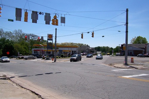
This southbound photo shows where the Michigan Road enters downtown Greensburg at State Road 46.
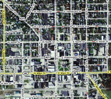
I've seen maps that label as "Michigan Ave." the three blocks of North St. between East St. and Jackson St., so I followed East St. north to North St. and then North St. west to Jackson St. If East St. was the Michigan Road, you can't follow it northbound today as it is one way south.
This East St. building is interesting only in how you can see that its original lower windows were filled in, to be replaced with new lower windows, which themselves fell into disuse and were boarded up.
This old house, obscured by trees and shrubbery, stands across the street. If I learned nothing else exploring the Michigan Road this summer, I learned that if you want to take a photo of an old house, wait until late autumn when the leaves are off the trees.
When I reached North St., I headed west. The street signs all said North St., giving no help in determining the Michigan Road's original route through town. This house stands at the corner of Franklin St.
Post office, southwest corner of North and Franklin.
The former YMCA buildings stands just south of North St. on Broadway St.
This postcard image shows how the YMCA hasn't changed much since the card was printed, probably in the late 1930s.
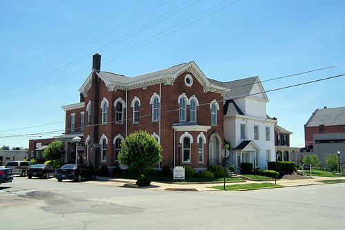
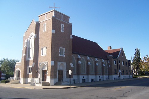
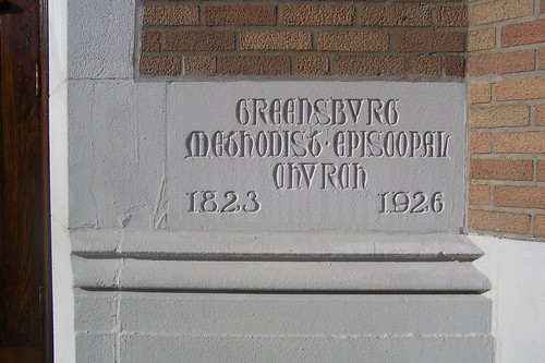
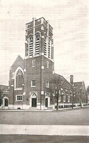
Across North St. from the YMCA stands the Greensburg United Methodist Church building.
As is the case with so many old United Methodist buildings, this was once a Methodist Episcopal Church.
The building once had a bell tower and stained-glass windows, which both have since been removed. This postcard image from probably about the 1930s shows them.
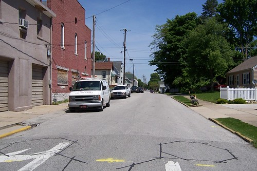
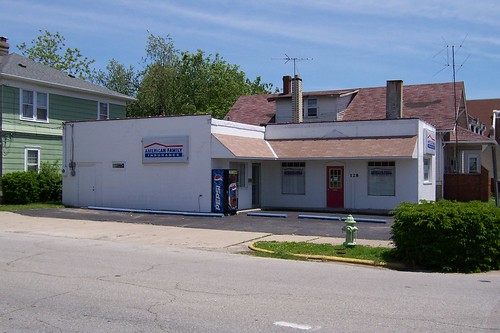
A block west on North St. at Jackson St. stands this building, which looks to me to be a former service station.
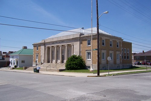
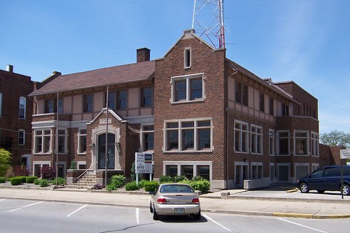
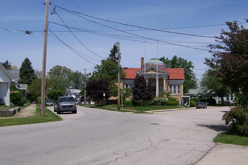
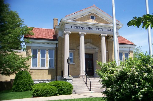
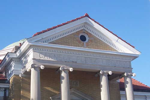
Taken from the former service station, the Michigan Road angles its way out of town. The former Greensburg City Hall, originally a Carnegie Library, stands on the right.
This was the Greensburg City Hall until 2006, when the city adapted a former school building on Washington St. for the purpose.
I learned of the building's Carnegie Library roots on a return trip through Greensburg when I saw that the City Hall sign had been removed.
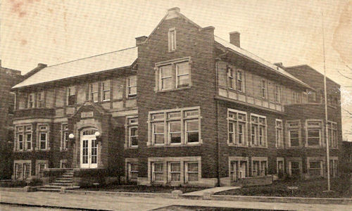
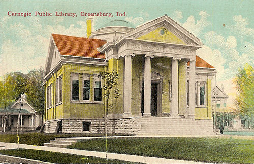
This postcard, probably from about 1910, shows the library as it stood in its neighborhood. The Michigan Road is in the foreground.
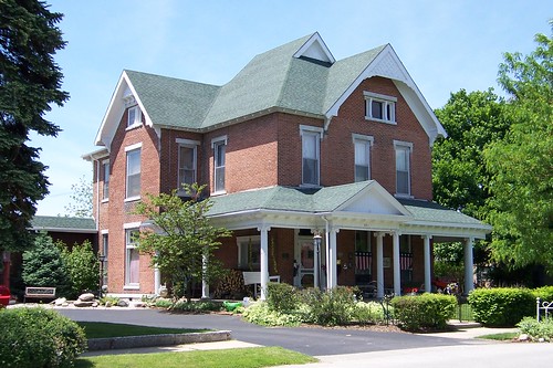
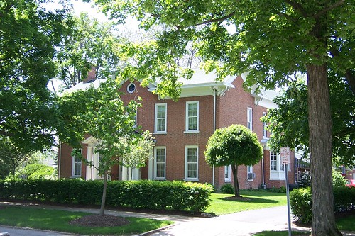
The few blocks of Michigan Ave. before it meets US 421 again are lined with lovely older homes, like this one.
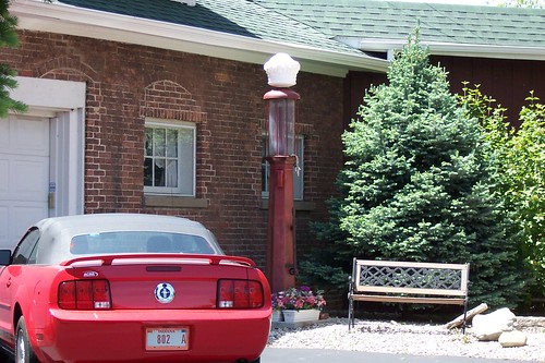
The owner keeps an old gas pump next to his garage. Notice the old window arches now filled in with bricks. The garage door was clearly not original.
Another older home on Michigan Ave.
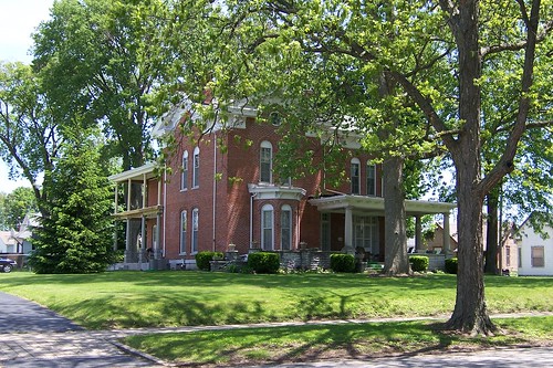
This is probably the grandest older home along Michigan Ave. in Greensburg. Notice the porch and balcony at the rear.
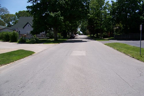
From where US 421 rejoins Michigan Ave., this is the road southbound.
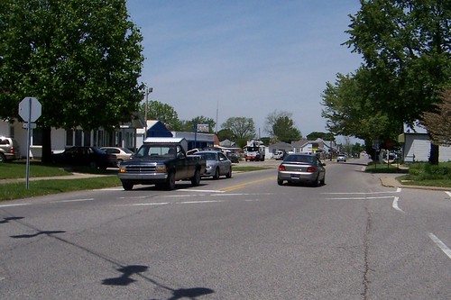
This is the road northbound from the same spot. The grand old homes disappear at this point.
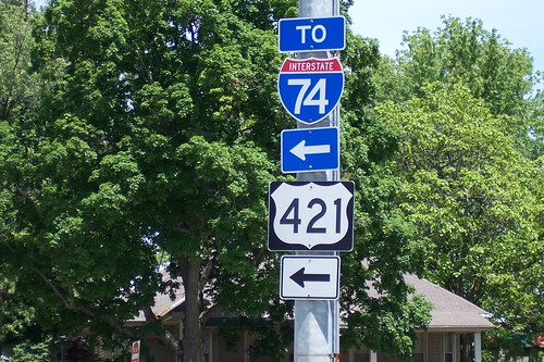
Just north of Greensburg, I-74 moves in and follows the Michigan Road corridor all the way to Indianapolis.
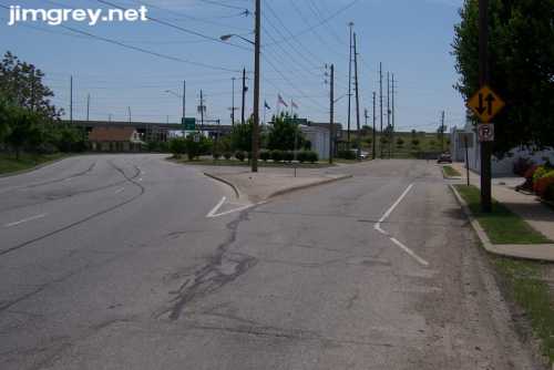
This jerky video follows this segment of the Michigan Road from the former gas station to just past where it becomes US 421 again. At State Road 3, Greensburg proper peters out. There's a little light industry, but farms quickly take over
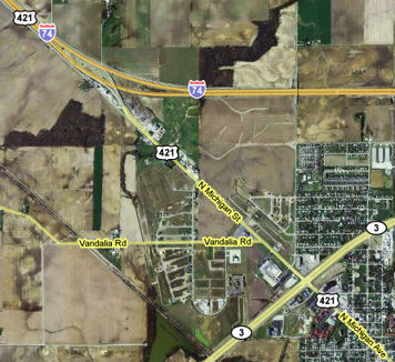
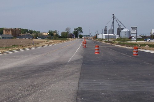
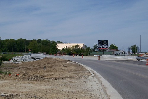
Since the aerial image above was taken, Honda bought land here and built an assembly plant. The state widened the Michigan Road to four lanes and built a new ramp system for I-74 to serve the new plant. Here, finishing touches are being put on the two new lanes.
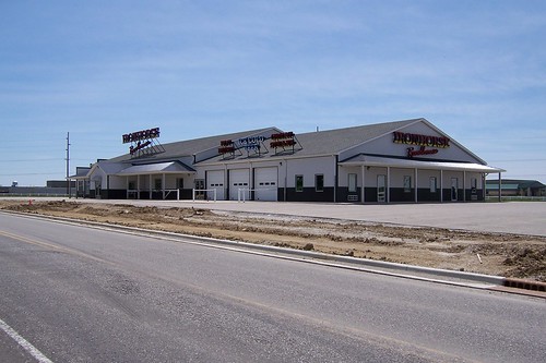
Predictably, plenty of businesses are going in, ready to serve Honda workers. This huge roadhouse appears to be ready to go.
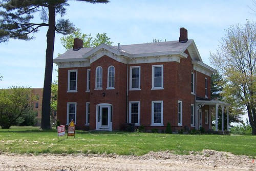
This old house, which probably once anchored a farm behind it, remains. It's for rent! You can see a brand new Hampton Inn behind it.
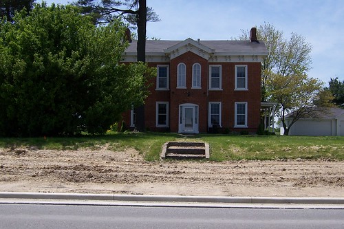
The house's walkway and steps don't quite make it to the road.
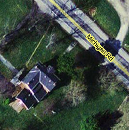
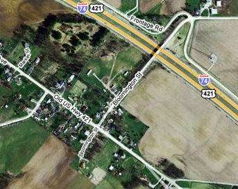
As the aerial image below shows, the road's shoulder used to touch these steps, but the project to widen the road also moved it slightly east. It looks like the road's shoulder was eliminated in the widening. Notice how large the house is compared to its apparent size in the photos above.
As part of beefing up I-74 access, this new bridge was built, and the Michigan Road was curved where it once ran straight to provide better access to the new exit. The map above shows the Michigan Road running straight over this creek.
Beyond the I-74 interchange stands this old house.
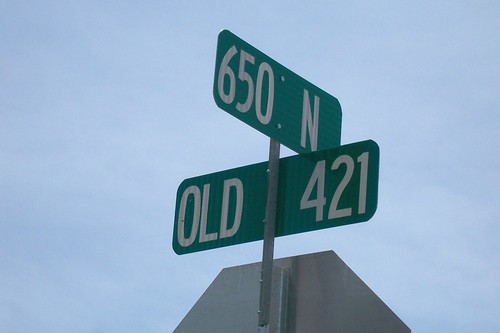
Outside of Greensburg, the road is signed Old US 421. It's just a county road out here.
St. Omer lies in Decatur County's northwest corner.
This building, which I think used to be a school but appears to be a private residence today, is the most interesting sight in town.
|
||||
|
||||
|
Created 25 July 2008. Updated 13 March 2009. |
||||