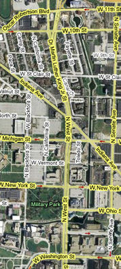
The Michigan Road |
||||
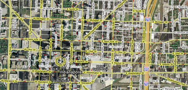
Marion County, CentralThe Downtown Indianapolis portion of the Michigan Road follows Washington St., which is the old National Road and former US 40, west. On Downtown's west edge it turns north onto West St. I say that the Downtown portion of the Michigan Road ends where it intersects with North St. and Indiana Ave., because there the road resumes its northwestward tilt and becomes Dr. Martin Luther King, Jr., St, formerly Northwestern Ave.
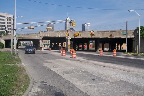
A couple blocks before entering the Mile Square, which is the heart of Indianapolis's Downtown, the road passes under this hulking railroad overpass.
I've been fascinated by this structure as long as I've lived in Indianapolis because it is so imposing. Travel lanes are narrow, as this shot of College Ave. shows.
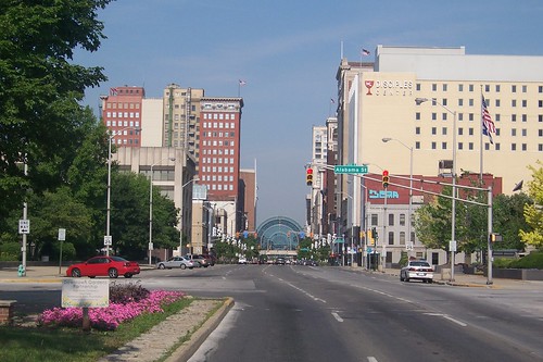
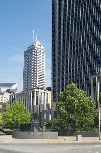
From about East St., Downtown looms.
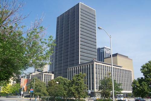
The City-County Building went up in 1962 and is now the seat of the merged city-county government.
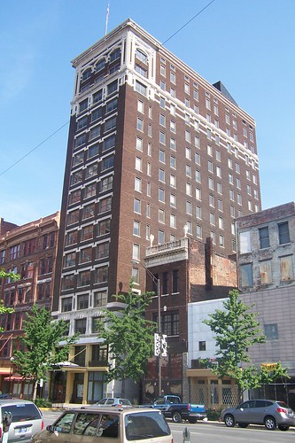
Indiana's tallest building, the Chase Tower, is visible behind the City-County Building.
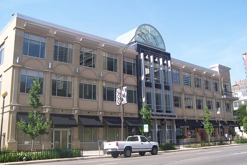
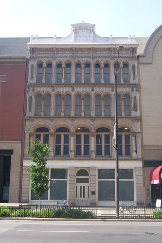
The Broadbent Building may look brand new, but its skeleton dates back to 1960. Once known as "the zipper building" because of its trapezoidal windows, the facade was removed in 2007 and this facade was put in its place. But what was here before that was a grand and imposing structure made of cut stone called the Vance Block, which was built in 1875 and razed in 1959. This page has photos of the Vance Block, photos of Washington St. in the late 1800s, and even one photo of the zipper building.
This building houses the Indianapolis Business Journal.
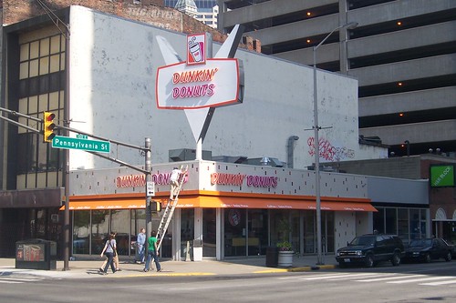
Dunkin' Donuts was preparing to open in this building on the day I took this photograph. The building once housed a Roselyn Bakery, a popular local chain that went out of business some years ago. The V-shaped sign is adapted from the original Roselyn sign. If you drive around Indianapolis, you'll see plenty of these veed signs next to buildings that house any number of businesses today. Here's a 1998 photo of this corner from when this building was still Roselyn Bakery.
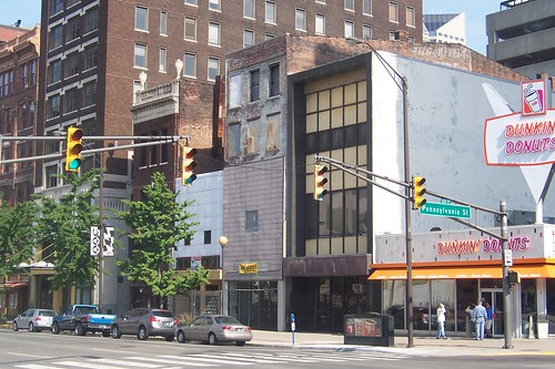
All is not bright and shiny in Downtown Indianapolis, unfortunately. Like most cities, Indianapolis lived through years of malaise, and much evidence of it remains.
Indianapolis did not get modern skyscrapers until the City-County building was built in 1962, making this one of the city's tallest buildings for many years.
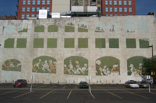
This mural, "The Runners," is by James McQuiston. It is on the south side of Washington St. just east of Meridian St.
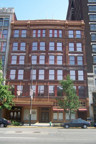
The Victoria Centre building, which I understand is being converted into condos.
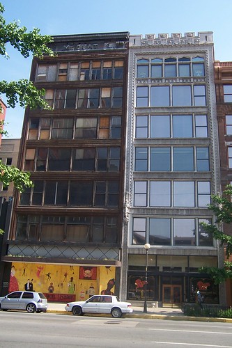
The decaying McOuat building on the left was supposed to become condos a few years ago, but those plans apparently never materialized.
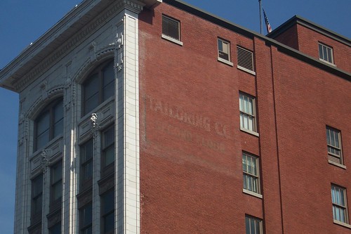
A faded advertisement remains near the top of this ten-story building.
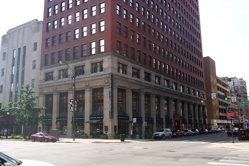
I couldn't fit the entire 17-story Merchants National Bank building, built in 1909 and now called the Barnes and Thornburg building, into a frame. This building's first floor houses a Borders bookstore.
Until the City-County building was built, the Soldiers and Sailors Monument, completed in 1901 at 284 feet, was the tallest structure in Indianapolis. The Statue of Liberty is only 15 feet taller! Imagine how, before Indianapolis's skyscrapers began to be built in earnest in the 1980s, the Monument had to dominate the Indianapolis skyline. Today, the tall buildings block the view, unless you look down Market St. or Meridian St. at it. This photo looks north up Meridian St. to the monument.
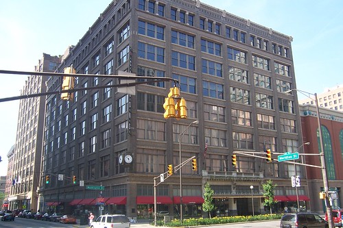
This building was the flagship of H. P. Wasson and Co., an Indianapolis-based department store chain that closed in 1980. It stands on the northwest corner of Washington and Meridian.
On the southwest corner stands the shell of the L. S. Ayres and Co. building. L.S. Ayres was Indiana's premier department store for many decades, but consolidation in that industry and decreasing Downtown shopping ended this store's Downtown days in 1991. Its suburban and out-of-town locations continued for several more years, but today the Ayres name is gone. All the former locations are now Macy's. Today, this building is part of Circle Centre Mall. Typical of the mall project, the facades of many buildings were kept and incorporated into the mall. Carson Pirie Scott now uses the first three stories of the building.
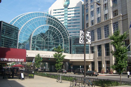
Looking west down Washington St., all of these facades front Circle Centre Mall. The Indianapolis Artsgarden spans the intersection of Washington and Illinois Streets.
The building once behind this facade used to stand on the other side of Washington St. The Griffith Block was built in 1872 and demolished in 1990.
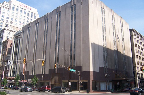
This photo from in front of the Griffith Block facade shows the Artsgarden and the new Conrad hotel. The Conrad was an empty lot most of the years I've lived in Indianapolis. In the background is the Capital Center.
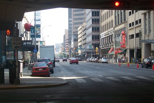
This photo looks westbound from underneath the Artsgarden.
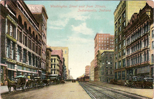
Consider how much has changed from this vantage point since 1910, when this postcard was postmarked!
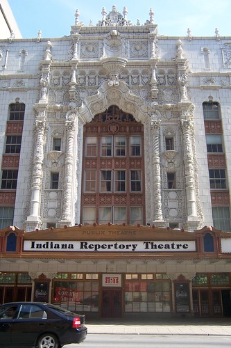
Continuing westbound on Washington St., the Indiana Repertory Theatre building was built in 1927 as the Indiana Theater, a movie house in the Paramount Publix chain. It was refitted for IRT's use in 1980. Source:
The Indiana Statehouse was completed in 1888 and continues to house Indiana's executive offices, the State Senate, the House of Representatives, and the Supreme Court.
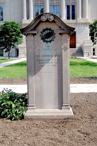
Standing quietly in front of the Statehouse is this monument to the National Road. It was placed here in 1916 as part of Indiana's centennial celebration to commemorate the Road's role in Indiana's settlement. No doubt, many who came from points east followed the Michigan Road from here to settle in northern Indiana. Sources:
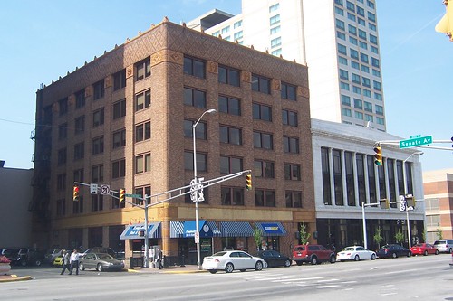
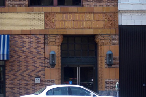
On the opposite corner stands the Old Trails Building, completed in 1928 to house the Old Trails Automobile Insurance Association. Washington St. was not only part of the National Road and the Michigan Road, but also the National Old Trails Road, which was established in 1912 and connected Baltimore to Los Angeles. Presumably, the insurance company was named for the road. Check out this photo taken just after the building was built. Sources:
The building is rich with terra cotta ornamentation, such as around the building's entrance.
I haven't found any documentation or maps that spell out the Michigan Road's route from here, or even if the Michigan Road had an official route through Downtown. Today, it is simplest to follow Washington St. to West St. and then turns north, and I feel confident that 19th-century travelers agreed with me.
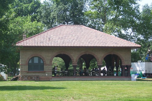
Military Park stands on the southwest corner of West and New York Streets. It's Indianapolis's oldest park, originally used to train the militia and, later, as an encampment for Civil War soldiers. It also hosted the first Indiana State Fairs. This shelter house is the current centerpiece of the park. Source:
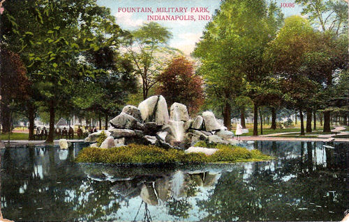
At one time, this fountain stood at the center of the park, but it is gone today. This postcard image is from about 1910.
|
||||
|
||||
|
Created 31 December 2008. Updated 13 March 2009, 2 January 2012. |
||||