The Michigan Road |
||||
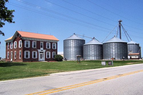
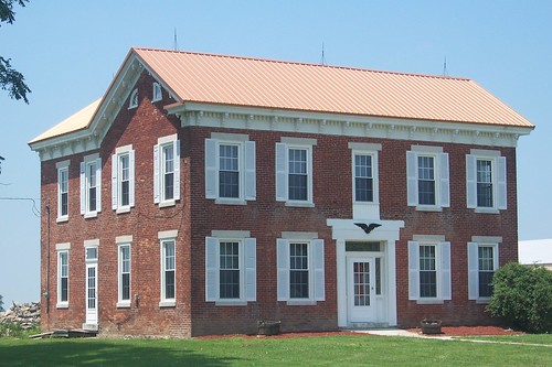
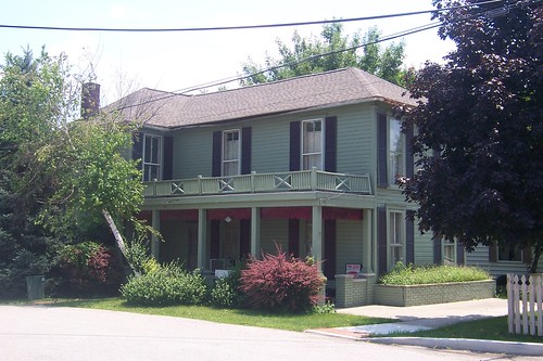
Carroll CountyCarroll County was formed in 1828 and was named for Charles Carroll, the only signer of the Declaration of Independence still alive at the time. Almost as soon as the Michigan Road enters Carroll County, the Mathews Hoosier Homestead Farm appears. Hoosier Homesteads are farms that have been in the same family for over 100 years. The house was built in 1862 by George Harness; it and the farm passed through the family to Mary Mathews, granddaughter of the last Harness to own the farm. It served as a stagecoach stop for a while and is said to have been a stop on the Underground Railroad. Sources:
I wonder what happened to that missing shutter (second floor, front, second window from the left).
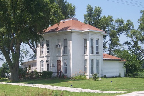
This old house appears just south of Burlington.
The road bends slightly east as it enters Burlington, and back west as it leaves.
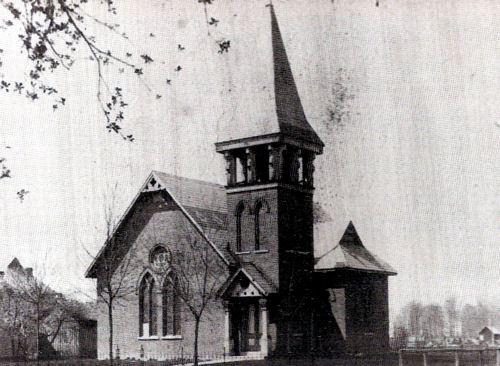
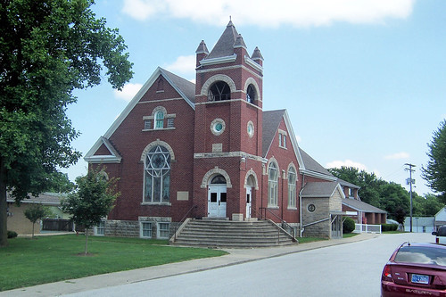
The Burlington United Methodist Church built this, its second building, on the Michigan Road at 10th St.
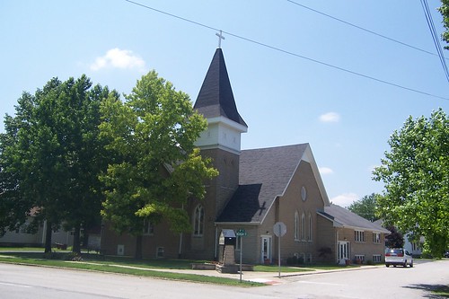
This is the church's third and current building, still on this site.
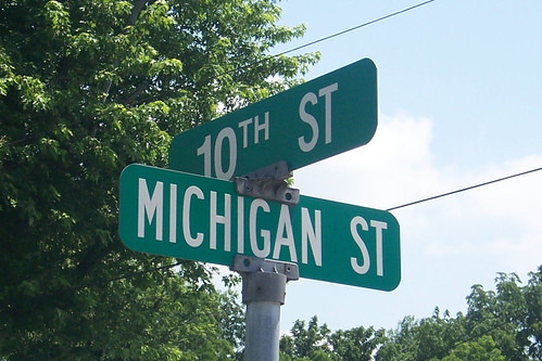
The road is Michigan St. in Burlington.
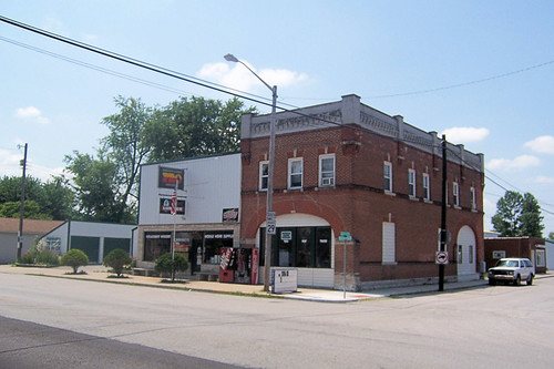
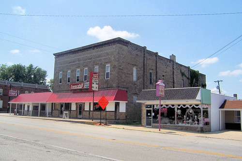
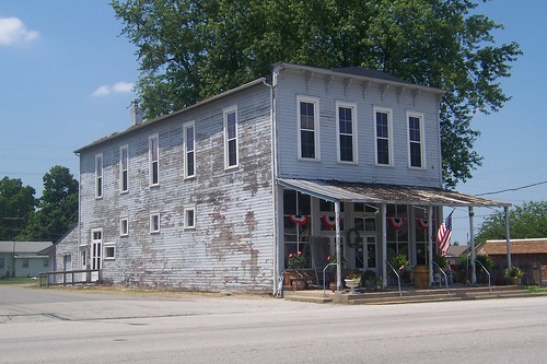
Shortly after Carroll County was created in 1828, David Stipp, said to be a cold and stingy man, laid out Burlington. It was hoped to become the seat of a new county made partly from the Great Miami Reserve, which was 2 miles east. The Lafayette and Muncie Road crossed the Michigan Road here, but I've had no luck finding any information about that road. Burlington was an important stage stop, mill village, and trading center for both whites and Indians from the reservation. The town, named after a chief of the Wyandot native Americans, was incorporated in 1967. Sources: This hardware store stands on the south end of Burlington's downtown.
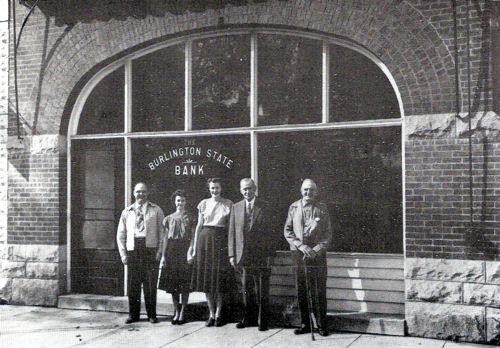
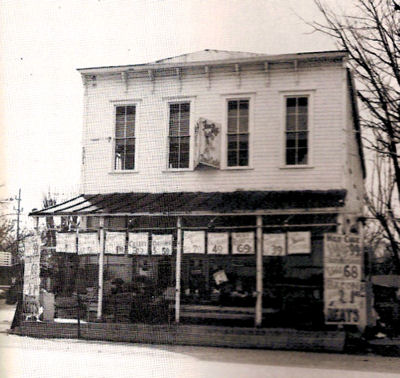
The older part of the building was once the Burlington State Bank, as this 1946 photo shows. I wonder if this was once a fire station. The current fire station is a block west down the side street in the photo below. The big arch certainly could have passed a fire truck.
An old house left near downtown, across the street from the hardware store.
These buildings stand in the heart of downtown.
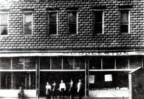
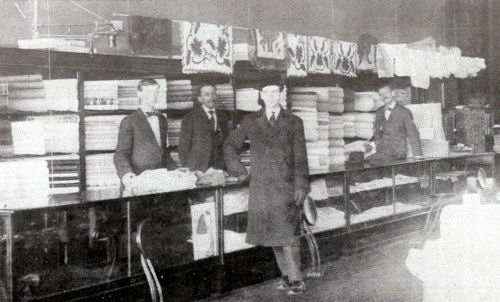
This photo shows the middle building sometime in the first half of the 20th century when it was Oyler and Huddleston's, a dry-goods store.
This photo is from inside Oyler and Huddleston's, which people in Burlington called the Park Store for some reason.
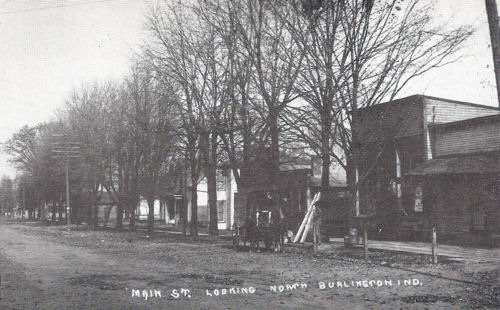
Some other shots of downtown. I'm guessing that this one is from the 1910s.
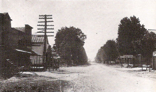
This one's probably also from the 1910s.
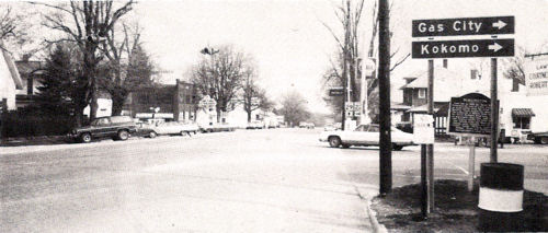
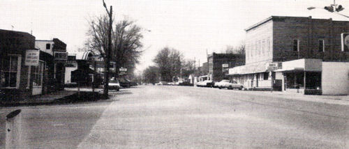
This photo from the 1970s shows the northbound road from State Road 22.
This is from the same spot, except southbound, in the 1970s. It shows the Oyler and Huddleston building on the right and the former bank in the next block south.
This is a former general store, north of downtown. On the vacant lot to the north once stood a house built by David Stipp that, after he sold it, was a relay house for stage horses. A tavern was kept in the basement; the entrance was a trap door on the porch!
Here's the store during its days as the Farm Boy store, probably in the 1970s.
Burlington Church of Christ, formerly the Burlington Christian Church. This is the third building the church used, built in 1908, and the second on this site.
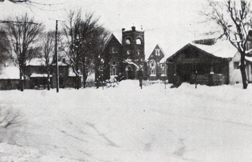
This 1929 photo was taken after a snowstorm that shut down the town. The Church of Christ is near the center.
This photo is of a well used until 1935 to supply the north side of town (and passing travelers) with water. It was on Burlington's north edge, just south of the bridge over Wildcat Creek.
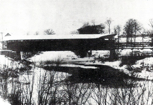
There have been quite a succession of bridges over Wildcat Creek. The earliest recorded was a wooden covered bridge. I'm not sure which end is north and which is south!
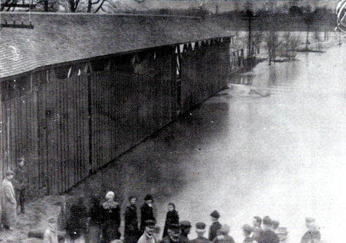
Here's the bridge in 1913 during a flood.
This photo from the bridge's north end was taken in May of 1919, shortly before the bridge was torn down, suggests that the bridge had lived out its life.
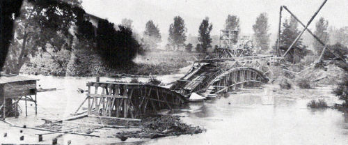
A concrete bridge was planned. This formwork was constructed, but a flood destroyed it in 1920. Builders had to start over.
The bridge was finished in 1923. Imagine – the bridge was closed for four years! This bridge, which was described as narrow, may have been a Luten bridge. Even if it wasn't, it looks typical of the kinds of bridges Indiana was building in this timeframe.
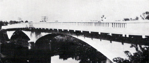
This northbound photo shows the road leaving town and crossing the current bridge, a typical boring slab supported by piers.
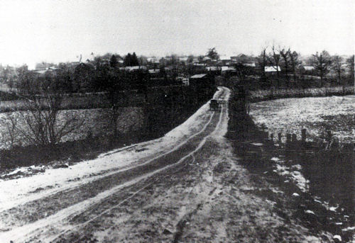
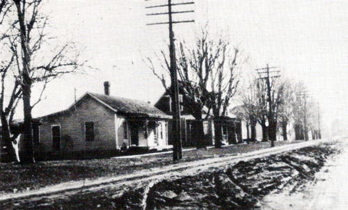
This photo shows the Michigan Road southbound as it heads toward Burlington. This is probably from the 1910s, as the covered bridge is there. Notice that the road is made of dirt.
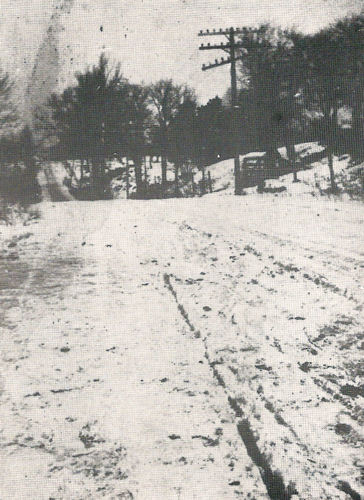
The Michigan Road wasn't paved in Burlington until 1929. This early-1900s northbound photo shows how the road became a rutted bog when it was wet.
This photo from about the same time shows not only how the road got rutted when wet, but also how it once rolled. This section has since been leveled; the road through Burlington is entirely level. There were certainly many such dips along the road until the modern era, roughly since 1950, when technology and road funding allowed rolling highways to be flattened.
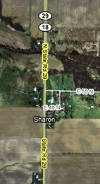
Sharon is the first spot on the map north of Burlington.
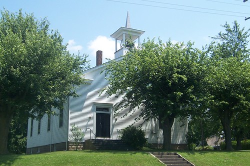
I stopped mostly to take photos of the Sharon Baptist Church.
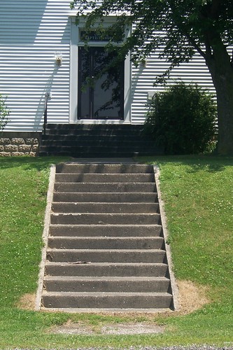
Some old buildings on the road have steps down to the road. Clearly, they are a holdover from a day before the Michigan Road was capable of handling 55 mile per hour traffic. Nobody parks along the road on Sunday morning and walks up these steps anymore.
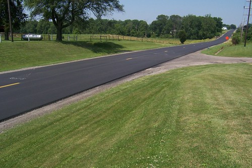
The road had been freshly paved when I drove through. Compare this to the muddy photos from 100 years before! Northbound.
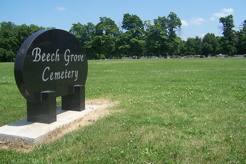
A cemetery stands north of the Sharon Baptist Church, just across County Road 50N.
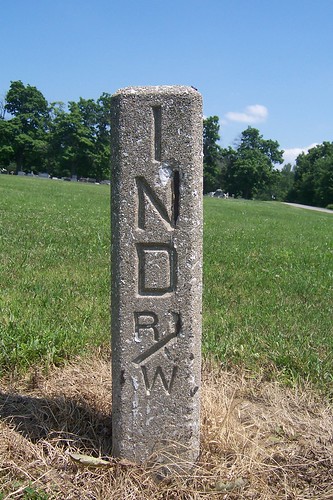
This right-of-way marker stands on the northeast corner of the Michigan Road and CR 50N.
North of Sharon stands Sycamore Row, a historic old alignment. When the Michigan Road was built in the 1830s, this land was marshy and hard to travel. In those days, the state of the road-building art was to “corduroy” such roads, laying long logs across it one after another and usually covering the logs with sand. The logs could roll, and horses could lose their footing, but it was better than getting stuck in the muck. The road builders used sycamore logs so fresh that new sycamores began to grow out of their ends. The corduroy road is long gone, but the sycamores that grew from them still stand. A historical marker proclaims this Sycamore Row.
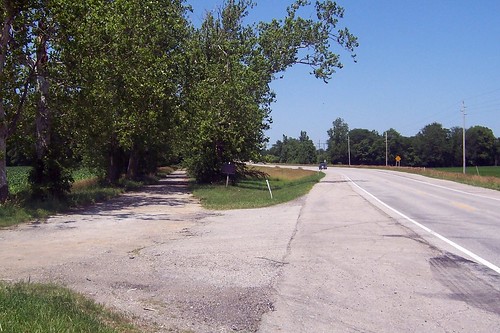
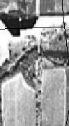
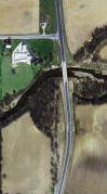
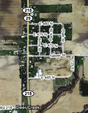
Unbelievably, this one-lane section of the Michigan Road (and the iron bridge over Deer Creek) was used into the 1980s. The grainy 1971 aerial image from the Indiana Historical Aerial Photo Index at left below shows no bypass. When the new bridge was built and Sycamore Row bypassed, not only was the road moved but Deer Creek itself was rerouted, as the 2008 image at right shows. I imagine it would have been a lot cheaper to just cut down Sycamore Row, widen the road, and build a new bridge where the old one was, but I'm glad this bit of history was saved.
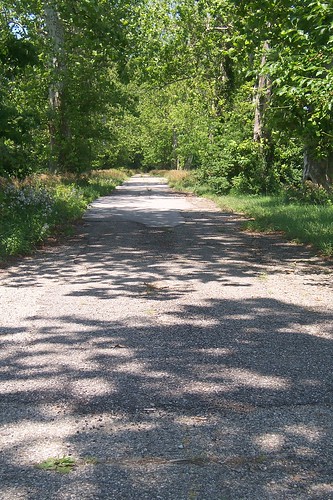
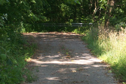
This is what the road inside Sycamore Row looks like today. This image shows the road while it was still in use, sometime after the historical marker was installed in 1963 (even though the page claims the photo is from the 1920s). The comments about this Sycamore Row photo include someone who remembers traveling this stretch while it was open; he said that cars moved down the narrow passage slowly and carefully, but he remembers needing to stop only when they encountered a truck.
Sycamore Row ends, of course, where the old bridge used to be. This is a popular place for local fishermen to park.
This southbound shot shows Sycamore Row lining up with the Michigan Road's path.
The little town of Deer Creek lies just north of Sycamore Row and the creek the town is named after.
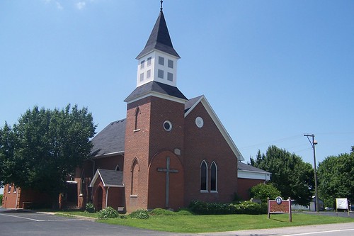
This is the Deer Creek Presbyterian Church, which was established in 1842. This building is certainly newer than that.
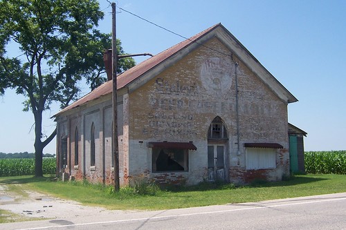
This Deer Creek building was a feed store during at least the late 1950s, but it sure looks like it was a church before that.
|
||||
|
||||
|
Created 31 December 2008. Updated 27 March 2009, 2 January
2012. |
||||