The Michigan Road |
||||
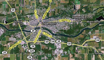
Cass CountyWhere the Michigan Road leaves Carroll County and enters Cass County, it stops being a north-south road and curves northeastward. It stays that way until Rochester. Cass County was formed in 1828 and was named after Lewis Cass, who was then governor of the Michigan Territory. He was involved in making treaties with the Native Americans who lived in the region, opening the area to white settlers. Source: The Michigan Road comes to Logansport shortly after entering Cass County. Despite what the map says, State Road 29 no longer goes into Logansport, instead veering away from the Michigan Road south of town and ending about where it intersects with State Road 25. When SR 29 was decertified inside Logansport, that stretch of road was renumbered as State Road 329. But even that was decertified in about 2000, and now the Michigan Road is just Burlington Ave. as it enters Logansport. Sources:
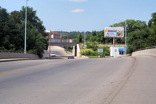
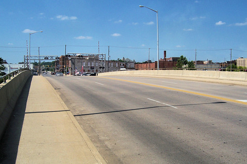
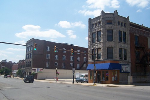
This southbound photo shows Burlington Avenue in Logansport.
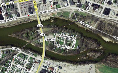
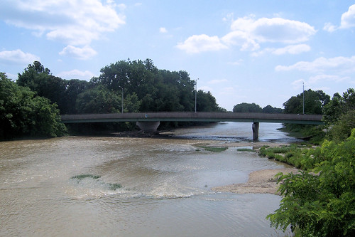
The Wabash and Eel Rivers meet in Logansport, and the Michigan Road crosses both of them. It encounters the Wabash first. There are two bridges over the Wabash because there's an island in the middle where the road crosses. This photo was taken on the south bridge.
There are a few streets on the island.
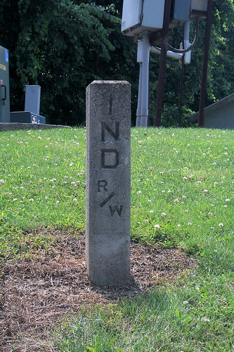
When you cross the south bridge, Burlington Ave. becomes 3rd St. This right-of-way marker stands on the island.
This is the north bridge.
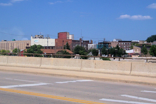
From the north bridge, this is downtown Logansport.
Here's a view of the north bridge from downtown.
I haven't found any authority that states the Michigan Road's path through Logansport. Indeed, I understand that in the road's early days, there was no set path through town. It came in on what is now Burlington Ave. and exited on what is now Michigan Ave., but how you got from one to the other was up to you. It seems likely to me that the Michigan Road followed 3rd St. to Broadway St., went east on Broadway to 6th St., crossed the Eel River, and then turned onto Michigan Ave. That's the route we'll follow here.
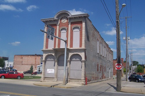
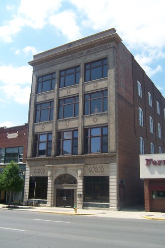
The Todd Bank Building, built in 1870, stands on 3rd St. just north of the north bridge. It is one of the oldest brick structures in Logansport.
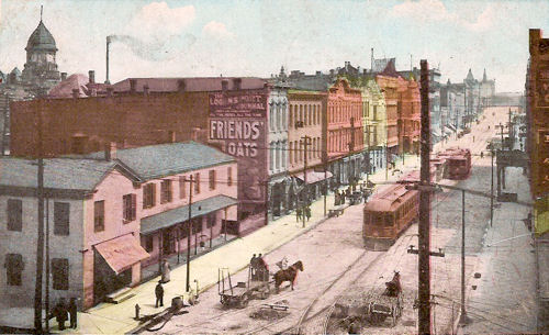
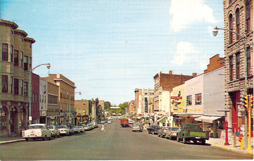
Logansport was named for John Logan, a half-Shawnee soldier who had been friendly to area settlers. The forest that covered what is now downtown was cleared in 1828, and the town grew quickly as a transportation hub. The Michigan Road came in 1832, the Wabash and Erie Canal in 1837 or 1838, and the first of many railroads in 1855. The railroad left the deepest impression on Logansport; by the 1920s, they employed 3,000 here. Sources: A thriving downtown was built during Logansport's best years. This image from a postcard postmarked 1908 shows eastbound Broadway St. from 3rd St.
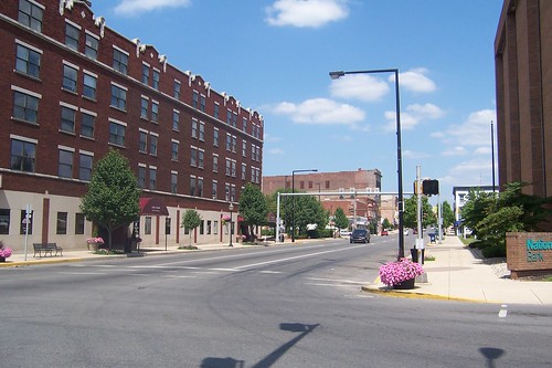
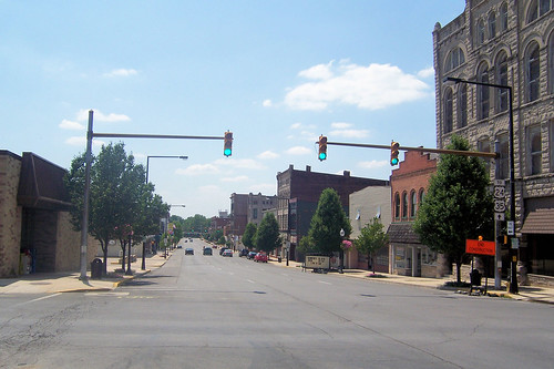
Much has changed in this scene in 100 years. Only one older building is visible from this corner today. 3rd St. is one way west today, so northbound Michigan Road travelers follow Market St., which is one block south. This is where the Michigan Road becomes State Road 25, which it will remain until it reaches Rochester.
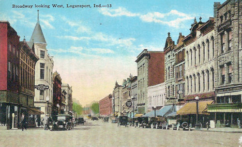
This postcard, probably from the 1910s, shows westbound Broadway St. from 5th St.
Logansport's boom busted. Over time, many of its downtown buildings succumbed to the wrecking ball. This westbound shot was taken from about the same place as the postcard image above.
This building is in both of these Broadway St. photos.
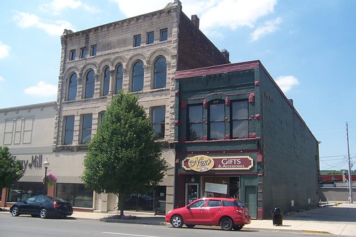
I was surprised by how many of Logansport's old buildings had limestone faces.
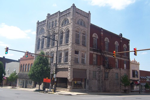
This photo is of the northwest corner of Broadway at 6th St, which is where the Michigan Road turns north. This is the Keystone Building, which when built was so far away from the rest of town that locals snickered behind the builder's back.
It appears that many of Broadway Street's old buildings lasted through the 1960s, when this postcard photograph was taken.
This is the same scene in 2008. The north side of the street is far more intact than the south side.
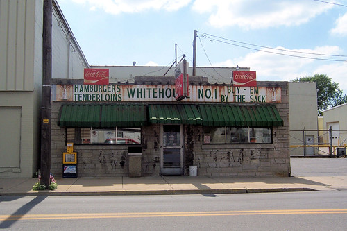
Around the corner on 6th St. stands this little greasy spoon with its gloriously rusty sign.
The Michigan Road crosses the Eel River on 6th St., and then turns right onto Michigan Ave. This southbound photo from Michigan Ave. shows the bridge over the Eel River.
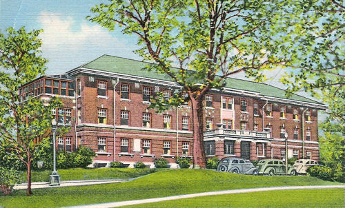
The Michigan Road passes Logansport's Memorial Hospital, which looked like this in about the 1930s.
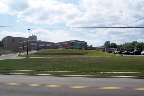
The hospital is a sprawling complex today, of which this is but a small part.
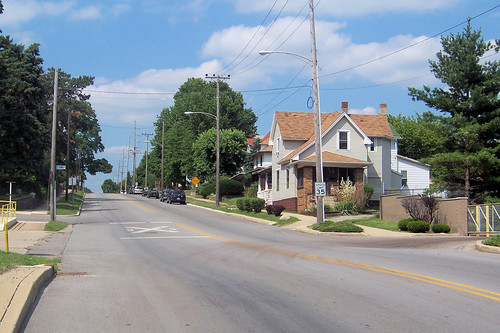
Northbound from the hospital, the Michigan Road passes through a residential area.
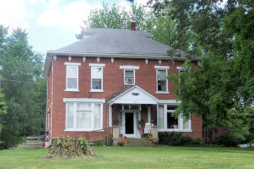
I'd love to know this old house's history.
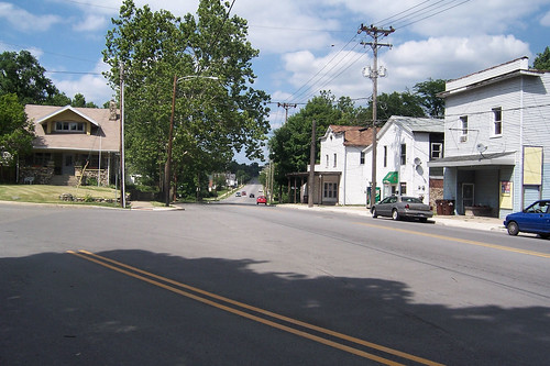
Because the Michigan Road passes through most of Indiana at an angle, you get used to seeing roads coming in at crazy angles. Logansport's history includes annexing a couple of smaller towns, and I would not be surprised if this was once the center of one of those towns because of the storefronts here. The Michigan Road begins to ascend out of the river valley here.
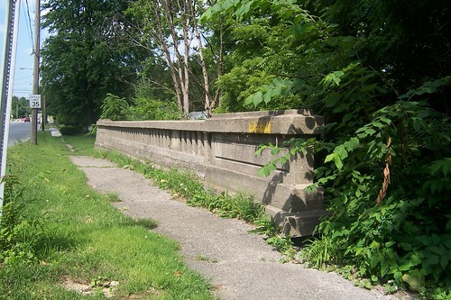
Most of the Michigan Road's bridges in northern Indiana are modern, so it was a pleasure to find this survivor. My guess is that this bridge is from no later than the 1930s.
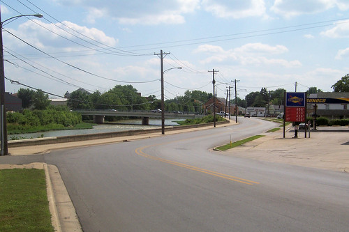
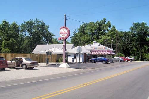
As the Michigan Road leaves Logansport, it passes by the Char-Bett, a hamburger and ice-cream stand.
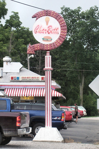
Here's a closer look that the wonderful sign.
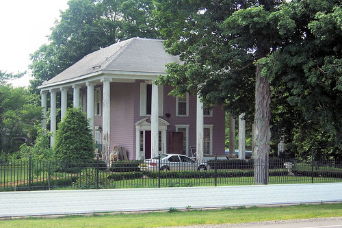
This photo is from the grounds of Inntiquity, a bed and breakfast north of Logansport.
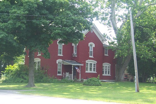
An old farmhouse in Cass County.
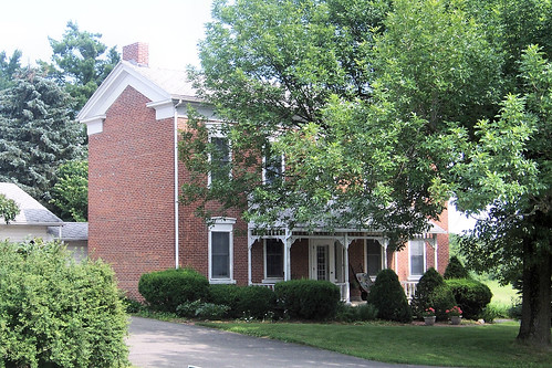
I really like the strong lines of this house, which I guess to have been built around 1850, but the landscaping made a clean shot impossible.
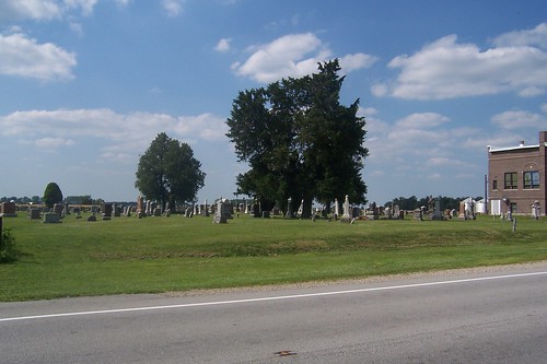
Metea is a tiny unincorporated town in northern Cass County. It was laid out in 1853 and has been called New Hamilton and Lick Skillet, a name applied to more than one economically depressed Indiana town. (One explanation for the name is that the people were so poor that they ate anything with any food value, including the skillet's scrapings.) Metea never amounted to much, and today all that's there is a cemetery, a church, and a few homes. This is the cemetery. Source:
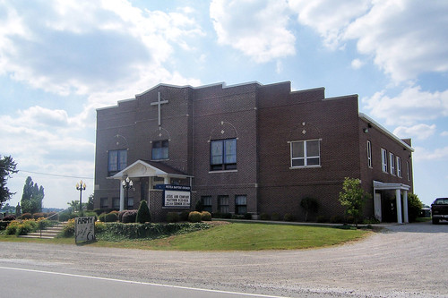
This is the church.
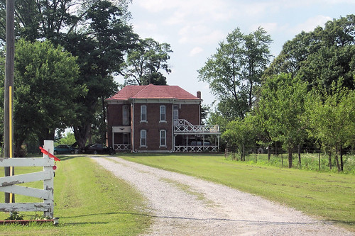
North of Metea, just before leaving Cass County for Fulton County, stands this old house. It's set way back from the road.
|
||||
|
||||
|
Created 16 January 2009. Updated 27 March 2009, 2 January 2012. |
||||