The Michigan Road |
||||
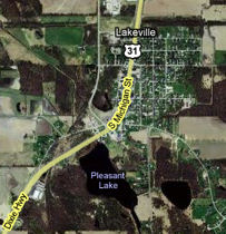
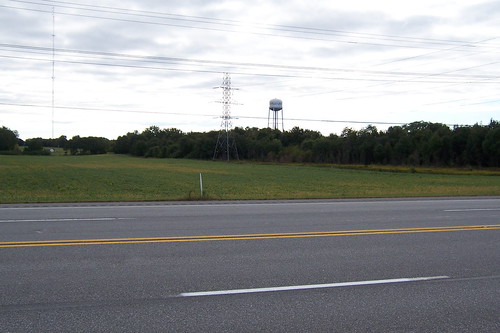
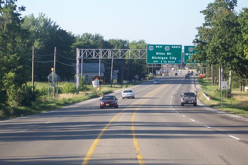
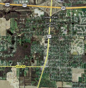
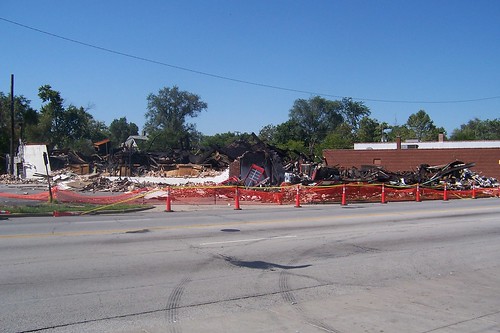
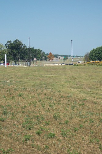
St. Joseph CountyLakeville is along the road in southern St. Joseph County. It and La Paz have always struck me as twin sisters, towns of similar size one right after the other along the road. Where La Paz is bounded by US 6 on the south, Lakeville is bounded by State Road 4 on the north. As La Paz is a railroad town, so once was Lakeville, but several years ago Lakeville's tracks were removed. You can't tell from the road that tracks were ever there. This map shows how the Michigan Road swings around Pleasant Lake and into Lakeville from the south.
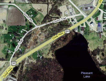
It's hard to make out on that map, but the Michigan Road's original path diverges briefly from US 31 as it passes Pleasant Lake. The northernmost tip of this original alignment probably passed behind what is now a shopping strip north of US 31 (see the upper right corner of this map) and curved into current US 31.
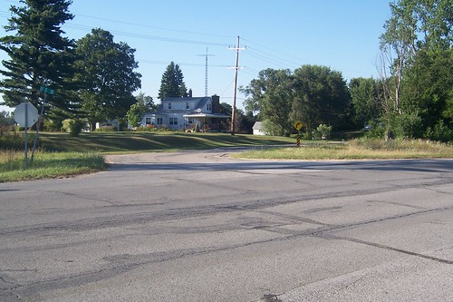
Here's the south end of Quinn Trail.
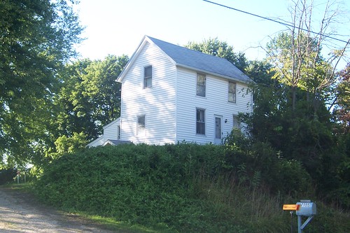
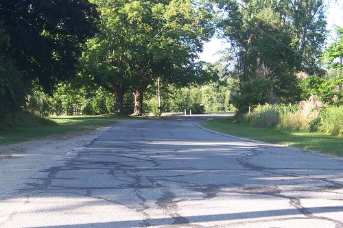
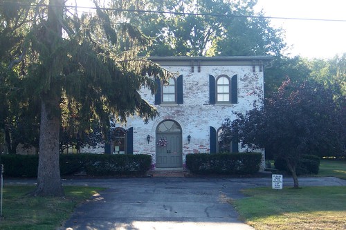
Just north of where Quinn Trail begins, this house appears on a bluff overlooking the road.
This northbound shot shows the road from in front of this house.
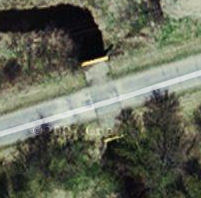
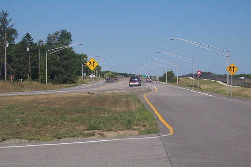
I think that this ceased to be a highway when US 31 was expanded to four lanes in northern Indiana. It's not clear to me why Quinn Trail was left behind; it seems like it would have been possible to expand this road to four lanes. A small bridge built on what is now Quinn Trail seems to have anticipated a wider US 31 – as the map excerpt below shows, it could carry four lanes of traffic, albeit with no shoulder.
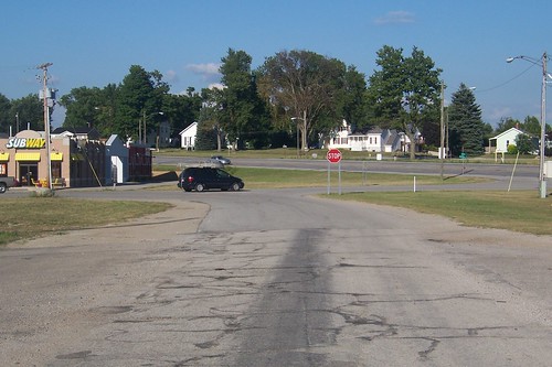
Here's Quinn Trail's northern end. At one time, it almost certainly went through the lot that the Subway stands on.
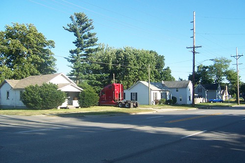
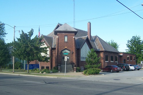
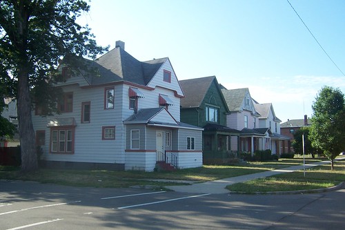
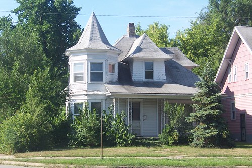
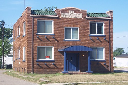
Lakeville was named after the two small lakes that stand near it. It was deliberately founded along the Michigan Road to take advantage of all its benefits, but I haven't been able to learn exactly when. The town did all right because of the road, but really took off when railroads intersected it. Lakeville is lined with homes; this one is typical. Sources:
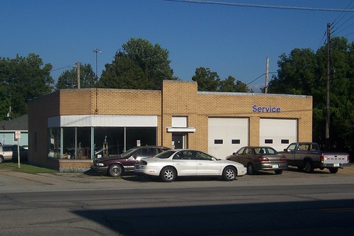
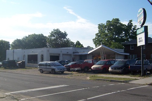
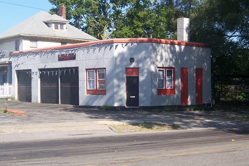
This was once Lakeville's Mobil station.
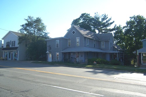
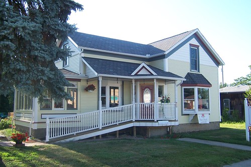
This is probably the nicest old house on the road in Lakeville. It's an apparel and gift store today.
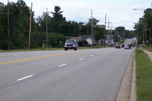
This southbound shot of the east side of the road is north of Lakeville's business district.
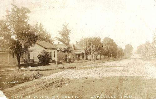
I think that this postcard, postmarked 1911, was taken in about the same spot. I figured I'd have no trouble finding this scene in modern Lakeville, but it turned out to be quite challenging. I think that the third house from the left in the postcard is the same one as the third house from the left in the photo above.
I marvel at how there is no sign that there were ever tracks on Lakeville's north side. This photo is taken from where the road once passed over the tracks.
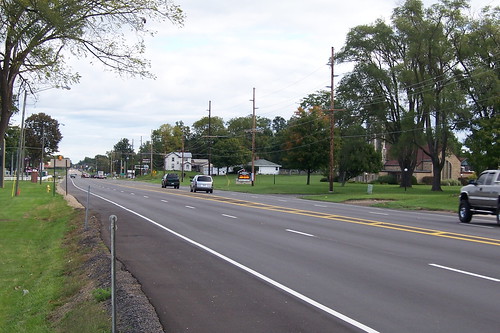
From about the same spot, here's the southbound road as it leads into Lakeville.
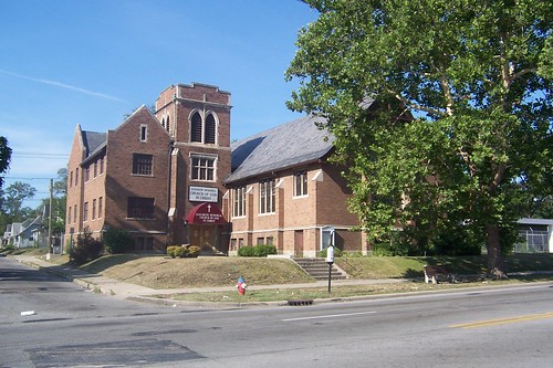
And here's the northbound road as it leads out of Lakeville. The Lakeville United Methodist Church is behind the trees on the right.
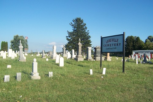
The Lakeville Cemetery, established 1849, is actually north of Lakeville.
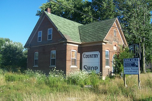
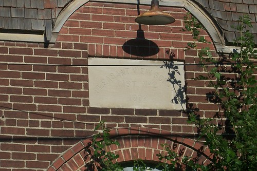
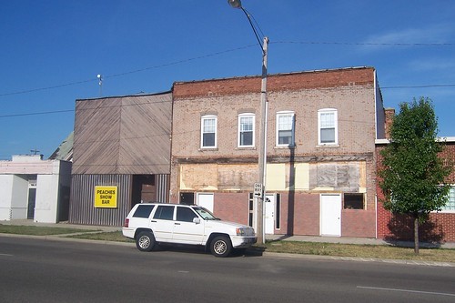
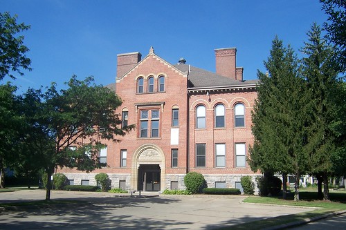
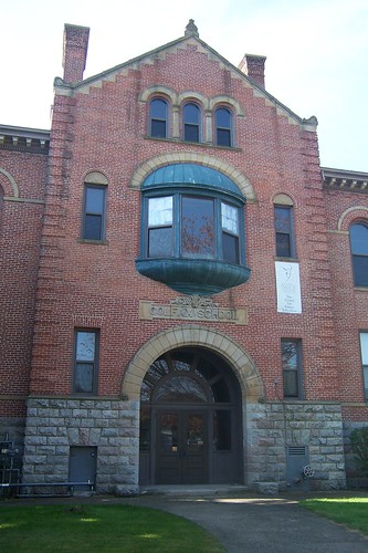
This building was once a school. It most recently housed an outlet of the Country Bake Shop, but even that has been closed for probably 20 years.
In case you can't read it: "Pleasant View School, Dist No 2, 1902."
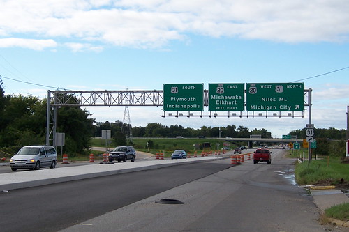
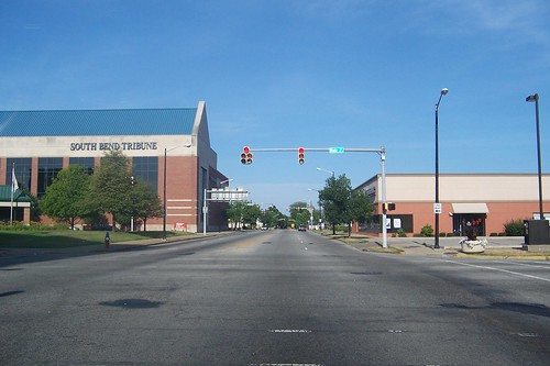
This is the Michigan Road as it enters South Bend. I'll bet that the original Michigan Road builders' minds would be blown if they could see what the road has become here.
Here's the road as it approaches the St. Joseph Valley Parkway, which carries US 31 around the west side of South Bend.
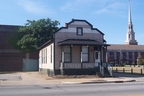
An interesting old house just south of the city limits.
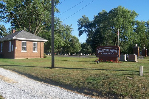
Southlawn Cemetery, which has been here since 1836, appears at the very bottom of the map above. Source:
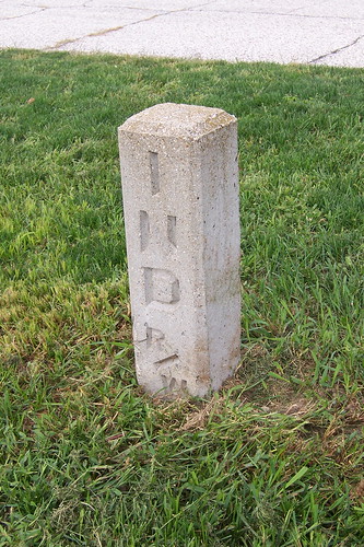
An Indiana right-of-way marker. It's in front of a furniture store near Johnson Road. My understanding is that on older roads, these tended to be placed for reconstruction projects such as widening or realignment.
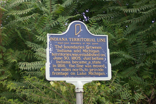
People from South Bend can joke that they live in extreme southern Michigan. Originally, Indiana's northern boundary was even with the southern tip of Lake Michigan. What is now Johnson Road in South Bend was originally along that boundary line.
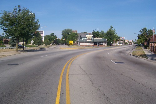
This southbound shot shows "the bypass," which is what South Benders have called the St. Joseph Valley Parkway as long as I can remember. When I lived here, the bypass didn't go any farther east than this. Even though US 31 has not gone through South Bend in decades, people still call the road through town "31."
The first white man to set foot in St. Joseph County and what would become South Bend was French explorer Robert de La Salle in 1679. The first white man to settle St. Joseph County was Pierre Navarre, who came in 1820 and built a home north of the St. Joseph River near what is now downtown South Bend. In 1823, Alexis Coquillard (co-QUILL-erd) began trading furs near where La Salle landed. The area was first known as St. Joseph's, and in 1829 a town named Southold was founded here. Navarre and Coquillard were the driving forces behind the town's early development. The town's name became South Bend in 1830. In 1831, South Bend was named the seat of the newly formed St. Joseph County, and in 1835 was incorporated as a town. South Bend is said to have lobbied hard to have the Michigan Road routed through town. With the river, the Michigan Road, and the railroad's 1851 arrival, the stage was set for South Bend to boom, and it did. Manufacturing companies blossomed in the fledgling town, which became a city in 1865. Sources: This map shows the Michigan Road's route through town. It heads north on Michigan St., and then makes its big left turn and heads out of town on Lincoln Way West.
This in-car photo was taken just south of Chippewa Ave., where Michigan St. becomes one way north all the way to downtown. There's no way to drive the Michigan Road south from downtown to Chippewa Ave.; you have to drive Main St. instead, one block west.
North of where Michigan St. becomes one way north stands the South Bend Motel.
The South Bend Motel's great neon sign.
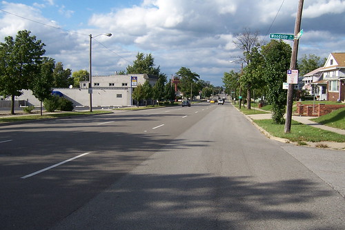
This northbound shot shows the one-way Michigan Road on South Bend's south side. I grew up four blocks east of here; these are my old stomping grounds. The street sign in the photo says "Woodside Av." The old embossed street signs all said "E Woodside St" until the city replaced them all several years ago. Somehow narrow Woodside became an avenue in the process.
This used to be Cira's Supermarket, which had all of five aisles but a well-regarded meat department. I rode my bike down here for a gallon of milk more times than I could ever count.
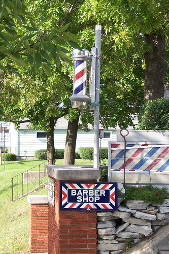
I never got my hair cut here, but I rode my bike past this barber shop and its little pole all the time. It's about a half block north of Cira's.
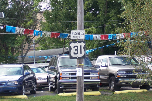
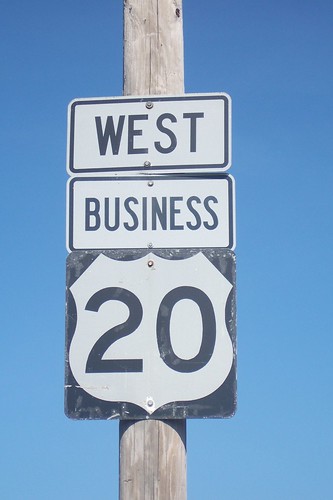
South Bend is full of non-standard highway shields. I've counted three shields with this funky shield shape and blocky typeface. Sign fans will also notice the single "Business North" sign, when the standard is to have separate signs.
This building about a mile north on Michigan St. just south of Indiana Ave. used to be a Bonnie Doon drive-in. Imagine a day when the locked gate was gone, the sign's first two parts still read "Bonnie" and "Doon," and you could get a great tenderloin and wonderful made-in-South-Bend ice cream here. At one time, Bonnie Doon locations dotted Michiana. I think only one Bonnie Doon, on the Lincoln Highway in neighboring Mishawaka, remains.
This former church now houses a parole office.
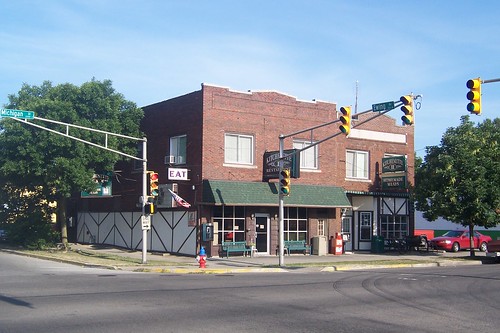
Two restaurants, the Kitchenette and the Kitchenette II, stand on the northeast corner of Ewing Ave. The neon Eat sign still lights up every night.
North of Ewing, it becomes clear that South Bend's south side has seen happier days.
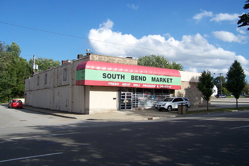
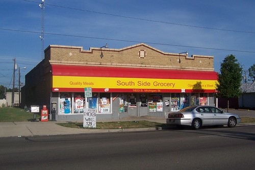
This little market seems to be doing all right.
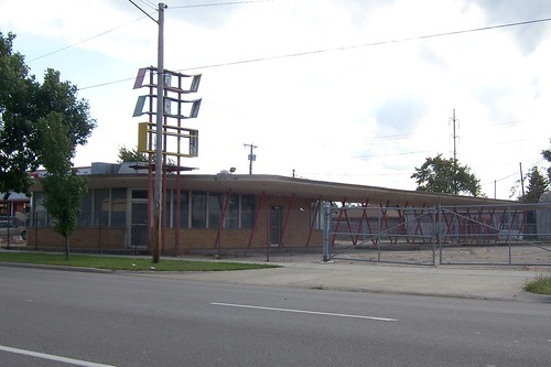
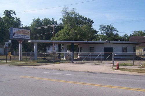
This appears to be a 1930s service station with a 1960s overhang tacked on.
Michigan St. was once rich with homes and neighborhoods on the south side, but over time most of the homes have been razed. Here are some survivors.
More decay on the south side.
This northbound photo was taken just south of Sample St.
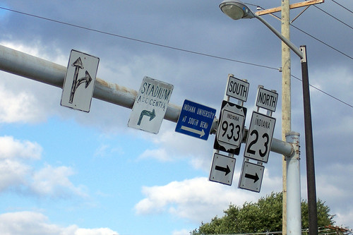
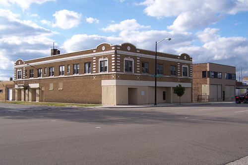
Here's a closer look at some of the signs in the previous photo. Notice how some of the signs are fading badly. The "Stadium A&C Center" sign is easily 40 years old.
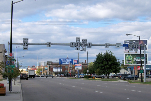
Notice how an Indiana 933 shield was tacked over a US shield. US 33 once ran through South Bend on its way to St. Joseph, Michigan, but since 1998 has ended on the western outskirts of Elkhart. Old US 33 in St. Joseph County is now State Road 933. (It's not a highway at all between the St. Joseph County line and Elkhart!) When it came time to change the signs, somebody got cheap. Check the funky wide typeface on the US 31 shield. Most, if not all, of the overhead US 31 shields look like this.
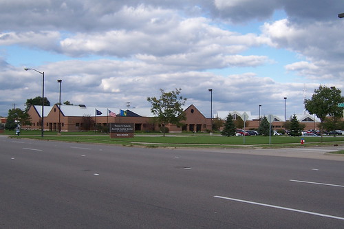
I made a road trip along this corridor once before when I explored US 31's original path in northern Indiana. A fellow e-mailed me to say that he used to live in a neighborhood that used to stand here. It made way for The Frederick Juvenile Justice Center.
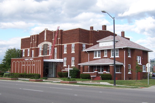
This imposing structure, the Christ Temple Church of God in Christ, was originally the First Brethren Church. The house is attached.
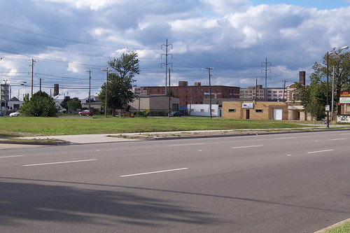
Nearer to downtown, entire blocks have been razed. The near south side could be turning into an urban prairie!
I have heard that this block was in danger of being razed.
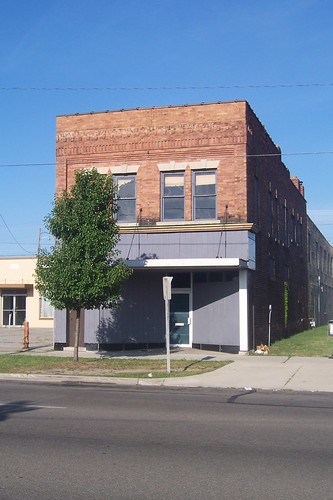
The South Bend State Bank has been gone for longer than I've been alive, but its building remains.
Signs of life begin to appear again immediately south of downtown. The Victory Bar has some great signage.
The UAW meets here.
The St. Andrews Greek Orthodox Church.
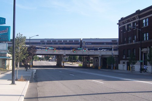
At Bronson St., the railroad is overhead. An Amtrak train happened by when I was here.
This imposing building with its prominent fire escape stands right by the tracks.
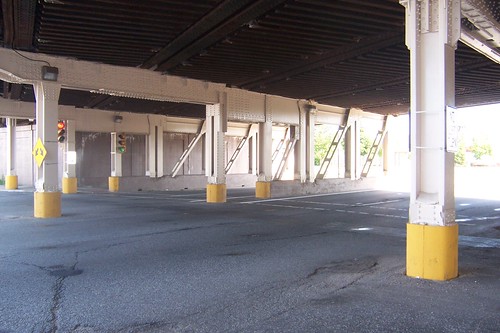
Here's a view under the tracks. Bronson St. actually meets Michigan St. here.
Last time I drove by here, this great neon sign was gone.
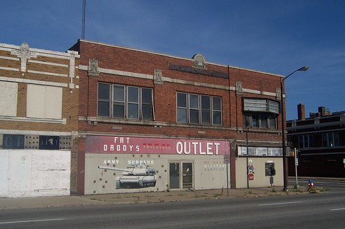
This corner has never been in great shape in my lifetime, but when I moved away from here in 1985 it still contained viable businesses. Today, except for an auto repair shop on the southeast corner, all of the buildings at this intersection are vacant. This is the southwest corner. Even though Fat Daddy's was by no means the original tenant of this building, this is known as the Fat Daddy's Block.
This is the northwest corner, which used to house Whitmer-McNease Music and a news stand.
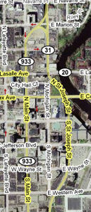
I'm relying entirely on memory of my 12th-grade social studies class for the story I'm about to tell, because my research has found no facts. The teacher was also a county-city councilman, so I think his his story was sound. The Associates was a national investment company founded and headquartered in South Bend. In the wake of Studebaker's failure, the company wanted to build a new headquarters and revitalize downtown at the same time. To build the new downtown Superblock, as it was called, several downtown buildings were demolished. Until that time, US 31 followed Michigan St. through downtown. The Superblock project rerouted US 31. Main St. was made one way south, and southbound US 31 was routed onto it. Michigan St. was made one way north, and northbound US 31 was routed onto it, except for several blocks downtown, where it was routed one block east to St. Joseph St. Michigan St. between Western Ave. and LaSalle Ave. was torn out and made into a pedestrian-only "mall." This map shows how it works:
Then in 1975, The Associates relocated to Chicago, leaving the project a shambles. The city became known for the holes in the ground where proud buildings, some historic, once had stood. The pedestrian mall succeeded only in making it necessary to park farther from downtown businesses, creating a needless barrier for customers. South Bend's first mall was built at about the same time, and shoppers went there instead. It took South Bend 15 years to rebuild downtown after that. This photo shows where Michigan St. starts to curve away onto St. Joseph St. Michigan St. has since been repaved and opened to traffic, as you can see near the center of the photo.
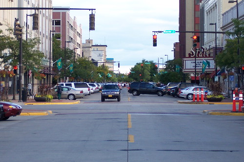
To follow the Michigan Road, turn left onto Western Ave. and then immediately right onto Michigan St., where you are greeted with this scene. As someone who grew up with that awful pedestrian mall, it is very gratifying to see all the cars here.
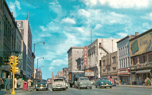
This early 1950s postcard is from about the same place.
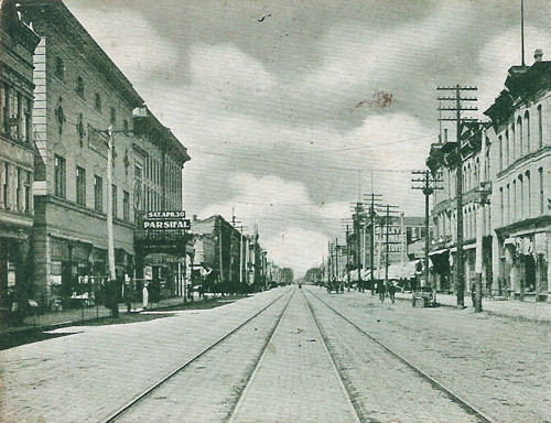
This image from a postcard postmarked 1906 is from about the same spot. South Bend has changed a great deal in the past century!
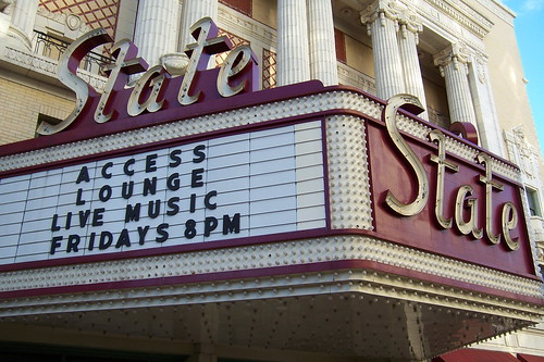
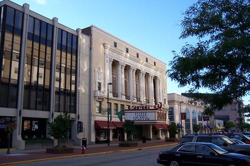
Check out the old State Theater marquee in the 1950s postcard photo. The one below is the only one I've known. I saw my first movie at the State, a rerelease of Bambi, sometime in the early 1970s.
Here's a long shot of the State.
South Bend still bears some evidence of its disastrous urban renewal period, as this block north of Jefferson Blvd. shows.
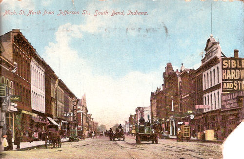
This image from a postcard postmarked 1909 shows the road northbound from Jefferson Blvd. as it once was.
The First Source Bank and Marriott Hotel building at Washington St. filled one of the last downtown holes in South Bend. When I was a kid, this lot was a popular place for people to watch the annual July 4th fireworks.
This grand 1921 building was originally a vaudeville theater called the Palace but is now the Morris Performing Arts Center. This real gem has been extensively restored. I've been in it twice, before and after the restoration, and all I can say is that an amazing, painstaking, and loving job was done. The theater's story is here: www.morriscenter.org/history.html
Here's the entrance.
The block of Michigan St. in front of the Morris is only one lane wide and not used for traffic. To follow the Michigan Road, you have to turn right onto Colfax Ave. and left onto St. Joseph St.
The former La Salle Hotel stands where St. Joseph St. merges back into the Michigan Road's original path. But to keep following the Michigan Road, you turn left around the hotel onto La Salle Avenue.
Here, the Michigan Road ceases to be the Dixie Highway and becomes the Lincoln Highway, running east-west rather than north-south. This is westbound La Salle Ave.
Shortly, La Salle Ave. curves and becomes Lincoln Way West. Before the Lincoln Highway came, however, this road was Michigan Ave.
This little building on La Salle Ave. was the South Bend Hat Bleachery in the 1930s and a women's clothing shop into the 1970s, I'm told.
While the road is signed "Lincoln Way" today, until recently it was signed "Lincolnway," and many businesses adopted that spelling. This building, at the corner of Cushing St., was once an A&P grocery at which both my father's and mother's families shopped. Today, it is Lincolnway Foods.
Rather, it was Lincolnway Foods. It burned to the ground during the week after I took the previous shot.
Lincoln Way passes through an old part of South Bend, with many of its brick streets still intact. This is Cushing St. Of all the brick streets I've driven on, South Bend's are the rumbliest.
The imposing Oliver School is today the Colfax Cultural Center, which houses space for artists, performers, and related businesses. This is what it looks like as you drive toward it on Lincoln Way.
This is the front entrance, which faces Lincoln Way.
Many older homes stand along the road here.
This is the Elizabeth Memorial Church of God in Christ, but I suspect that this building housed another congregation previously.
A former service station along Lincoln Way.
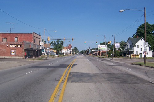
This is the westbound road. Notice the "SUPRKET" sign on the storefront on the left. When I was a kid, that sign read "SUPERMARKET." Somewhere along the line it lost its ERMAR.
From the air, this recording studio building looks like a guitar pick.
This neat little apartment building was named after the Lincoln Highway.
I'm not sure what this monstrosity is, but I couldn't resist photographing it.
Kreamo Bread was once a South Bend bakery, and its headquarters are on the Michigan Road (and the Lincoln Highway).
The 1911 Epworth Memorial United Methodist Church, hidden behind trees. I'd have better luck taking photos in the winter, when the leaves are down.
US 20, the longest numbered highway in the nation, made its mark on South Bend along the Michigan Road and the Lincoln Highway before "the bypass" was built. US 20 now skirts Elkhart and South Bend to the south.
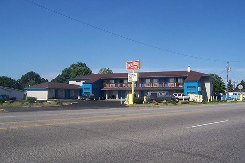
The Lincolnwood Motel.
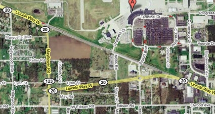
The South Bend Regional Airport needed to extend its runway a few years ago, and to do so it took out part of the Michigan Road's original route. This shows the road curving slightly south around the new runway, but originally it went straight through here.
Google Maps' imagery isn't up to date. It still shows the Michigan Road on its original route. Its labels show the current route, though, on which there are two roundabouts.
I took this westbound photo from where the road curves away from its original route. You can see the road pick up on the other side of the airport.
This eastbound photo is from the west side of the airport. If you view this at full size and squint, you can see the stoplights at Sheridan St. glowing red. The road in the middle of the photo is the original Michigan Road path, left behind in the runway expansion.
Here is where travelers curve back onto the road's original path on the west side of the airport.
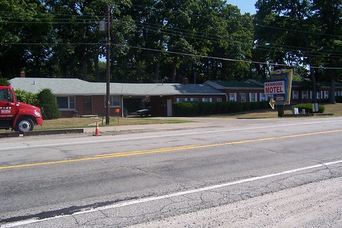
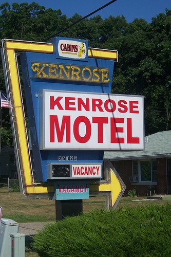
The road becomes US 20 outside of South Bend. Just beyond the city limits stands the Kenrose Motel, which didn't appear to be very busy this day.
Here's a closer look at the Kenrose's sign.
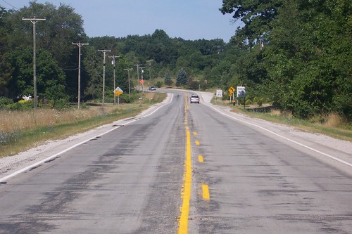
The Michigan Road narrows to two lanes as soon as it leaves South Bend.
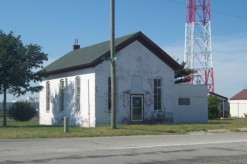
The road passes through the Terre Coupee prairie on its way to New Carlisle. I'm told this building was once a school and later a store.
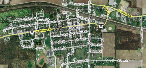
The Michigan Road next comes to New Carlisle.
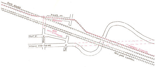
Notice how the road curves wide on the east side of town. Until 1926, the road ran straight here, crossing the railroad tracks at an awkward and dangerous angle that was the scene of many accidents. Four tracks crossed the road here then, two owned by the New York Central Railroad; one by the Chicago, South Bend, and Northern Indiana Railway; and one by the Chicago South Shore and South Bend Railroad. The tracks were even at different levels, the interurban tracks a few feet lower than the New York Central tracks, making the crossing even more challenging. This drawing, courtesy Rob Heinek, shows the original configuration of the tracks. The road's original path is shown with red dotted lines. Heinek also provided the story of the viaduct I've shared here.
Negotiations with the railroads to build a viaduct and reroute the road for safer passage dragged on for several years but kicked into high gear when New Carlisle passed an ordinance limiting trains to eight miles per hour. The terms worked out, a viaduct was built and the road curved. A retaining wall on the southernmost curve touts New Carlisle's virtues today.
Here's what it's like to enter New Carlisle under the viaduct. This eastbound photo shows the road as the curve returns to the road's original path. The driveway that begins where the road curves is the original road.
On the edge of downtown New Carlisle, this mural of the town from about 1941 is painted onto a building.
Here's the same scene in modern times.
Downtown New Carlisle makes a hodgepodge of its buildings, which seems typical of towns of this age and size.
New Carlisle is better cared for than many other Michigan Road towns of its size, however.
A longtime bank building, today a Wells Fargo branch. Somehow, I doubt the drive-through is original to the building.
I find it interesting how these two mirror-image buildings ended up differently decorated.
The only reason I'm including this photo is because I happened to go to public school with this podiatrist, and I haven't seen her in over 20 years. I was surprised to see her name again after so long.
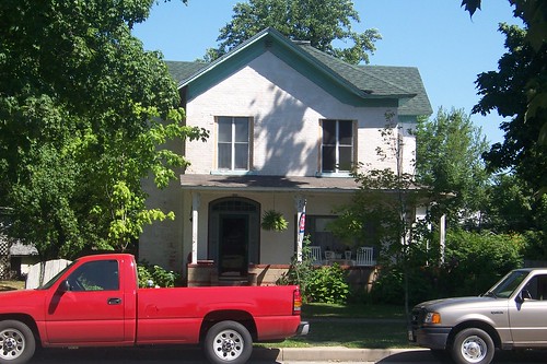
New Carlisle is rich with older homes.
The sign says, "God wants spiritual fruits, not religious nuts."
Another older home along the way in New Carlisle.
And another.
The road's name tips its hat to its heritage. Richard Carlisle founded New Carlisle in 1837 along the road. Source:
New Carlisle's park.
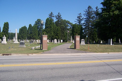
Outside New Carlisle, on the border with La Porte County, stands the 1863 New Carlisle Cemetery.
|
||||
|
||||
|
Created 17 February 2009. Updated 24 February 2009, 12 January 2012. |
||||