The National Road in Illinois |
||||
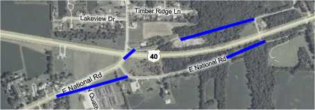
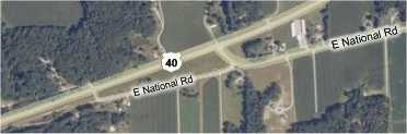
MarshallWhen we reached where US 40 curved to bypass Marshall, we turned left to follow old US 40 and the National Road. This map shows how I think the north and south National Road alignments might have converged here. I've added blue lines where the road might have gone, but no evidence is present today.
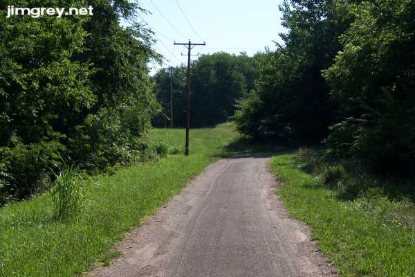
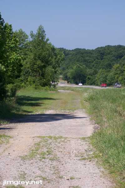
We chose to explore only the south alignment here, so we turned left onto the remnant of the south alignment. We were surprised to find it paved and barely one lane wide. At its east end, it curved sharply, probably into somebody's driveway. But the telephone poles, which curved gently to the north, show where the road used to go.
I looked back westbound and saw that the only destination back here was that driveway.
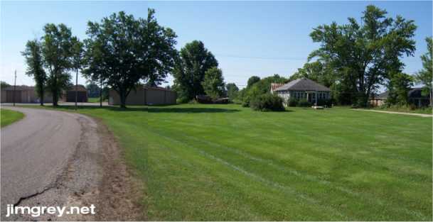
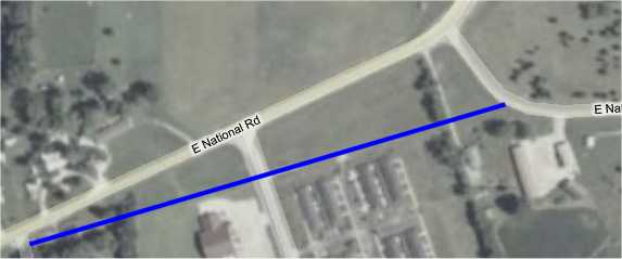
After my last attempt to turn around on this trip, I played it safe and backed my car out of there. I turned around in the parking lot at far left in the photo below, which I stitched together from two photos since I lack a wide-angle lens. This is where the road was curved to meet old US 40. I noticed how all the buildings here faced the same way. The square house, I'll wager, used to sit directly on the National Road. I'm betting that bush in its front yard, to the left of the house in the photo, used to be right on the edge of the road.
If that were my house when they built US 40, I would have been really ticked to gain so much more front yard to mow. Notice how, in this map, the house and its neighbor buildings all face the same way. I drew a blue line where I think the road used to go. The house and its bushes are about 3/4 of the way across the image.
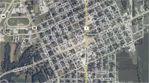
We climbed back onto old US 40, signed Archer Ave., and headed toward downtown Marshall. This map shows most of the town. On the upper left, US 40 is heading back south to rejoin its original path on Marshall's west side.
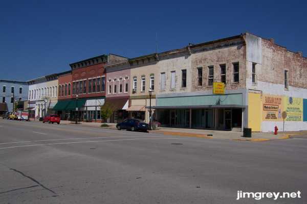
Marshall's downtown begins just west of Illinois State Road 1. Its buildings date from about 1870 to maybe 1920. The east end of the block in this photo, the north side of Archer Avenue between 7th and 6th Streets, looks a little rough, but as we went west, the buildings were in better and better repair.
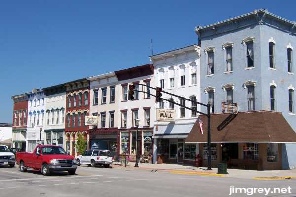
This photo of the north side of Archer Avenue between 6th and 5th Streets, is as close as I could get to being the modern equivalent of the photo George Stewart took of the same block for his 1953 book, US 40: Cross Section of the United States of America. Praises to Marshall for preserving these buildings, at least externally. Sadly, one building from Stewart's photo is gone today; it stood to the left of the building at far left. While the remaining buildings are probably different colors, awnings have been added or deleted, and the signs have changed, this block is remarkably intact.
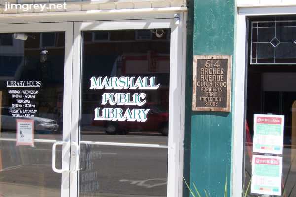
Marshall appears to be proud of its old downtown. Many buildings wore plaques attesting to when they were built and their first business. The Marshall Public Library building, built around 1900, was a farm implement store. It is on the north side of Archer Avenue, the tallest building in the photo of the block between 7th and 6th Streets.
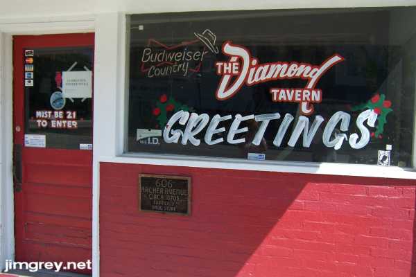
A few doors down from the library is the Diamond Tavern. The building was built in the 1870s and was a drug store, the plaque says. But today the Diamond Tavern is closed until further notice by order of the mayor, the sign taped to the door says. Health code violation? Teenagers let in with a wink and a smile?
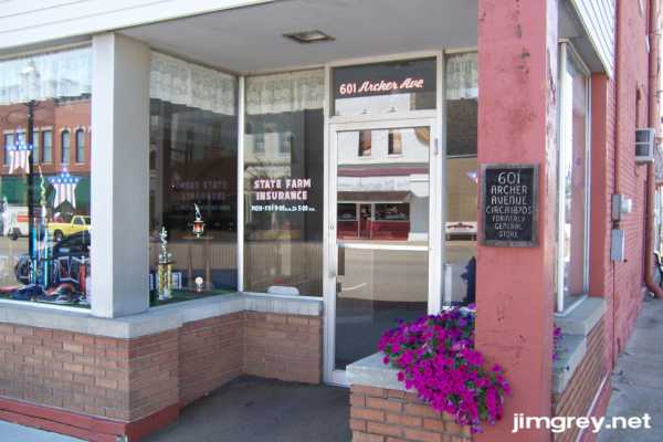
The old General Store, build around the 1870s, is now home to a friendly State Farm agent. It's on the southeast corner of Archer Ave. and 6th St.
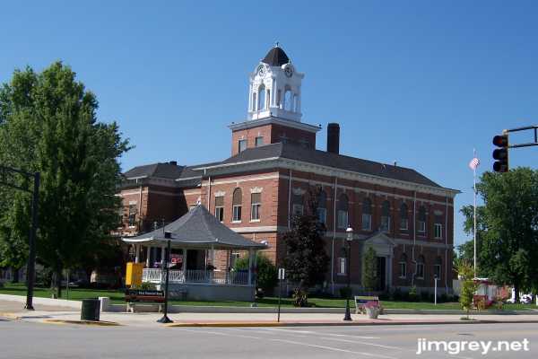
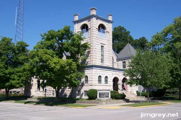
Across 6th St. is a striking courthouse. I especially liked the lines of the gazebo's roof.
This imposing building, the First Congregational Church, isn't actually on old US 40, but one block north on the northwest corner of 6th and Plum. It's so striking even viewed from a block away that I walked up to see it.
There was plenty more to see in Marshall, which seems to have a lot to be proud of. But we needed to keep moving, so we headed west out of town on old US 40. As this map shows, beyond where the road was curved to meet US 40 a short, narrow segment of the road still remained, and where that was curved to meet US 40, the remnant of the old road continued.
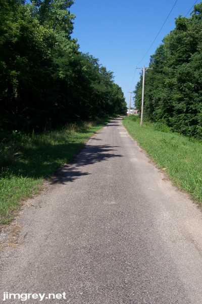
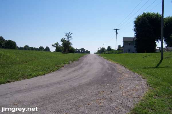
This eastbound photo is from the west end of this narrow asphalt segment that seems only to provide passage to two homes built on the route.
Westbound from this spot, here's the old National Road. It looks like it's gravel, then cement, then brick. Past the brick section, the road curves to run parallel with US 40.
|
||||
|
||||
|
Created 22 July 2007. |
||||