The National Road in Illinois |
|
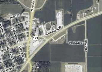
GreenupI said to Dawn as we drove west on US 40 toward Greenup, "Whenever we drive on US 40 on this trip, I keep wondering where the other two lanes are. I keep being surprised to find oncoming cars along this road." There was just something about this two lane road that said, "westbound lanes." I couldn't put my finger on why. Greenup is 10 miles west of Casey and, since there was so little cement or brick highway to stop and see, we came upon it quickly. Unlike every other town that US 40 bypassed so far, the highway went around town on its south side. Through town, the National Road was signed as both Cumberland St. and Illinois State Road 121.
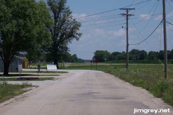
A short segment of the old road lay to the east of the turnoff. This photo shows how westbound traffic on US 40 used to flow smoothly right down this segment. Today, it's a local road, so the guy hawking vinyl siding could not have been getting much business if that sign was his only advertising. The utility poles that disappeared a few miles back reappeared here, as the photo shows.
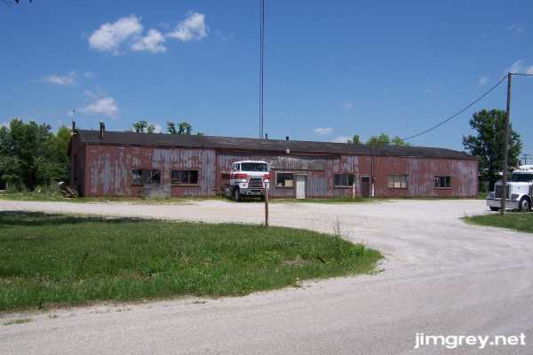
A building marked Greenup Fertilizer Co. in fading paint sat along this segment. We couldn't tell if it was a going concern, or a vacant building that semis use as a parking lot.
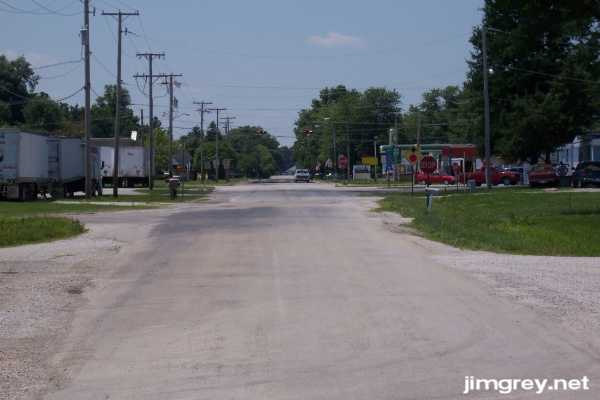
Past the stop sign, this segment becomes Cumberland St. and State Road 121.
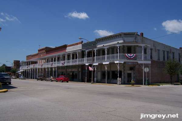
Greenup's main road was lined with reasonably well-cared-for homes – not as nice as in Casey, but not as dense, either. Quickly, we came to downtown. Like so many of the Illinois towns along the National Road, the buildings were a hundred or more years old. But in Greenup a row of second-floor balconies had been built along all of them on the block between Kentucky and Mill Streets. At any moment, I expected Jesse James to jump down from one to his horse waiting below and gallop off. This photo is of the north side of Cumberland Street west of Kentucky Street.
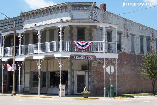
Here's a close-up of the building on the northwest corner of Cumberland and Kentucky. As you can see, it's not been maintained as well as the buildings we saw in Casey or Marshall. I wonder who Elstun was since his name was on the top of the building.
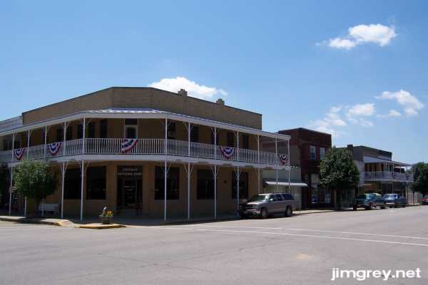
This photo is of the south side of the same block. Typically, the Greenup National Bank's door faced the corner. The bank was gone, though, replaced by something called ClearPoint Resources.
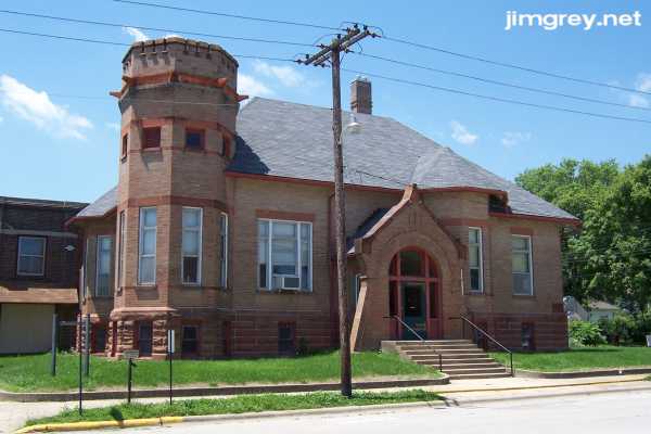
A sign by this grave and imposing building called it the Greenup Township Carnegie Library. It was built in 1904 with money given by Andrew Carnegie. It's on the northwest corner of Cumberland and Mill Streets.
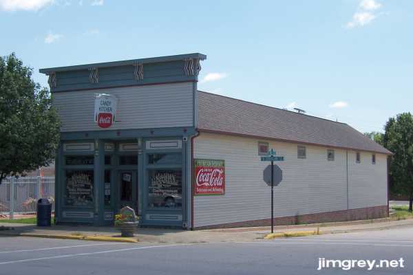
On the southwest corner of this intersection stands the Candy Kitchen with its old Coca-Cola signs and its promise of an old-fashioned soda fountain. We wished it were open that afternoon, as ice cream would have been welcome on that hot day. A five-and-dime near my childhood home had a soda fountain of gleaming stainless steel. Every time I had the money, I went down there and had a chocolate malt. The store closed while I was in college twenty years ago, and I haven't sat at a soda fountain since. I sure wished it had been open.
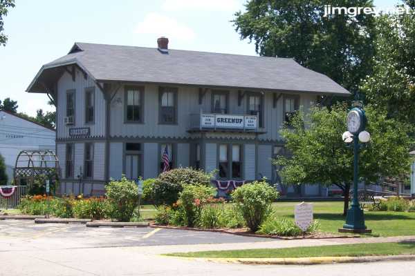
On the southwest corner of this intersection sat a train depot used today as a rail museum. It was built in 1870. We were running behind so we didn't stop in. (I would have run farther behind for a chocolate malt, though. Priorities.)
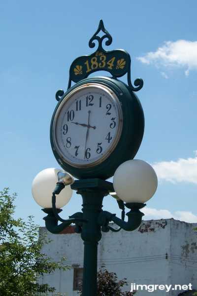
Here's a closer view of the clock, which was not keeping accurate time.
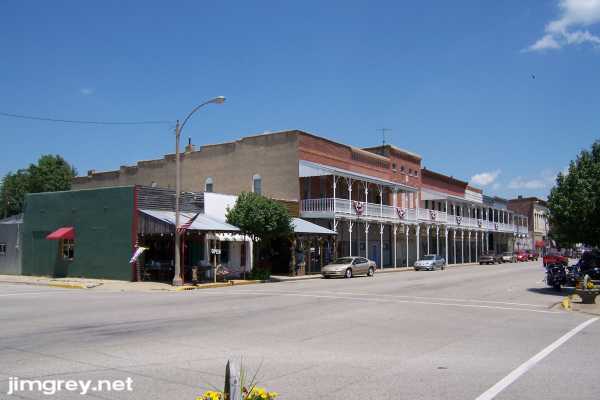
I took one last photograph of Greenup's balconies from the southwest corner of Cumberland and Mill Streets before we continued our trip west.
|
|
|
Created 22 July 2007. |
|