The National Road in Illinois |
||||
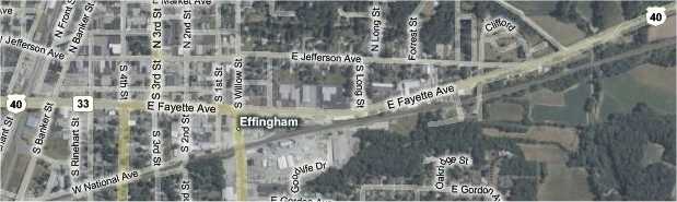
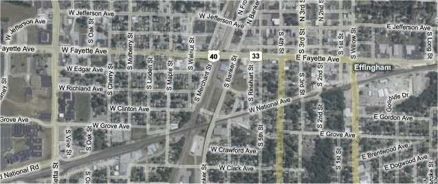
EffinghamEffingham began a mile after Teutopolis ended. The map showed that while US 40 didn't bypass this city, it didn't follow the National Road alignment, either. The National Road itself appeared to stop and start through town as it paralleled the railroad tracks.
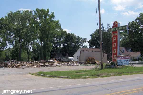
As we came near to Effingham we could see a tall neon sign in the distance. As we got closer, we could see that it was grand.
But when we got up on it, the scene was sad.
The building had burned about a month earlier, on the night of June 5. It had stood since 1938, first as a bar, then as a fine dining establishment, and most recently as a roadhouse of sorts. For many years, it was the only place on US 40 for several states that was open Sunday nights, when it drew crowds from a hundred miles away. Soon we came upon a fork in the road where a Historic National Road sign pointed us to the north fork. I was surprised by this, since our map showed road segments labeled National Avenue to the south, along the railroad tracks. We weren't expecting to see this, so we zoomed right by it at first.
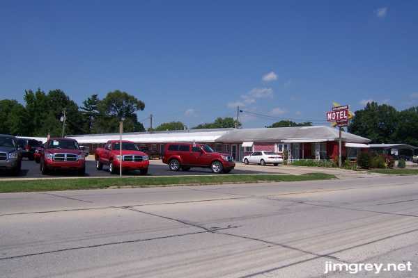
While we looked for a place to turn around, we passed an old motel on Fayette Avenue, old US 40, and its neon sign.
The motel was a going concern. Apparently, the half-ton truck convention was staying here. Or perhaps the motel was next to the Dodge dealership. I can't remember which.
We turned around and headed back for Jefferson Avenue. I fully intended to weave my way through Effingham along the railroad to follow the National Road, but followed Jefferson Avenue because the Historic National Road signs had so far been trustworthy. Jefferson Avenue was middle-class residential at first, a street of nicely kept older homes.
We followed the Historic National Road signs, which had us turn south on US 45 for a block and a half, and then west onto US 40, which led us out of town. You can see the path on this map. US 45 is Third Street.
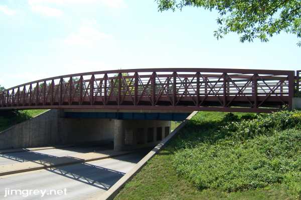
US 40 was dug under the Amtrak tracks between Banker and Merchant Streets. I'm pretty sure there's a pedestrian walkway alongside it.
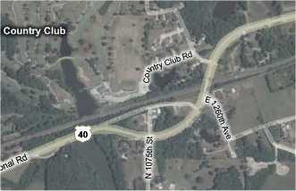
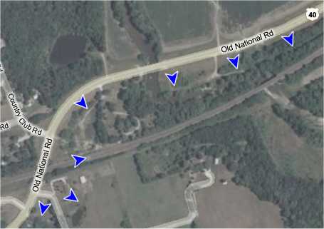
We followed US 40 out of town. It was four lanes through town until it turned south on Henrietta Street, where it became two lanes again. When it reached the railroad, it turned west and ran along it. Another day I'll return to follow the road marked National Road along the railroad tracks. Just west of Effingham, US 40 crossed the railroad tracks.
I think the National Road used a tighter curve to navigate these tracks. Traces on the aerial map show a road that runs closer to the tracks coming from the east, and suggest the tighter curve. The blue arrows in the map below show where I think the road may have gone.
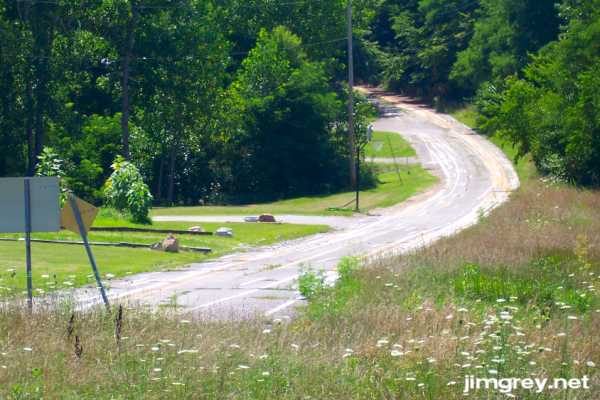
I didn't think of this until after the trip, unfortunately, so we didn't look for the remains of this road. We did, however, see the funniest old-road remnant of the day. Just past where US 40 crossed the tracks, facing westbound, we saw the National Road covered in stripes. It looks like this is where ILDOT trains stripe painters! Notice also the basketball goal on the road by the first driveway. It must be an Illinois thing to play basketball in the street.
|
||||
|
||||
|
Created 22 July 2007. |
||||