The National Road in Illinois |
||||
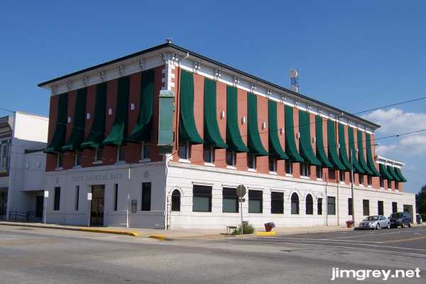
Going homeWe were both pooped and hungry after our hundred-mile trek into Illinois. We looked around for a place to eat in Vandalia, but couldn't find one (on a Saturday night, no less). But we did see a bit of Vandalia's downtown along State Route 140, which had at various times been US 40 and Alternate US 40. The First National Bank building was striking with its tall green awnings and art-deco style lettering across its front.
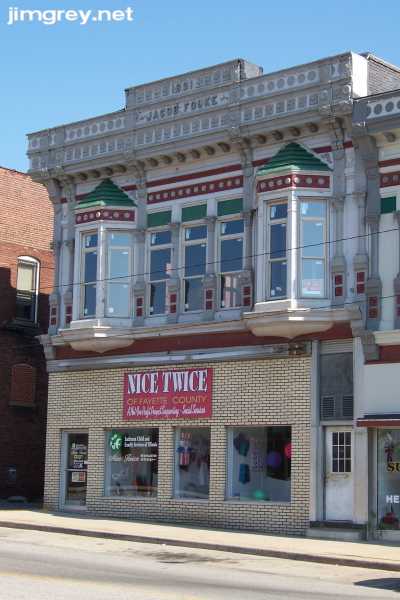
Also along 140 was the 1891 Jacob Fouke building, painted brightly on the second story but not looking too authentic downstairs.
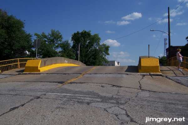
We also walked south on Third Street behind the old statehouse and saw a bridge that rose high above street level.
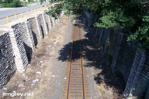
We looked over the east railing and saw remarkable stone retaining walls on either side that provide safe passage for trains. The walls looked very old and probably set by hand. This underpass must have been a huge job to construct in its time.
Vandalia even took great care to plant flowers all around the statehouse. These purple flowers were popular in planters along the sidewalks.
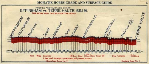
Vandalians have a nice little town and many reasons to be proud to live there. I recommend that they add someplace to eat downtown on a Saturday night, though! So we climbed aboard I-70 and ate in Effingham. As we sped home on I-70, Dawn and I talked about the trip. We agreed this was an outstanding day, jammed with great things to see. It was very exciting at first to see all the old brick pavement. The excitement diminished to a mere buzz after fifteen miles or so, but it was still great to keep pace with the old road as we cruised westward on US 40. I was puzzled that the Mohawk-Hobbs Guide said that in 1924 the road was concrete except for short brick sections at Marshall and Casey. We didn't see the first concrete pavement until a few miles east of Martinsville, and once we saw concrete we saw no more brick.
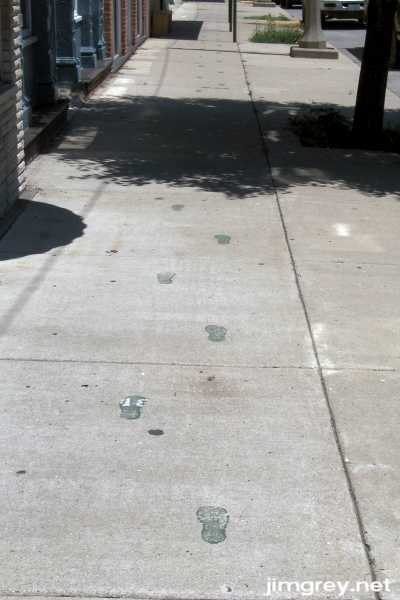
We were surprised that, when we stopped in many of the towns along the road, we were the only people on the street, even when cars were parked in front of businesses. The day was very hot, which would keep people indoors, but we saw very few people outside even walking to and from their cars. There were a few signs of vibrant life in some towns, though, such as the green footsteps going east on the north side of the National Road in Greenup.
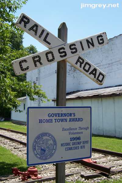
Another day perhaps I'll stop and look at the railroad museum in Greenup. The section of tracks in the photo is only as long as the white building next to it and appears to be ther for show. Dawn thinks a track may have gone through there once, and that the white building was there to dump grain into the cars.
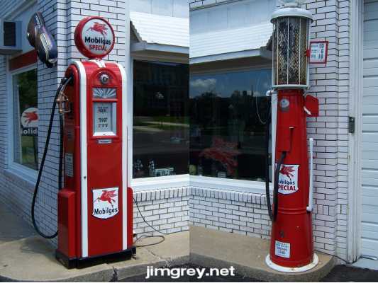
I am still impressed with cheerful Casey. And while the former service station turned quasi-museum is a little puzzling in its lack of signage, it was thrilling to enjoy the fruits of someone's effort and expense in putting this together. I always get a kick out of seeing old Mobil items because of how they made words out of their name, such as Mobilgas and Mobiloil. One of the many nicknames my dad called me as a boy, I'm sure a twist on a Mobil product name, was Mobilene, and I use that name as my online nickname almost everywhere today.
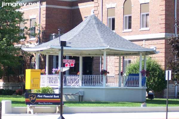
The way Marshall's downtown was so well maintained said a lot about its people. I thought the gazebo on the courthouse lawn was especially cheerful.
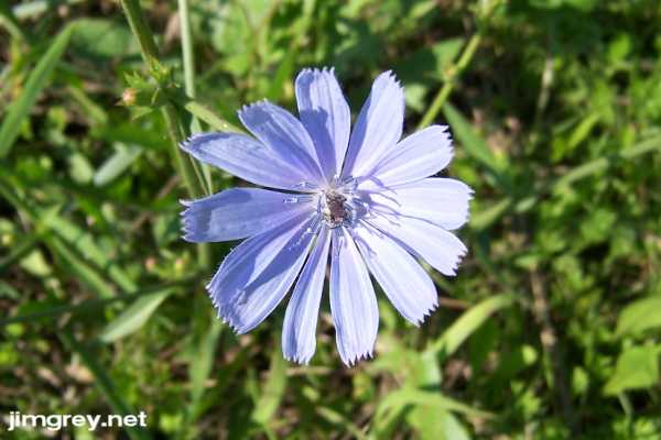
Around Livingston, and only around Livingston, these tiny blue flowers were everywhere along US 40 and the National Road. If you look closely at the center of the flower in this picture, you'll see some sort of little bug.
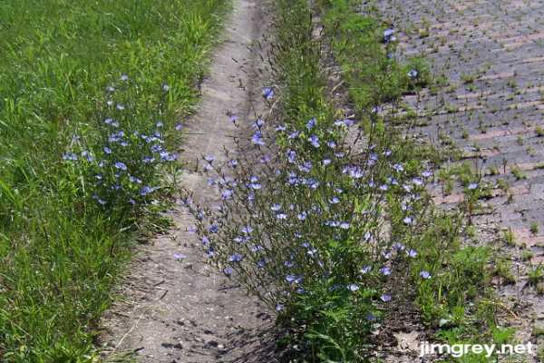
A bunch of them were growing in one of the gutters along the brick road. Notice how the plants shoot straight up and flowers bloom all up each branch.
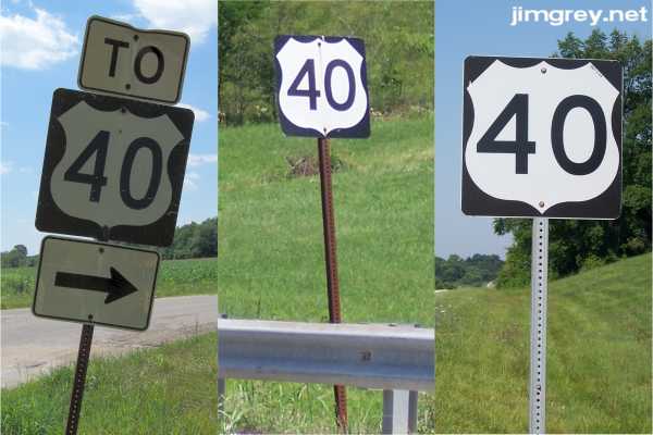
I hoped we would see some old highway signs along the road, but we had almost no luck. Up until 15 years ago or so, I remember seeing a hodgepodge of signs on the roads I drove, from different signmaking eras. You could guess a sign's age by the typeface of its numbers. Today, it seems like Indiana, and now I see Illinois, keep their signs new. The only older sign we saw was west of tiny Jewett, probably overlooked because it merely pointed the way to US 40 from the National Road. Notice how the shield doesn't touch the edges of the sign and the font is narrow. I remember signs like these growing up in the 1970s. The signs at center and at right are modern, although the one at center from east of Effingham is on a rusty post that may be older. The one at right, which says "ILDOT 11-99" in the upper right corner of the shield, is from Livingston.
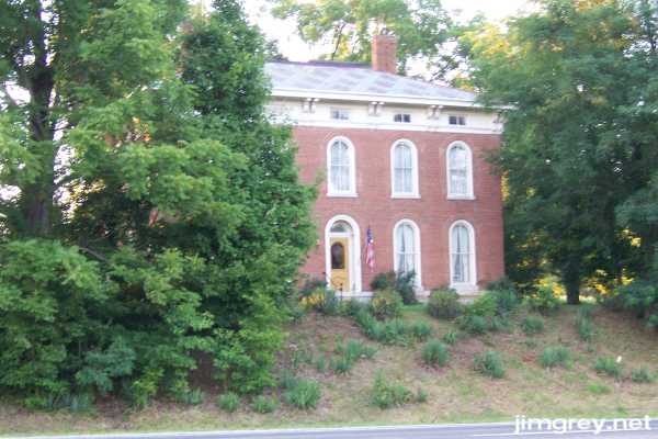
After we crossed into Indiana, we detoured briefly onto US 40 east of Brazil to find a house that George Stewart photographed for his US 40 book in 1950. We found it in fine condition. In 1980, Thomas and Geraldine Vale stopped here to take a photo as they worked on their follow-up to Stewart's book, and found the house abandoned and crumbling. Today, the house is a bed and breakfast named after its original owner, a doctor named McKinley.
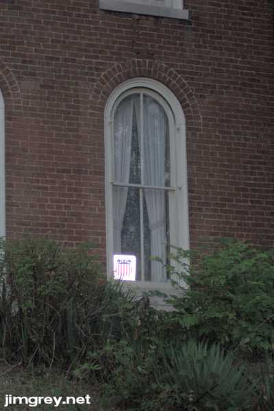
I'm sharing this non-Illinois site with you in part because the house acknowledges its National Road heritage with a sign in its window. My camera's flash made the sign pop.
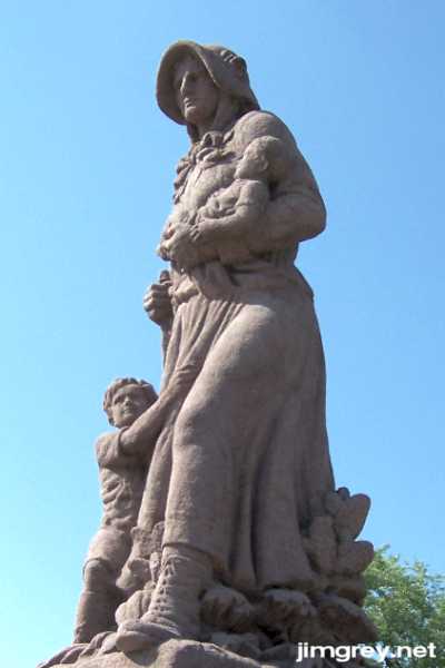
I'd like to thank my friend Dawn for her company and, as usual, her sharp eye on the trip. I'd also like to thank the gang at the American Road Magazine forum for providing information and encouragement as I planned this trip. It was exciting to be introduced to a wealth of information I didn't know existed, and it will forever change the way I plan for these trips. I especially thank Dave Paul for sharing his collection of early-20th-century road guides and allowing me to reproduce scans from them here. Finally, I thank I-70, without which it would not have been possible to see so much of the brick and cement National Road. Here's one final look at the Madonna of the Trail at Vandalia, her bonnet keeping the early-evening sun out of her eyes as she leads ever westward.
|
||||
|
||||
|
Created 22 July 2007. |
||||