The National Road in Ohio |
||||
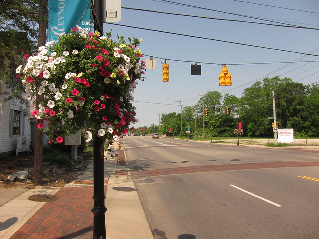
Franklin CountyBy the time I reached greater Columbus, I could see that I had left the rugged terrain of eastern Ohio behind. The road tracked straight, and except for a US 40 bypass of tiny Etna, the old and abandoned alignments had all dried up. But what central Ohio lacks in old alignments, it makes up for in roadside sights. Reynoldsburg begins inside Licking County, but most of it is in Franklin County.
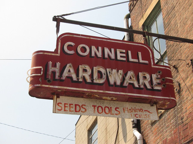
My favorite sight in Reynoldsburg is Connell Hardware.
My favorite of its two neon signs is the one facing the side street.
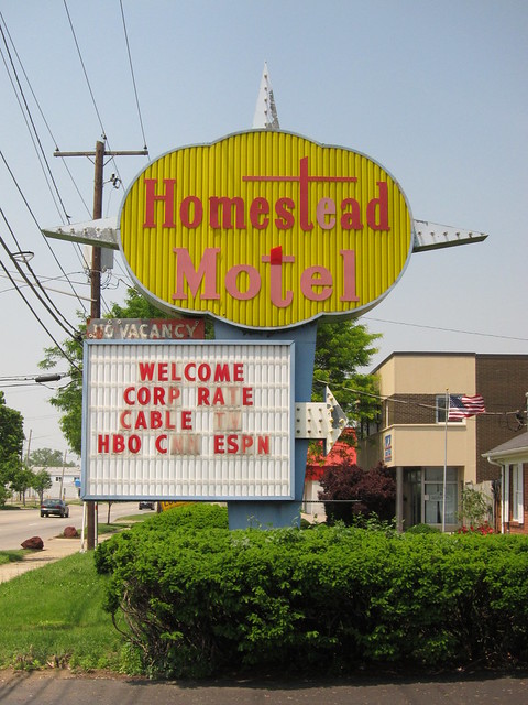
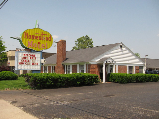
As I entered Columbus proper, I thought I had stepped back into the 1950s because of all the great old motels still operating. I came upon the Homestead Motel first as I entered Columbus from the east. Check out what its sign looks like lit. Its sign is similar to the one for Baker’s Motel on the National Road in Norwich.
But this isn’t the Homestead’s first sign; this page shows postcards of two other signs this motel has used, as well as cards of other Columbus motels.
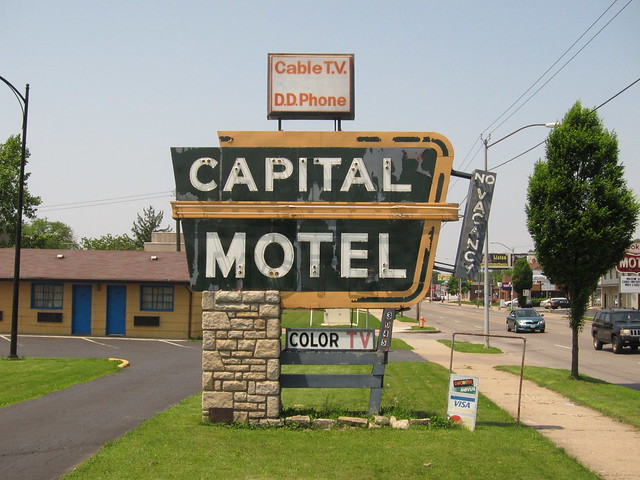
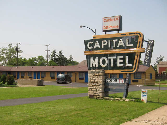
The Capital Motel is next. Check out its sign when lit.
It doesn't look quite as tidy as the Homestead.
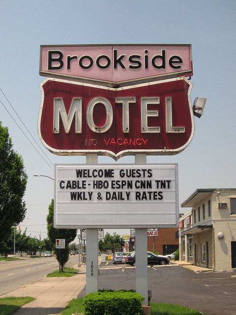
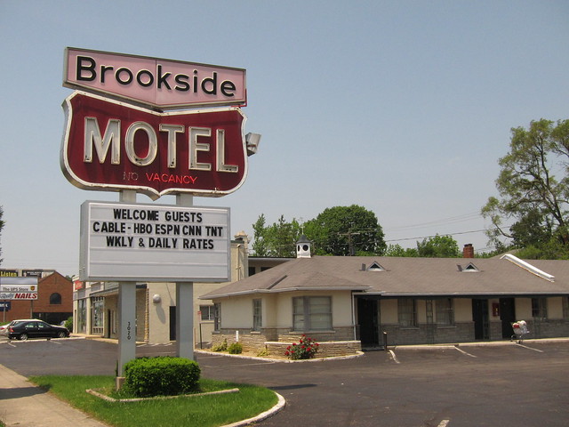
Of all the old motels I saw in Columbus, I liked the sign for the Brookside Motel the best. The top once rotated, and the other side of the top is white letters on black. (See it here; see it lit here.) This motel was originally the Brookside Tour-O-Tel and had a different sign saying so.
I love to see these old motels still operating and kept in good nick.
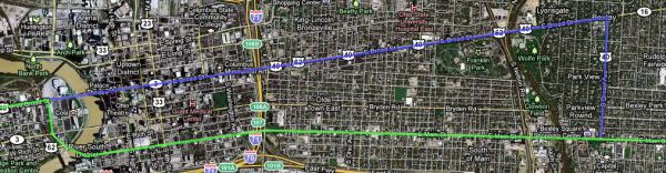
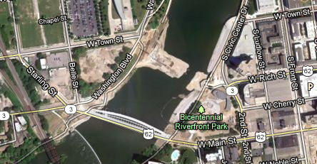
The road soon reaches the the town of Bexley, which Columbus surrounds. What many don’t know is that the National Road and US 40 take different paths when they reach Bexley. US 40 turns north on Drexel Avenue and then left on Broad Street. The National Road keeps going on Main Street through downtown until it crosses the Scioto River, where it curves around on Starling Street and then turns left onto Broad Street, rejoining US 40. This map shows the National Road in green and how US 40 differs from it in blue.
Imagery © 2012 Digital Globe, GeoEye, U.S. Geological Survey, USDA Farm Service. Map data © 2012 Google. The road is nicely tree-lined in Bexley; it is clearly a very nice part of greater Columbus.
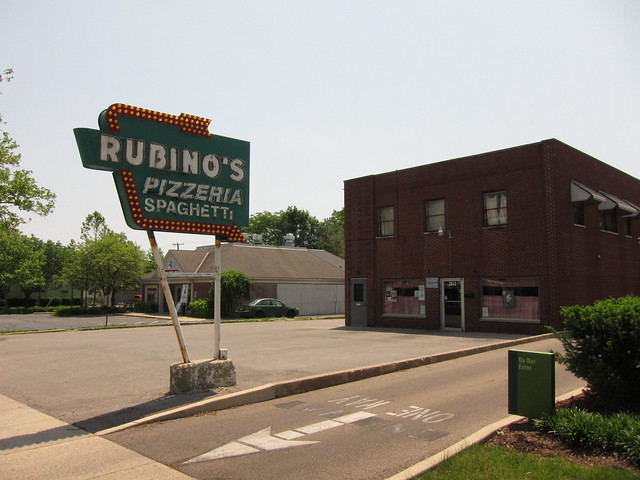
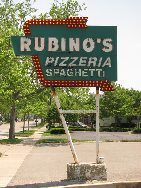
One of Bexley’s best-known places, at least among those present on the National Road, is Rubino’s Pizza. It’s been in operation since 1954.
Here's a better shot of its great sign.
The 1932 Christ Lutheran Church is nearby.
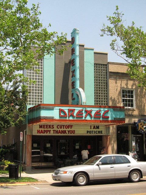
I’m told that the Drexel Theater is considered a local landmark. It certainly has a wonderful sign, which along with the building dates to the 1930s.
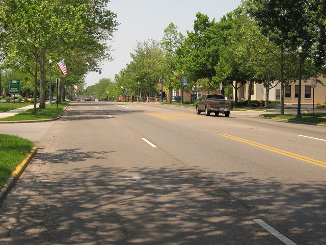
I stayed on Main Street, of course, past where US 40 turned away. Past Beckley, the character of the road and its environs changes quickly.
As I neared downtown I became impressed by how many older buildings have been well preserved. I wish my town, Indianapolis, had the same preservationist spirit.
Main Street is one way eastbound downtown, and I was headed west, so I parked my car and walked. This building features the familar script of the Ford Motor Company logo. It’s in the triangle with wings at the top center of the building’s facade. I’m guessing this was once a Ford dealership, but when I took this photo it was home to the Karlsberger Company, an architectural firm. Less than 30 days after I took this photo, Karlsberger ceased operations.
I spotted this ghost sign on a building just down the block from the Ford building.
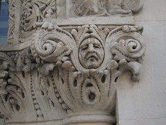
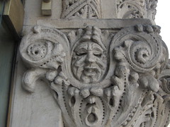
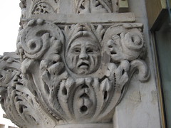
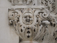
As I neared High Street, which is Colubus’s east-west dividing line, I was drawn to this wonderful ornate archway and sign.
Check out this detail! I probably spent 20 minutes here enjoying and photographing this great arch.
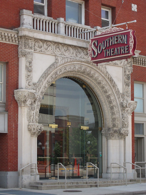
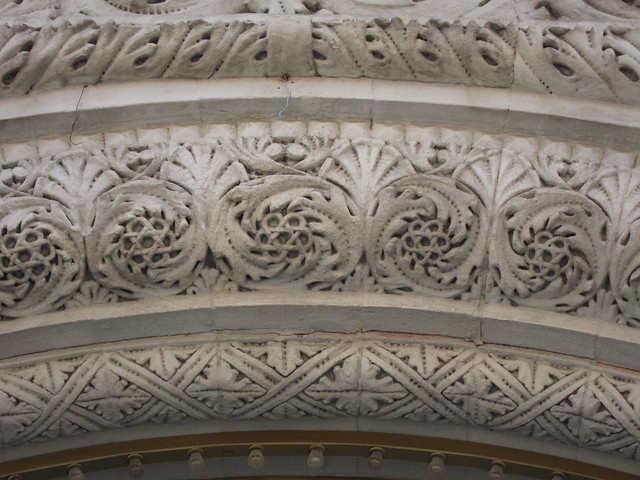
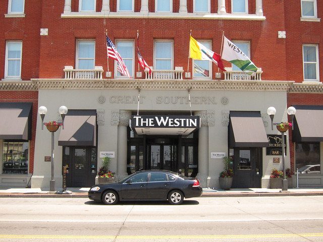
The Southern Theatre is part of the enormous Great Southern Hotel, which was completed in 1896. It’s on the National Register of Historic Places. It’s a Westin property today. As massive as the Southern Theatre’s arch is when you stand before it, the building to which it is attached overwhelms it.
The front entrance is on High Street.
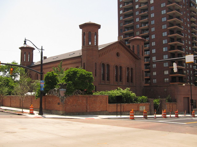
I continued westward toward the Scioto River. This building, which I believe was once an armory, stands on the southwest corner at Second Street.
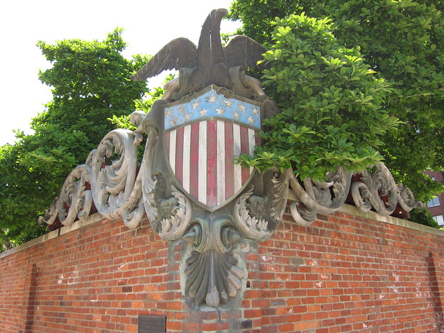
This ornate eagle and shield on the corner once adorned the battleship USS Ohio.
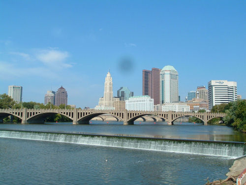
Columbus has long been known for its beautiful bridges across the Scioto and
Olentangy Rivers. Built in the early 20th century, these multi-span concrete
arch bridges frequently had open
spandrels and lovely decorative touches that helped create a vibrant and
beautiful downtown.
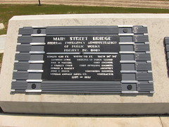
Calvin Sneed photo At least the city commemorated this bridge by placing its builder’s and dedication plaques on a concrete marker at the replacement bridge’s west end.
Fortunately for the people of Columbus, city officials intended the replacement bridges to have their own beauty and give a new look and feel to downtown. The Main Street Bridge was to be unique, with a grand arch soaring high above its two decks – one for motor vehicles, and one for pedestrians. Unfortunately, nobody was happy when the bridge cost $40 million more than budgeted and Columbus residents found themselves on the hook to pay for $15 million of the overage. The bridge was completed in 2010 and opened to one-way traffic. It was finally opened to two-way traffic two days before I visited it.
The arch is dramatic.
As I stood on the pedestrian deck with my camera, a steady stream of bicyclists rode by. I waited for several minutes for a break in the action, as I generally prefer my road and bridge shots to be free of cars, bicycles, and people so you can really see the road or bridge. (It does sometimes occur to me that the shot would be more photographically interesting with cars, bicycles, and people in them.) Notice how the pedestrian deck is higher than the motor-vehicle deck.
I run afoul of many of my fellow bridgefans when I say that if the old bridge had to be replaced, this is just the kind of bridge to build in its place. 100 years from now, assuming Columbus is wise enough to maintain it well, I say that city residents will feel proud of this and the other new bridges, because they will long have been part of the city’s identity.
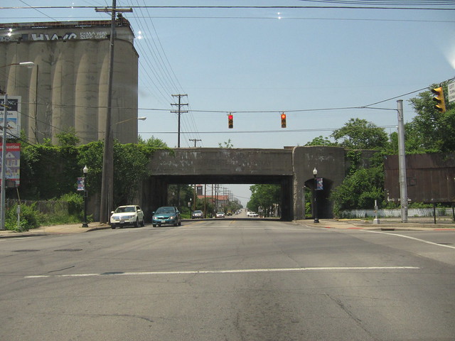
Speaking of other new bridges, this is the new Rich Street Bridge under construction. It is meant to replace the old Town Street Bridge, built in 1917 to replace, as best as I can tell, an earlier bridge at Rich Street.
After crossing the Main Street Bridge, the National Road follows Starling Street north to Broad Street, where it turns left and rejoins US 40.
Imagery © 2012 Digital Globe, GeoEye, U.S. Geological Survey, USDA Farm Service. Map data © 2012 Google. On the ground, I thought Starling Street was closed. But now that I reflect on it, this was probably neighboring Belle Street.
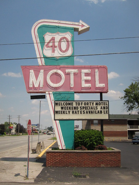
Regardless, because so many other streets in downtown Columbus were closed because of bridge construction and associated reroutings, I couldn’t get my car anywhere near the Main Street Bridge to drive over it. After driving around confused for fifteen minutes, to great relief I finally found Broad Street and followed it across the Scioto River to where the National Road met it and assumed its path out of town. On my way out of Columbus I passed perhaps the best known of Columbus’s old motels, the 40 Motel. (Here’s its sign when lit.)
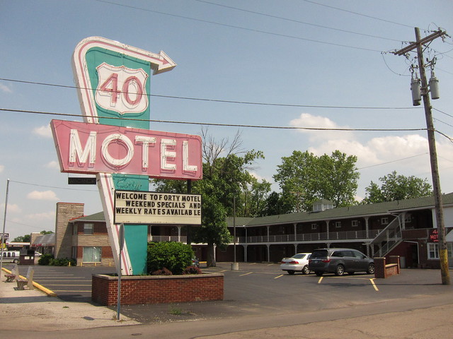
Here's a wide shot showing the motel itself.
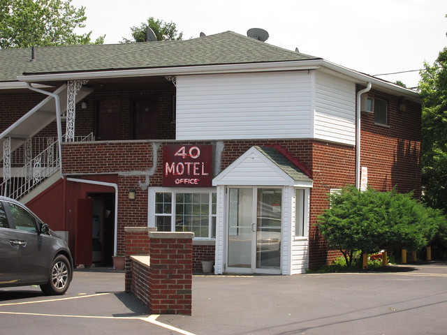
There's even a little bit of neon on the building.
|
||||
|
||||
|
Created 4 February 2012. |
||||