The National Road in Western Indiana, Revisited |
||||
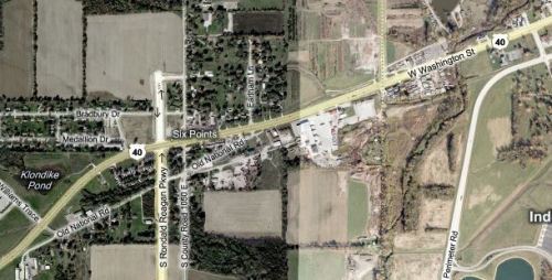
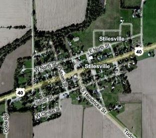
Hendricks CountyLet's look again at the aerial images from the Marion-Hendricks county line. First, the 2009 image from Bing Maps.
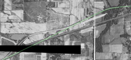
Second, 1937 and 1941 aerial images from the Indianapolis General Data Viewer, stitched together to show the same area. The green line is the National Road's (and US 40's) original alignment.
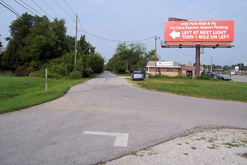
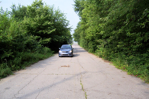
As early as 1937, the Six Points area just inside Hendricks County had already been bypassed. This was probably done for safety’s sake, as the original National Road intersected a railroad track there a dangerously shallow angle. Here is where the old and current roads diverge just east of Six Points. Remember the red billboard in the distance from the brief Marion County alignment? Here it is again.
This is Six Points, where the National Road and Six Points road intersect, and a railroad used to intersect. The railroad, removed long ago, cut across this scene from the left at a shallow angle with the National Road, and probably continued through about where that building is now. This would have been a very awkward intersection before it was bypassed!
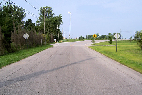
When I was last here, which was on my first-ever road trip three years ago, road-construction signs were posted at either end of this alignment. Figuring the road was blocked, I decided to come again when construction was finished and I could drive through to the end of this alignment. Turns out I never had a chance. The National Road was being permanently bisected by the new Ronald Reagan Parkway. Here’s the westbound scene today, just beyond Six Points. I suppose it didn’t make sense to build an overpass for this little-used road, but seeing the route cut like this still hurts a little.
Never wait to see something along the old road; you may lose your chance! I wonder what they found when they tore out this section of the old road. Bricks, maybe? Here's the westbound road from the other side of the Ronald Reagan Parkway.
Here's where this alignment ends.
I drove around to the 1930s bypass to photograph a couple well-known fixtures. The first is The Diner. The aluminum portion, made in 1954, used to stand alone; the limestone-faced building behind it was added later. It was closed this morning, and the closure looked permanent.
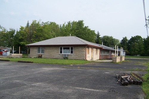
Next to The Diner is the former 40 Motel. This is its sign, the “MOTEL” letters across its middle long gone. The motel and the diner used to be owned by the same people, but no longer.
Here's the motel building, which appeared to be vacant.
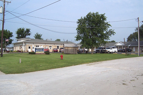
A couple other old motels are still operating along the road as it enters Plainfield. This is the sprawling White House motel.
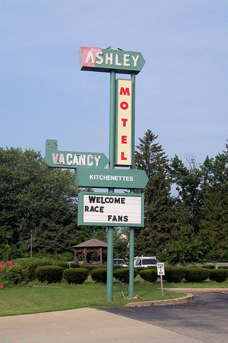
The Ashley Motel's sign.
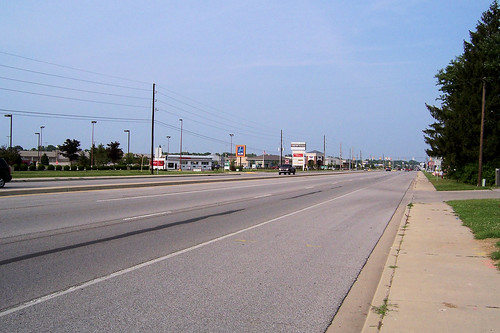
This is what most people think of when they think of Plainfield: the strip.
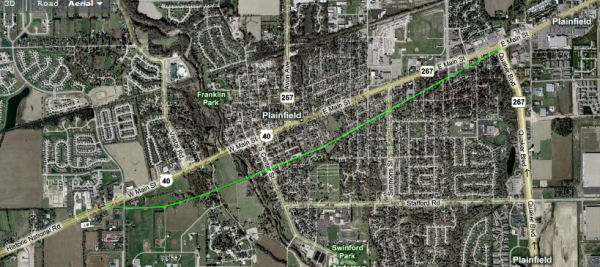
Here's a map of the road through Plainfield. US 40 is marked, but I've also highlighted a path in green that I'm curious about. You can't drive all of this path – the road stops and starts in several places, no longer crosses at least one creek (if it ever did), and is not accessible from the intersection at US 40 and State Road 267. But it's interesting to me how it continues straight along the line created by US 40 as it enters town from the west, and curves to meet US 40 on the town's west edge. I'd like to know more about this road.
Plainfield has a few interesting old homes, such as this one, which looks to me to be in the Colonial Revival style.
This house was built in 1872 by Quakers to store books and records, and was used as a residence for the Quaker Yearly Meeting Superintendent. It doesn't appear to be owned by the Quakers anymore.
Plainfield was founded by Quakers and has been a major Quaker center throughout its history. The Quaker Yearly Meeting building stands on land next to the house above.
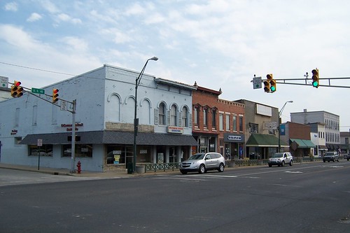
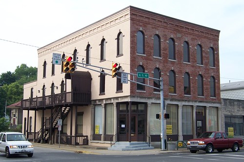
Plainfield has a small downtown; it's just a couple blocks long.
It is typical of so many Indiana small-town downtowns with its mix of buildings, some well cared for or restored and others neglected.
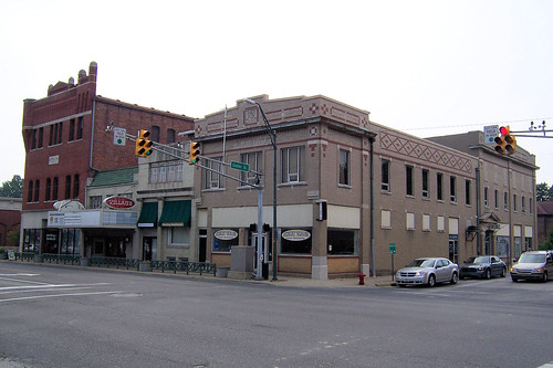
I like the detail in the building on this corner.
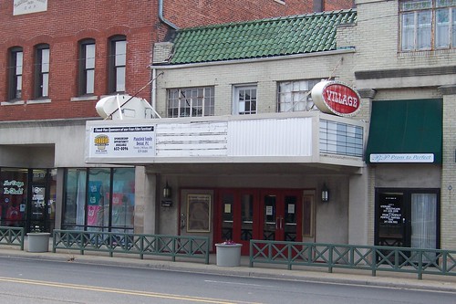
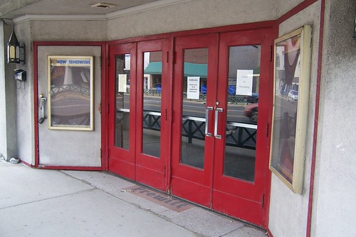
In the middle of this block stands the little Village Theater, which looks to be closed.
Here's the Village Theater's entrance.
I liked this building on the west end of downtown.
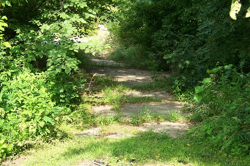
An abandoned alignment crosses White Lick Creek just west of Plainfield.
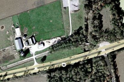
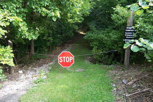
When I visited here last, I didn't know about the cemetery nestled just northeast of this alignment. The map above shows it ringed with trees. This scene is the only clue of the cemetery that’s visible from the highway. The small sign calls it Iron’s Cemetery.
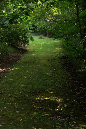
The path back to the cemetery is dark.
When you emerge into the light, the hushed space seems to be a million miles from anywhere. US 40 is 150 feet away.
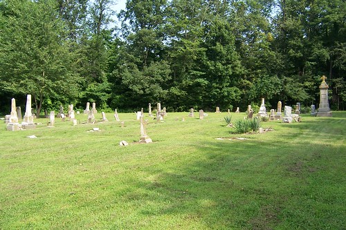
The cemetery feels much bigger than it looks from the air.
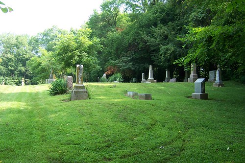
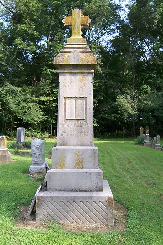
The oldest gravestone I found dates to 1872. The most prominent marker remembers a much-revered minister who died in 1885.
Someone clearly keeps the grounds here.
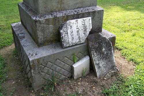
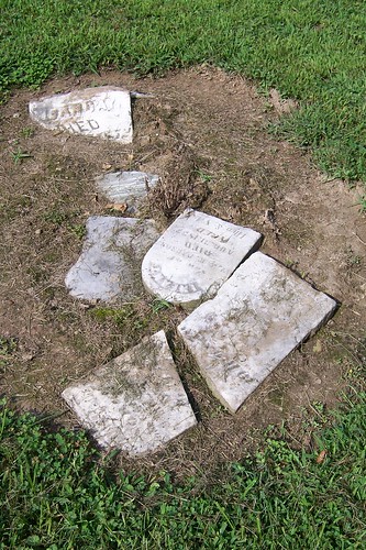
But many of the gravestones lie broken, as if casually discarded.
I'd sure like to see this cemetery restored.
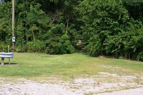
Right next to the cemetery entrance is a hole in the brush where US 40 used to go.
If you leave a road alone long enough, nature eventually reclaims it.
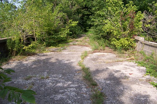
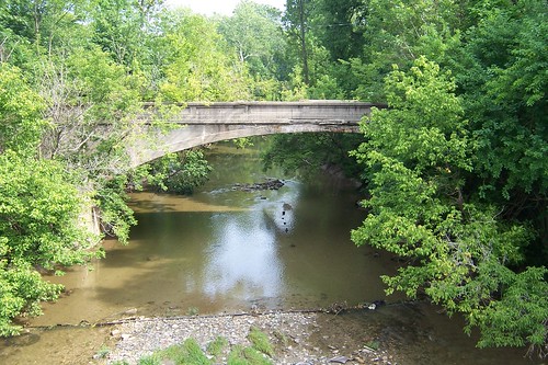
This abandoned and crumbling alignment of US 40 and the National Road lies between Plainfield and Belleville in Indiana, just west of the Oaktree Golf Course. It was left behind in about 1940 (give or take) when US 40 was widened to four lanes. I suspect that the Highway Department decided the existing bridge over White Lick Creek was too narrow to be kept in the widening, so they built two new ones, moved the road, and forgot about the old one. Here's the forgotten bridge.
You can see the bridge clearly as you whiz by on US 40 maybe 50 feet away.
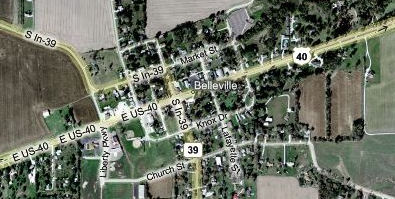
I’ve visited this spot several times – it was the first abandoned alignment I ever found. I still remember how excited I was to come across it, and it remains the coolest abandoned road I’ve ever experienced. This is what happens to a road when it’s left untended for 70 years. Nature always wins! The next town along the way is Belleville.
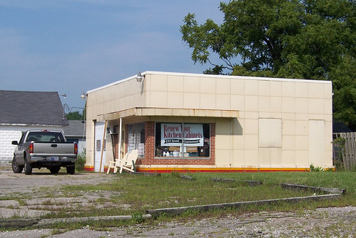
I stopped to photograph only this aging former gas station. I've become curious about these old stations with their square tile exterior walls. The independent mechanic who repairs my car owns one of these. Its exterior has since been brickfaced, but its interior shows these square tiles in a light blue.
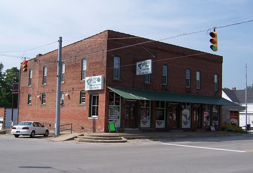
Several tiny towns dot the National Road in western Indiana, but most of them never developed any businesses of consequence (or at least no evidence survives) and today are little more than a collection of aging homes. Stilesville, however, apparently managed to develop a small local economy. I say apparently because Stilesville boasts an actual, albeit small, business district. In Stilesville, there’s some there there.
The town has, of course, faded considerably. I’m sure I-70 hastened its decline. I also understand that a fire in about 1920 wiped out a large portion of the north side of town. Yet people were out and about in Stilesville as I walked the town taking photographs. Several came and went from the Cornerstone Pub, the town’s most prominent building. A 1925 road guide I’ve seen said that Stilesville offered lodging and a restaurant; I wonder if this was the place. I understand that this building did once house a grocery store, an appliance and furniture store, and a bank.
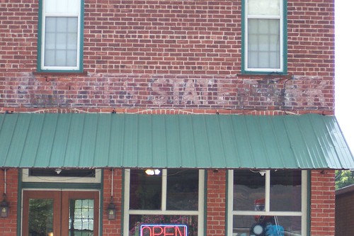
Evidence of the bank remains. I can’t quite make out the name painted on the building’s west end; can you?
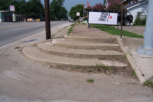
The main intersection, the one with the stoplight, had steps up to the sidewalk on three of the four corners. Fresh concrete had recently been laid on the fourth corner, but without steps, probably thanks to the Americans with Disabilities Act.
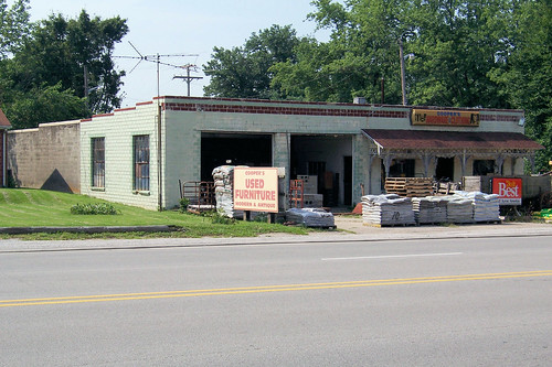
A block west, Cooper’s Hardware and Clothing was once a Shell station.
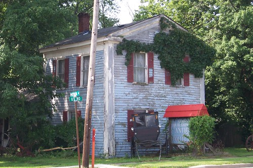
Dig the buggy in front of this little old house, the oldest in Stilesville. It dates to about 1850.
So why did Stilesville find success, but not Belleville or Putnamville or Manhattan, all similarly sized towns along the road? Perhaps Stilesville’s founders were a bold and forward-thinking bunch; after all, they built their little town in 1828, a year before the National Road began to be built in Indiana.
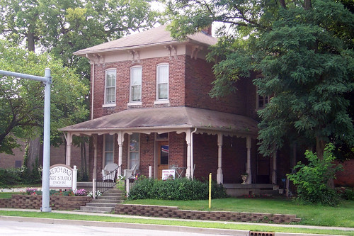
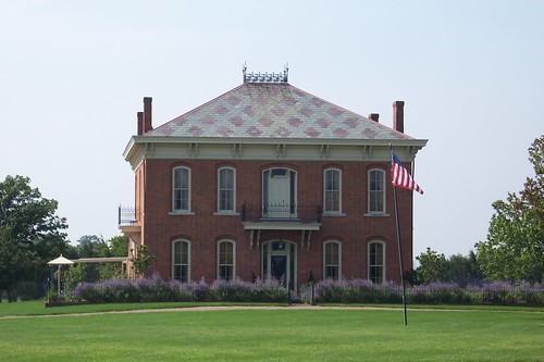
This 1872 Italinate (which I know only because I looked it up) is known as Rising Hall. It stands just inside the Hendricks-Putnam county line. A man named McHaffie built it; he is best known for providing more mules than anybody for the Union Army during the Civil War.
|
||||
|
||||
|
Created 1 January 2010. |
||||