Old US 31 in Northern Indiana |
||||
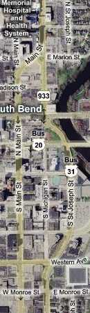
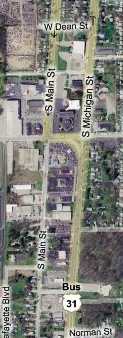
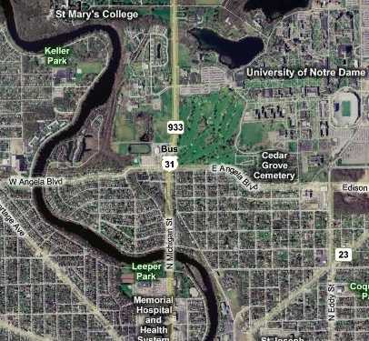
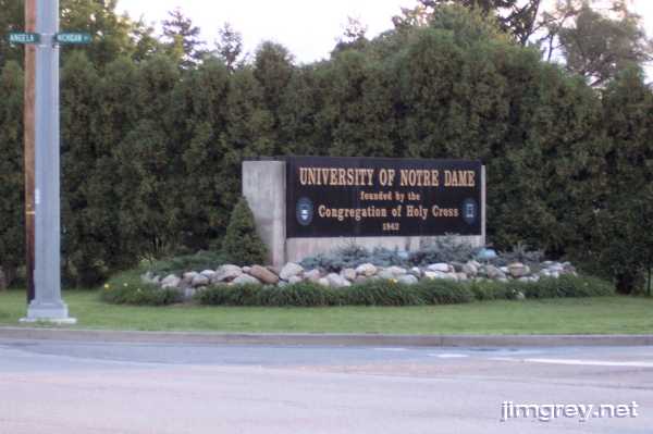
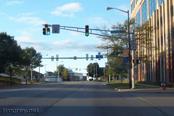
South Bend, Part 1Brian and I met in 1979 as seventh graders at Andrew Jackson Middle School on South Bend's south side. Our friendship has endured, even though our paths at times diverged widely. Brian recently resettled back in our old hometown with his family. I'm a little jealous, because I love South Bend. If there were work in my field there, I might not be in Indianapolis today. Old US 31 is Michigan St. in South Bend. As a kid, I thought it was so named because it was the St. to Michigan, but I think it has more to do with having been the Michigan Road, at least to downtown. This map shows old US 31 as it passes by Notre Dame, enters South Bend at Angela St., and heads toward downtown.
The University announces itself at the corner of Michigan and Angela Streets. Like most people from South Bend, we cursed the traffic on football game days. But unlike most South Benders, I feel sure, the University was part of my family's daily life. My father built furniture on a freelance basis for the University for years, which paid our bills. I worked for the University one summer in the art museum's gift shop. My brother graduated from Notre Dame and worked there for many years afterward.
Turning around, I took a southbound photo from the top of the steepest hill on old US 31 in South Bend.
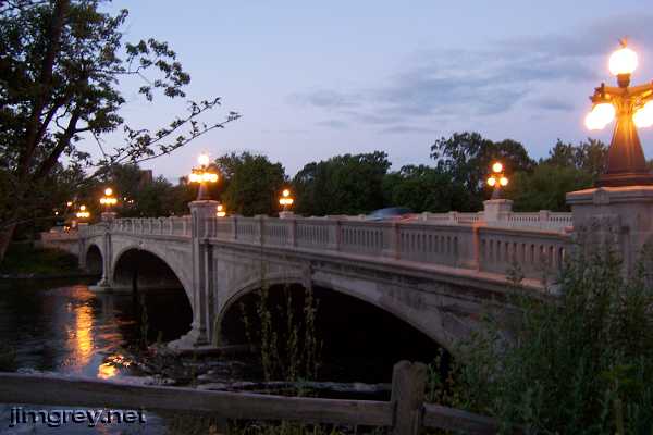
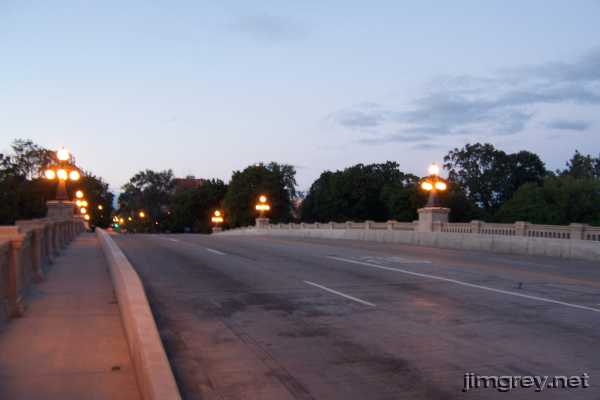
Shortly the road crossed the St. Joseph River at Leeper Park. This bridge and its park have been the subject of many postcards over the years. It was built in 1914 of Bedford limestone in the style of the City Beautiful movement. George Kessler, who was a leading figure in that movement, designed Leeper Park and is said to have designed the surrounding neighborhood. The $140,000 worth of lights on the bridge's posts were added in 2007, replicas of lights placed on the bridge in 1915 but long missing.
This bridge has escaped the wrecking ball at least once. I find it remarkable that this old bridge accommodates five lanes. The designers and builders could not possibly have anticipated the traffic that would eventually come.
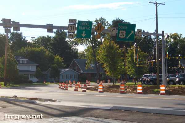
Shortly south of the bridge is Memorial Hospital, which has been swallowing neighboring land for years. My mother has a deteriorating black-and-white photograph of a great-grand-something-or-other sitting on the porch of a house he owned on Michigan St. that was razed for the hospital before she was born. More recently, my brother had an apartment in a house on Main St. that is now a parking lot for the hospital. Every time I visited him there, more houses had been razed. This is the road alongside the hospital. Notice how the road splits at the end of this block. The southbound lanes shift to follow Main St. through most of the city. At one time, all US 31 traffic followed Michigan St.
I'm relying entirely on memory of my 12th-grade social studies class for the story I'm about to tell, because my research has found no facts. The teacher was also a county-city councilman, so I'd think his his story was sound. The Associates was a national investment company founded and headquartered in South Bend. In the wake of Studebaker's failure, the company wanted to build a new headquarters and revitalize downtown at the same time. To build the new downtown Superblock, as it was called, several downtown buildings were demolished. Until that time, US 31 followed Michigan St. through downtown. The Superblock project rerouted US 31, with southbound lanes following Main St. to the south side of town, and the northbound lanes following Michigan St. except for several blocks downtown, where it was routed one block east to St. Joseph St. Then in 1975, The Associates relocated to Chicago, leaving the project a shambles. The city became known for the holes in the ground where proud buildings, some historic, once had stood. Michigan St. had been torn out downtown so that an outdoor "pedestrian mall" could be constructed, but it succeeded only in making it necessary to park farther from downtown businesses. South Bend's first mall was built at about the same time, and shoppers went there instead. It took South Bend 15 years to rebuild downtown after that. The split road remains. Traffic warranted it anyway. Michigan St. couldn't have been widened to accommodate as much traffic as the two one-way alignments do – up to five lanes in each direction. Main St. is one way south, Michigan-St. Joseph-Michigan is one way north, and the downtown segment of Michigan St. is two way. The map shows how it works.
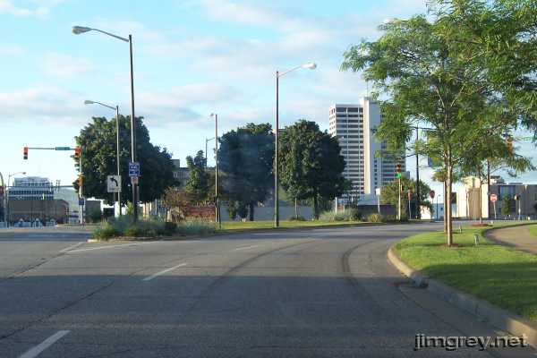
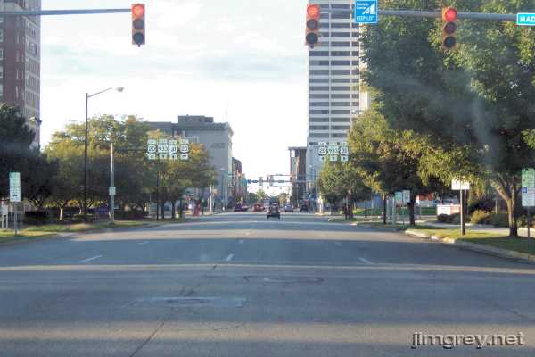
Here is where the road splits on the northside, with the southbound lanes heading off toward Main St. South Bend's tallest building is about two-thirds of the way across the photograph.
We followed this curve to LaSalle St. and hooked left back to Michigan St. to follow it south to where it ends. This northbound photo is at the north end of the isolated Michigan St. alignment where St. Joseph St. curves to become Michigan St. again.
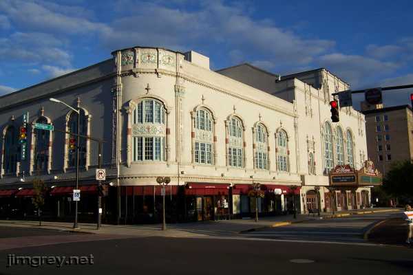
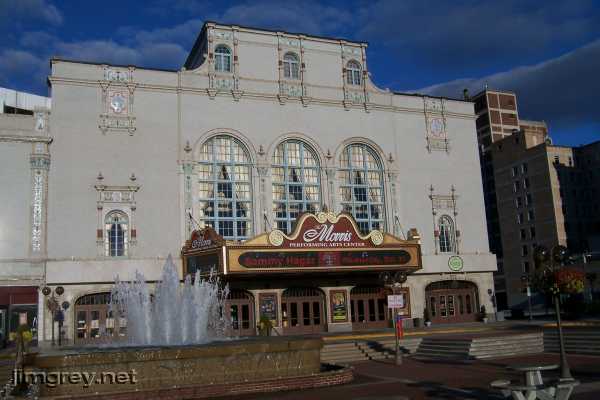
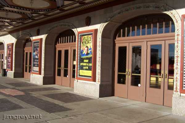
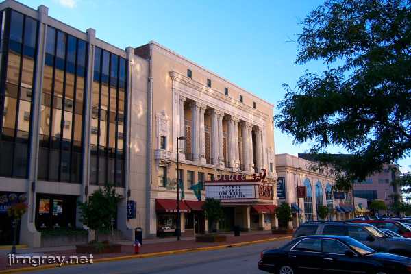
The 1921 Morris Performing Arts Center stands at LaSalle and Michigan, gorgeous in the early daylight.
The Morris was first the Palace Theater, a burlesque house and later a movie theater. During the downtown's malaise years of the 1970s and 1980s, the theater, renamed the Morris Civic Auditorium, had fallen into disrepair. I watched It's a Wonderful Life there at Christmastime in 1987 and the building was in a sorry state. But when I saw Heart play there in 2006, it was clear that great pride had been taken in the old theater's restoration.
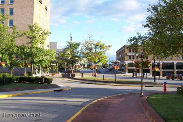
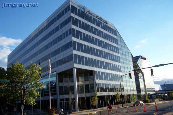
South of the Morris stand the modern twins, the 1st Source Bank headquarters and the Marriott Hotel. These buildings went up in the 1980s in the ongoing fight to fill the holes left by the aborted Associates Superblock. Their design was somewhat controversial at the time, but have become a point of pride for the city. These buildings fill the block; the Marriott borders St. Joseph St.
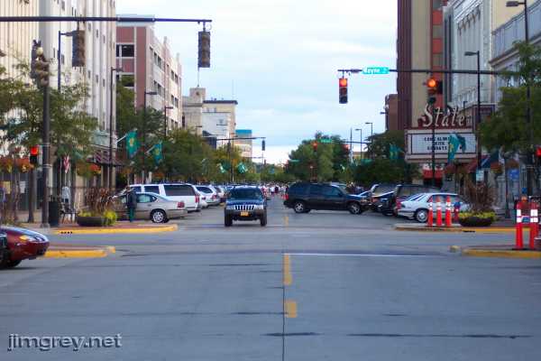
When the city tore out the unloved pedestrian mall in the 1980s, it rebuilt Michigan St. as two lanes with pull-in parking. The revival has had reasonable success, but there's still some work to do to bring businesses back to this strip. In the photo below, which is northbound from Michigan St. at Jefferson Ave., the street is blocked for a foot race.
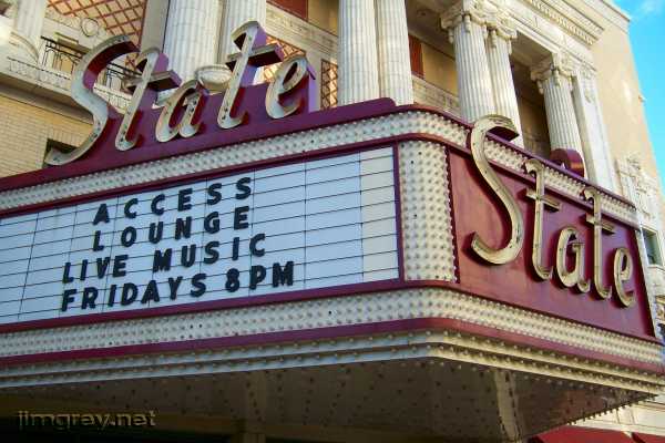
It was always hoped that the State Theater, south of Jefferson on the east side of Michigan St., would be returned to full use in some way, but none of the attempts ever caught on. At least the facade remains solid and strong.
My mother took my brother and I to see Bambi and, later, Fantasia, here when they toured in the 1970s. We took the city bus downtown and walked to the theater and its huge auditorium. I was very young, so I'm glad I have some memories of those trips.
This photo looks northbound from south of Wayne St. The second building on the left is the former Robertson's Department Store, now an apartment building. I remember that Robertson's advertised its annual clearance sale on TV with the jingle, "Save a fourth, save a third, save a half, on every department, on every floor!"
One block later, at Western Ave., the downtown strip of Michigan St. ends. It's clear how the road used to go through here.
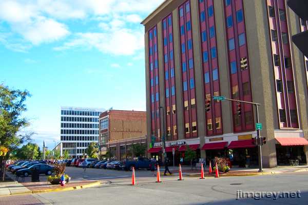
We went back to the north split and Main St., the current southbound route of Business US 31. This is a through-the-windshield view of South Main St. at Madison St., one block before the intersection with westbound Business US 20 at LaSalle St. South Bend's tallest building is just beyond it. When we crossed that intersection, we joined the Michigan Road.
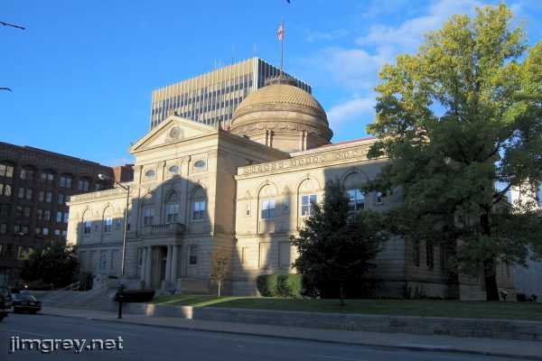
The 1898 St. Joseph County Courthouse stands on Main St. at Washington.
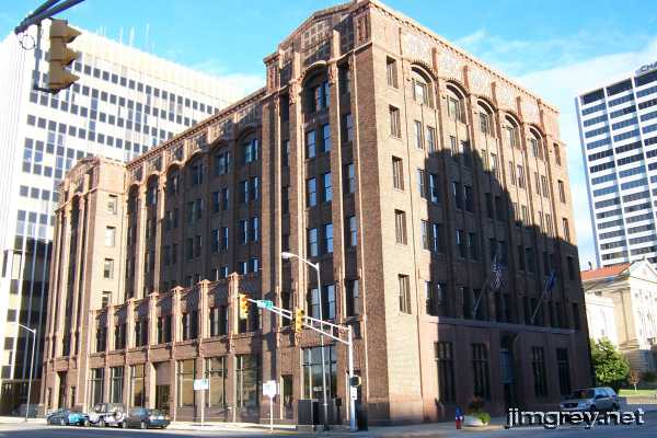
South of the courthouse, on Jefferson Blvd., stands the old First Bank building. The First Bank of South Bend renamed itself First Source Bank in the 1980s and then built the new headquarters pictured earlier. Quite a difference in architecture!
South of downtown, Main and Michigan Streets parallel each other, separated by one block. Main St. becomes lined with light industry and small businesses.
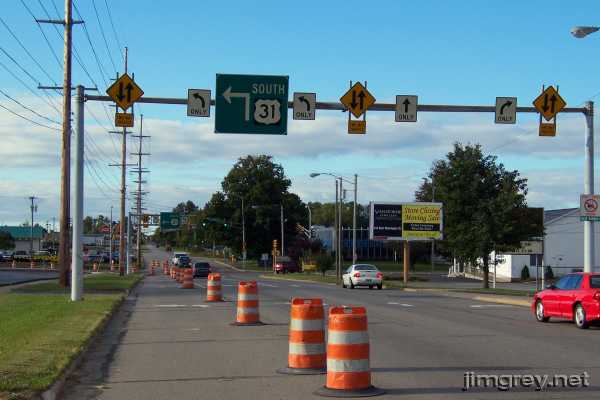
When Main St. reaches Chippewa Ave. on the south side, Business US 31 follows Chippewa east for a block. Then it curves south onto Michigan St. where the road resumes two-way traffic, as this map shows.
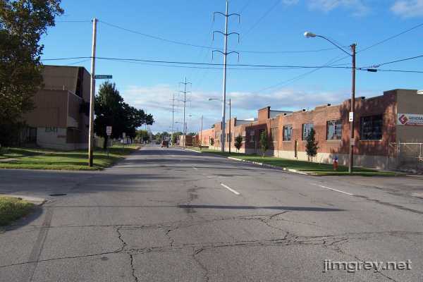
Here's the intersection of Main and Chippewa. I used to ride my bike every Saturday morning to bowl in a league at an alley on this corner. Looking back, maybe it wasn't so bright to ride my 3-speed across a busy highway while carrying a 14-pound ball.
This shot is of Chippewa Ave. east toward Michigan St. The curve onto Michigan St. was being rebuilt. On the south side of town, "Business" never managed to get appended to any of the old US 31 shields.
Even though we were most of the way through South Bend, there was a lot left to see on northbound Business US 31 between here and downtown. Part 2 of our stop in South Bend shows Business US 31 all the way to the north split. It then returns to this intersection, following the highway south from here to the outskirts of town. |
||||
|
||||
|
Created 13 January 2008. |
||||
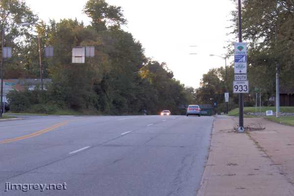
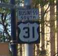 Notice the strange block numbers and the skinny shield on the reassurance
marker on the pole. Several of these line the road in South Bend. The one-piece Business
South sign is also nonstandard and might even be hand-painted. Through my
childhood in the 1970s, hand-painted signs were not unusual in South Bend, and
some of those signs remain around town today.
Notice the strange block numbers and the skinny shield on the reassurance
marker on the pole. Several of these line the road in South Bend. The one-piece Business
South sign is also nonstandard and might even be hand-painted. Through my
childhood in the 1970s, hand-painted signs were not unusual in South Bend, and
some of those signs remain around town today.