Old US 31 in Northern Indiana |
||||
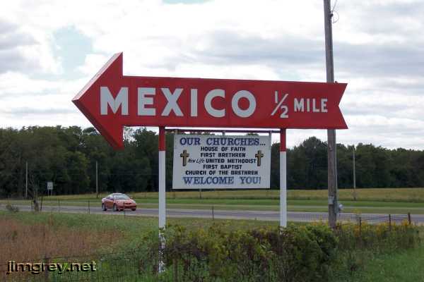
Mexico and PeruI had always been curious about this sign along US 31.
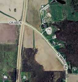
Today my curiosity would finally be satisfied. After only about two miles on the big slab we came upon Mexico Road, which is old US 31. It seemed odd that we had to make a solid left turn to get onto Mexico Road, as this map shows. I expected the road to flow more naturally out of current US 31. I saw no evidence either on the ground or on this map of the road being realigned. My 1916 and 1924 Automobile Blue Books both describe the road as having no turns between Rochester and here.
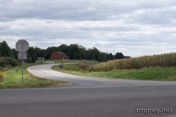
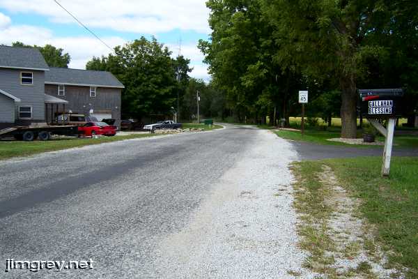
Here's what the turnoff looks like on the ground.
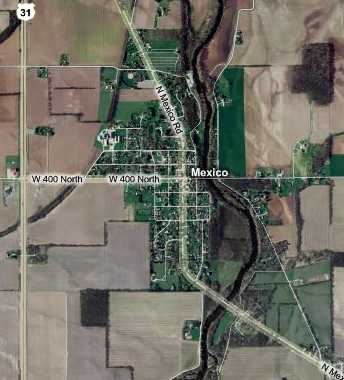
Shortly we entered Mexico, established in 1834. Here's a map. The Mexico sign is on the southeast corner of US 31 and 400 N, by the way.
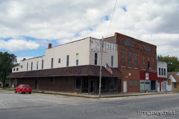
There wasn't much to see in Mexico. Everything centers around Mexico Road and 400 N. Here's the northwest corner of that intersection.
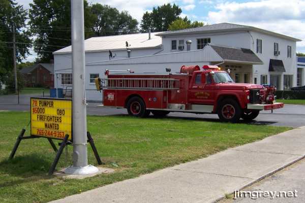
Down the street a bit, the Mexico Fire Department was selling an old pumper. The sign said it's a 1978, but it looks a lot more like a 1973 to me. They only wanted 5 large for it.
Brian and I were looking at the 1916 and 1924 Automobile Blue Books I brought along, and both of them told drivers to turn left at a bank (which we couldn't find, but we guess was at 400 N), over the Eel River bridge, and then right at the first road. This is almost certainly 190 W, the road just east of the river that intersects with Mexico Road in the lower right corner of the map above. The ABBs say this road goes all the way to Peru and did not mention this intersection, so in those days perhaps Mexico Road didn't come this far south. Brian speculated that State Road 1 may have followed this route, but I don't have enough information to confirm it. I took this northbound photo of 190 W where it met Mexico Road just for grins.
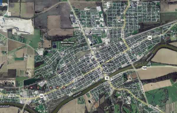
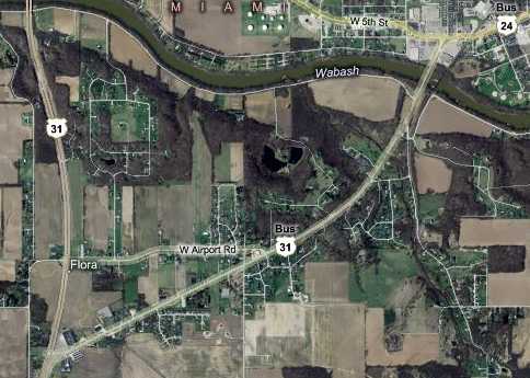
Peru was next, just a couple miles down the road. Some pronounce it PEE-rue and old maps sometime spell it Perue, but I understand most locals agree it's spelled and pronounced like the South American country. Built on the Wabash River, with a railroad and US 24's original route running east-west through it, Peru is wider than it is tall, as this map shows.
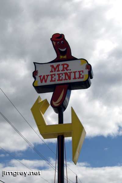
Just outside this map to the north is US 24, so Peru has been bypassed by two US highways. Business US 31 enters from the north on Broadway St., then turns west onto Main St. (Business US 24), and then crosses the Wabash on the little yellow-highlighted road in the lower left corner of the map. The first thing we encountered on old US 31 in Peru was the Mr. Weenie restaurant. The sign struck me funny, so I stopped for a photo.
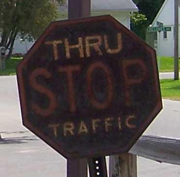
The restaurant itself was unremarkable, but this very old and rusty stop sign was at one of the exits. I've never seen one like it.
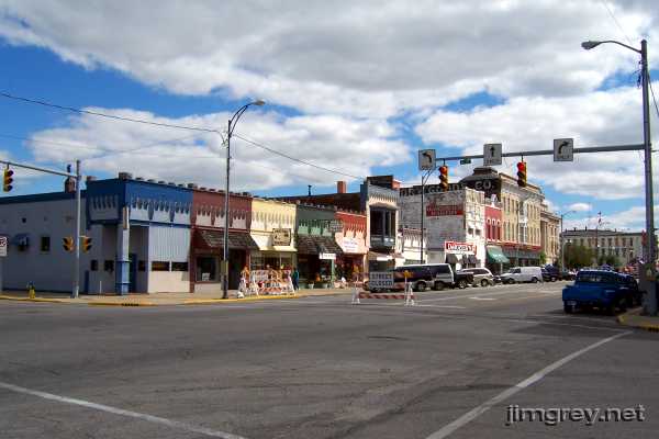
When we reached the edge of downtown at 6th St., we found old US 31 closed. We parked to find out why.
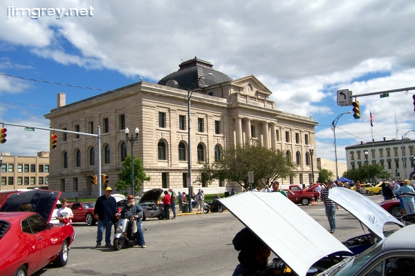
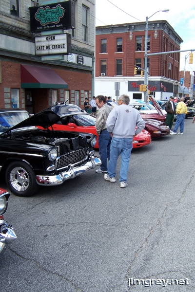
As we neared the Miami County courthouse, we could see that a classic car show was being held in front of it. Wow!
I love old cars! And so indulge me, as Brian did.
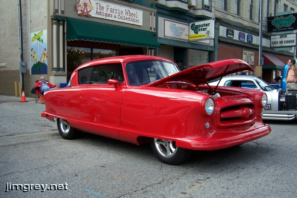
This is a heavily modified 1955 Nash.
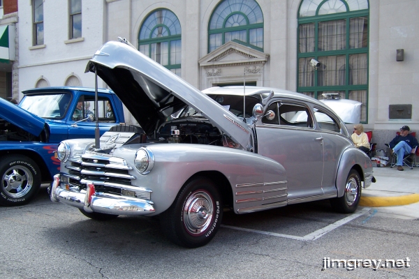
A 1946 Chevy.
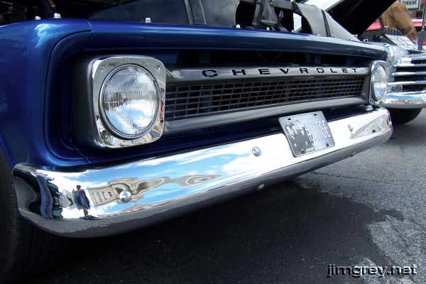
I thought the grille of the neighboring 1966 Chevy truck was cool. The chrome on the bumper was so fine that you can see me in it, taking the photo.
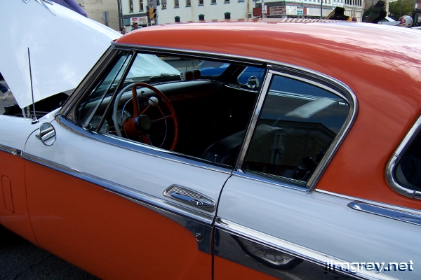
A 1956 Studebaker Golden Hawk.
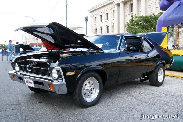
A third-generation Chevy Nova SS. They didn't change these much during the 1968-1972 run, so I can't tell for sure what year she is.
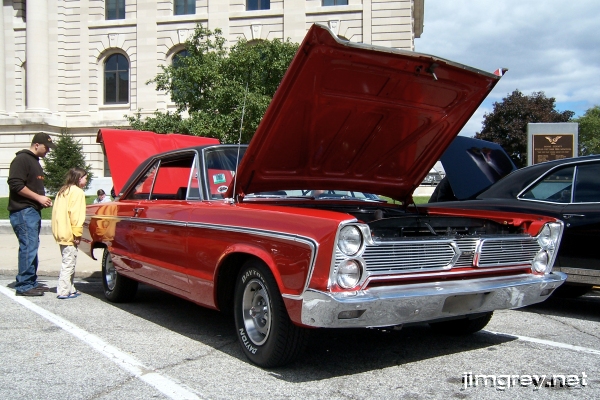
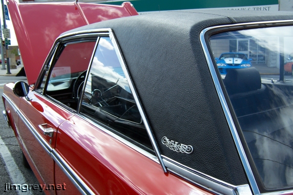
A 1966 Plymouth VIP. Ford had its LTD and Chevy had its Caprice, both their basic sedans dressed up in nicer trim. Plymouth responded with the VIP, based on the Fury III and the Sport Fury.
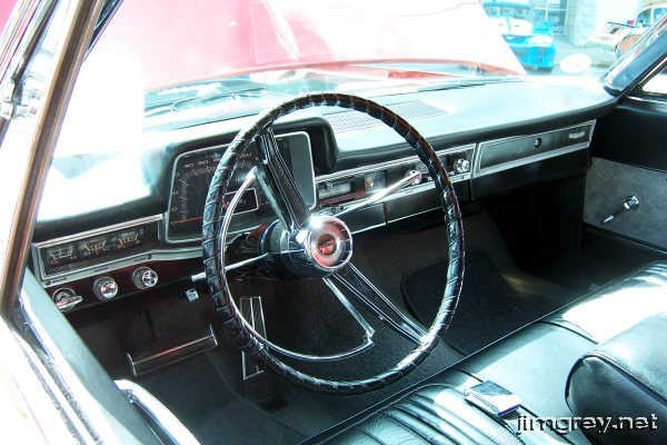
This was my favorite car of the show. I always thought late-60s Plymouth dashes were funky with their great-big speedometer pods at a time when most manufacturers were using horizontal speedometers.
As I prepared to take the shot below, a fellow tapped me on the shoulder and said, "I'll have to charge you a quarter for each picture." He owned the Plymouth. When I told him I had recently seen an old television ad for the VIP on one of the online video sites, he lit up for a moment. He told me that there was precious little information available about the VIP, which didn't sell very well. He said he had had a difficult time finding trim parts for the car, and pointed out a few places where he had to use slightly scuffed chrome or parts that didn't fit together just right because that's what was available.
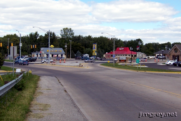
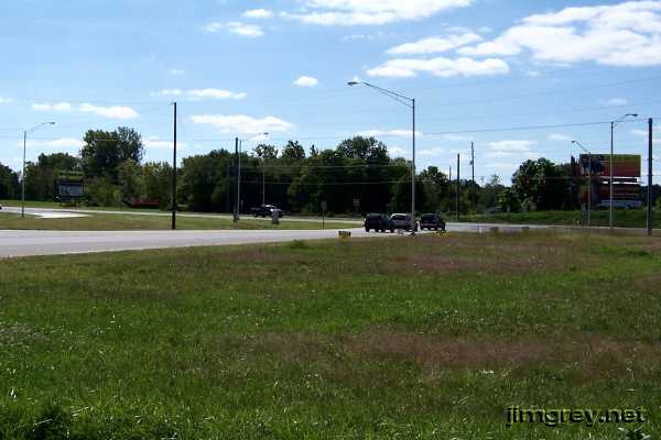
When I got home, I blogged about the 1966 Plymouth VIP and linked to the TV ad I had found. That entry gets about one hit a day now because somebody is looking for information about the '66 VIP. My camera's battery died while shooting the Plymouth, which brought me out of my old-car delirium to notice that Brian was standing politely on the curb, ready to move along. Even though there were more cars to see, we headed back to my car to continue our trip. I fished my spare battery out of a cup holder, put it in the camera, and we were on our way. I had been through Peru once before and I remember seeing US 31 and US 24 shields guiding the way through town. I suppose I was to intoxicated by the vintage iron to look for them that day. Because of the car show we couldn't drive Business US 31 to Business US 24 anyway, so we took a side street. At any rate, Business US 31 turns right onto Business US 24 and stays there for several blocks. The two split again on the west side of town, where Business US 31 heads south. Here's a northbound photo from Business US 31 of the intersection.
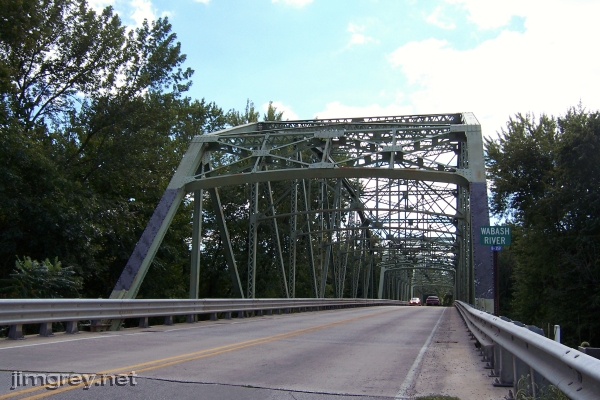
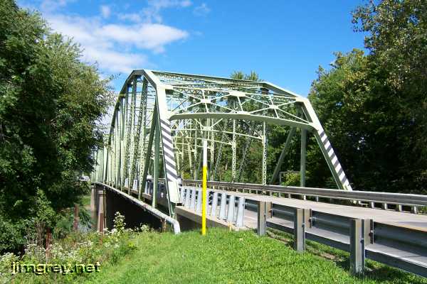
The road led directly to a triple-span steel truss bridge crossing the Wabash River.
The sun shone brilliantly through the beams and trusses.
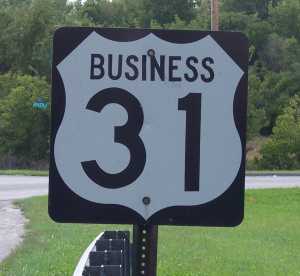
This unusual Business US 31 shield awaited on the guardrail after we crossed the bridge.
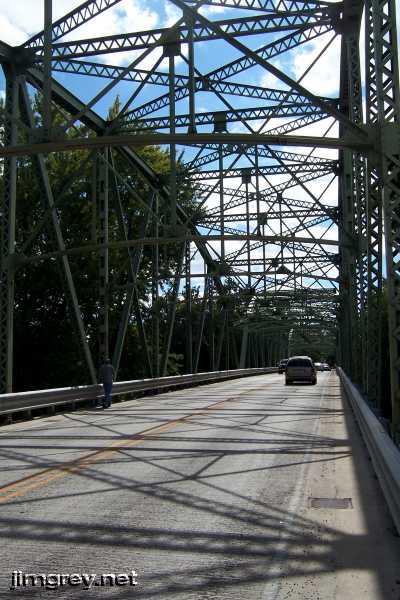
Brian, whose curiosity about old alignments was growing, wondered where the previous bridge might have been, and went off to search for clues. Unfortunately, he found very little, but his sleuthing gave me time to take more photos of the bridge, this time northbound.
We continued our journey south. This map shows Business US 31 from where it splits from Business US 24 to where it meets current US 31, a trip of about two miles.
Business US 31 ends at a stoplight with current US 31.
Reluctantly, we returned to the big slab for the trip to Kokomo. |
||||
|
||||
|
Created 13 January 2008. |
||||