US 36 in Western Indiana |
||||
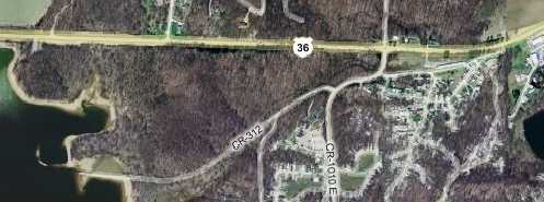
Raccoon Lake segmentUS 36 used to pass through the flood-prone land on either side of Big Raccoon Creek. The U. S. Army Corps of Engineers resolved to control the flooding, and so between 1956 and 1960 built what is commonly called Raccoon Lake. Along the way, they built a straight and modern new segment of US 36 over the new lake – and submerged a couple small towns and a segment of what had been US 36. This map shows how the old road, marked CR 312, goes into the east side of the lake. Since current US 36 was built, old US 36 has been diverted a couple times so that it's no longer a continuous road. But if you trace CR 312 back from the lake, you can see how it used to flow back into current US 36.
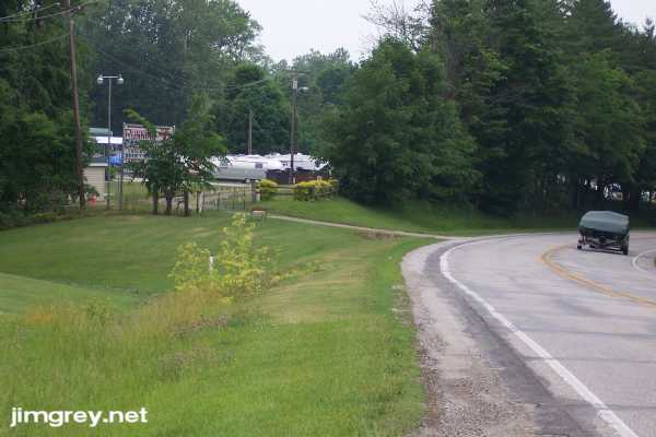
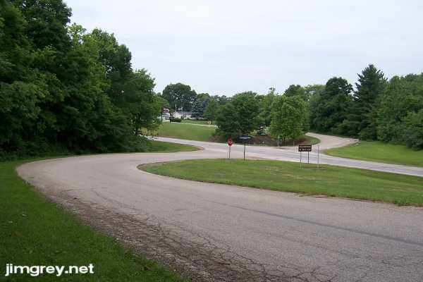
This photo below shows the curve in US 36 at the east end of the map above. I believe that before 1956, US 36 used to go through here, probably by the utility lines that come in from the left of the photo.
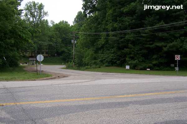
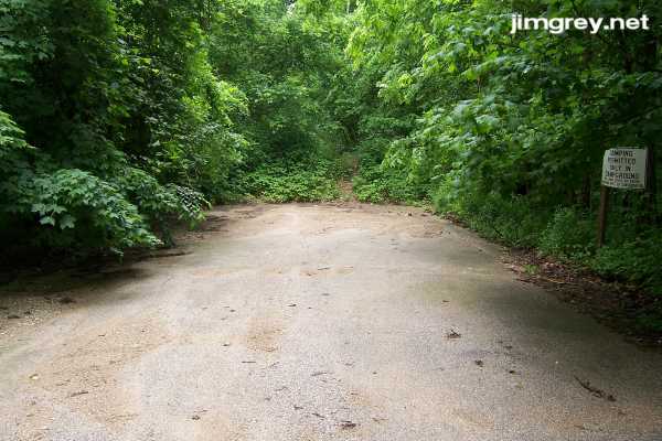
To access this segment, I drove a few hundred yards and turned left at a crossroads, shown in the photo below. Old US 36 cuts across where that road curves to the right.
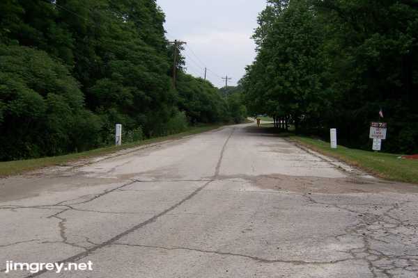
I took this photo from that curve. I was surprised to find a short stretch of old cement road that turns into a gravel path. Notice the utility lines along the north side of the road – these are the same lines that cut behind the ridge of trees two photos ago.
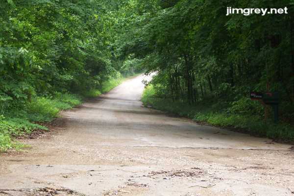
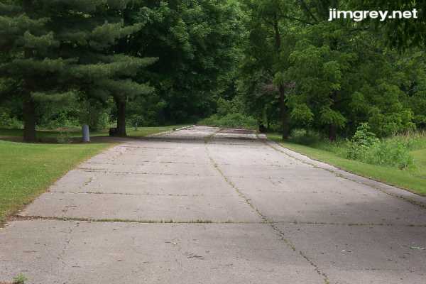
I walked westbound along old US 36 to the beginning of the CR 312 segment to take this photo.
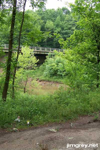
Shortly, the road ends. It's not a very auspicious ending – a mound of dirt was piled onto a short bridge. It is now overgrown with weeds.
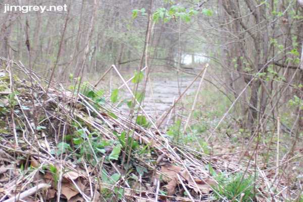
I climbed the mound to take a photo. Now, I'm going to cheat here, because a photo I took when I happened through here in April is much better than the one I took this day. The dense green of late-spring Memorial Day obscured the lake, while the sparse green of April early spring let it show. You can see how the forgotten road continues a short distance beyond the mound, with Raccoon Lake at the end.
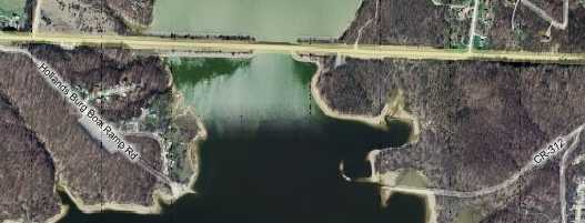
This map gives a clue of the road's underwater path and shows where the road emerges on the west side of the lake.
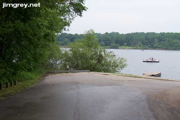
On the west side of the lake, a boat ramp has been built along where old US 36 emerges from the water. I've heard tell that in the winter, when the U.S. Army lowers Raccoon Lake by a few feet, you can see more of the old road. But I have to wonder if the whole old road is actually under water. Past the guardrail are some chunks of old pavement and then a dropoff to the lake below. I think it's likely that the Army dug up the old road, and whatever else used to be here, to provide a place for the dammed water to go.
Just west of the lake, old US 36, here signed Hollandsburg Boat Ramp Rd., snakes across current US 36.
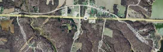
This map shows old US 36 as it crosses US 36 and eventually flows back into current US 36. It shows how old US 36 once curved gracefully across where US 36 is now, but was rerouted so it would cross US 36 at safer right angles. The problem with this map is that, west of the creek that appears about 1/4 of the way across the map from the left, most of the road no longer exists.
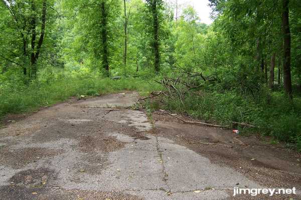
Old 36 Rd is old pavement until reaches its intersection with CR 870E, the north-south road roughly in the middle of the map above. West of there, the pavement is covered in what looked and felt to me like oiled gravel. The road is not well cared for here as the grass and brush narrow the road on both sides. Suddenly, the road dead ends at the creek, no Dead End sign in sight. I guess they expect that if you're driving back here, you must be local and know the bridge is out.
Current US 36 is visible several yards to the south as it spans the creek from on high.
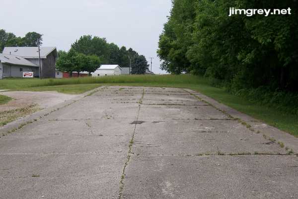
I backtracked to 870E and drove over the creek on US 36. Last time I was through here, I couldn't find the road leading to the creek from the other side. That's because it was pretty well hidden. On the map above, a tiny connector road just east of where the map mistakenly shows old US 36 merging into current US 36, provides access to a tiny segment of cement pavement that seems just to provide access to a couple homes. Here's its east end. I considered walking to the end to see if there were more road beyond what looked like a mound of dirt with weeds growing out of it, but figured I'd be trespassing.
I turned around and took this photo of the west end of this segment. US 36 is just steps to the left, which is south.
|
||||
|
||||
|
Created 27 June 2007. Updated 26 August 2007. |
||||