US 40 and the National Road in Western Indiana |
||||
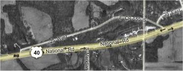
Deer Creek segmentAfter we crossed US 231 in Putnam County we began looking for a segment of an older US 40 alignment, marked as a county road, that crossed Deer Creek. It appeared to run about 1200 yards.
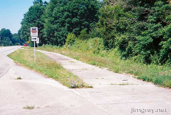
About a mile past US 231, we found a section of cement road running parallel to US 40 marked with a Historic National Road sign. It is a curious segment, one lane wide, with two exits back onto the current road. I took this picture pointing west at the first exit; there is maybe 50 feet of old National Road behind me. If you squint really hard at the map, you can see part of this segment.
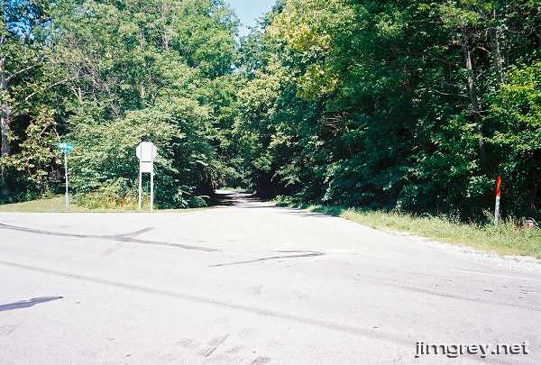
Just beyond this strip was the segment we were looking for. Windows Live Local called it E CR 550 S and 25 West, but it was signed as CR 35 E. This part of the road seems unlikely to have been US 40 or the National Road because it doesn't blend neatly with the current alignment. Sometimes, using the satellite images on Google Maps or Windows Live Local, you can trace where the original road might have gone because a faint ridge flows naturally out of a road, where the road was turned to meet US 40. There was no such ridge on the maps here. Perhaps the segment of National Road we had just encountered used to flow gracefully into this alignment.
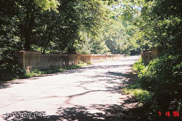
I wish I had paid better attention to the type of pavement on this segment, because that might have given some clues. Dawn and I noticed that a road created to access an old segment is frequently of one material or is newer, while the old segment is of another material or is older. The pavement leading up to and going away from the bridge was cement, but I failed to note whether it contained the chipped rock we saw before. Next time, I'll have a better idea of what clues to always write down. The bridge over Deer Creek was peaceful. It seemed like a bridge in the middle of nowhere -- even though US 40 was 100 yards to our south, all we heard were the birds and the breeze. While the road was clearly maintained and used, we encountered no traffic while we explored it. We walked the bridge's length and lingered here for a while.
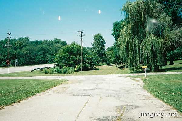
This alignment ends at a left turn back to US 40. It seems clear that this turn was added, but looking straight ahead in this photo there's no evidence that the road ever went that way. Notice how asphalt was paved over the cement as the road turns left to rejoin US 40.
|
||||
|
||||
|
Created July 2006. Last update 26 May 2007. |
||||