US 40 and the National Road in Western Indiana |
||||
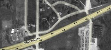
State Prison segmentThe State Prison at Putnamville maintains and uses about 500 yards of old US 40 and/or National Road alignment on its grounds. However, not only could we not access it, signs along the road warned us not to stop. We got no pictures, so all I can show you is the map.
Notice how this segment, which starts in the upper right corner of the map, appears to flow at a graceful angle out of the current road. The road appeared to be very well maintained, better than segments that had been made into county roads. |
||||
|
||||
|
Created July 2006. Last update 26 May 2007. |
||||