US 40 and the National Road in Western Indiana |
||||
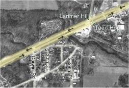
Toad HopWhen I was in college in Terre Haute, I had a friend who worked for a crappy little radio station. He invited me to come visit him one day while he was on the air. He gave me directions: "Take I-70 to the Darwin Road exit, then turn left on Old US 40. Then look for our tower and just follow the roads until you get to it." What? "Yeah, the station's out in Toad Hop, and the roads aren't marked back there." Toad Hop? What's that? "That's just what this area is called. And by the way, if you get lost, don't stop to ask directions, because the locals aren't too friendly." Toad Hop was famous for the big tire fire. People had been dumping used tires into a gully for years, and some yahoo lit the pile. It burned for months. You could see the smoke from Terre Haute. Even though Toad Hop was not the most welcoming place when I first visited, I remembered that my friend mentioned that "Old US 40" ran through it. So Dawn and I were off to Toad Hop. Before we got there, just after we crossed the Wabash river and entered West Terre Haute, we encountered what looked like an old alignment of US 40 since it kept going straight where US 40 curved. That road was even made of cement. I used to drive that stretch when I'd go visit a girlfriend at St. Mary-of-the-Woods College; it was a shortcut to US 150. It's signed Paris Road and it leads to Paris, IL, which is far north of US 40. I traced the map and couldn't find any reasonable way this could have worked its way back to US 40. I may have to find an old Indiana map and look this up. Unlike the other alignments we had visited, the Toad Hop alignment of US 40 doesn't flow nicely out of current US 40, as the map shows. The old alignment begins after what looks like a missing bridge just right of center of the map. Notice how, if you follow the curve of the road there, that it flows right into that road that flows north from US next to the Larimer Hill label. I traced it back, but couldn't find a workable route back to US 40 on the map.
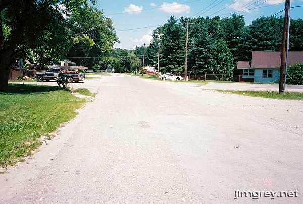
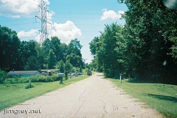
To reach this segment, we turned left off US 40 onto Darwin Road. We actually drove east in hopes of seeing where that bridge had been, but the road was lined with houses and trailers. The area looked no friendlier than it did when I was last there umpteen years before. To be safe, we took pictures from the Darwin Road intersection. This photo shows old US 40 eastbound from there, aiming right at that alleged bridge.
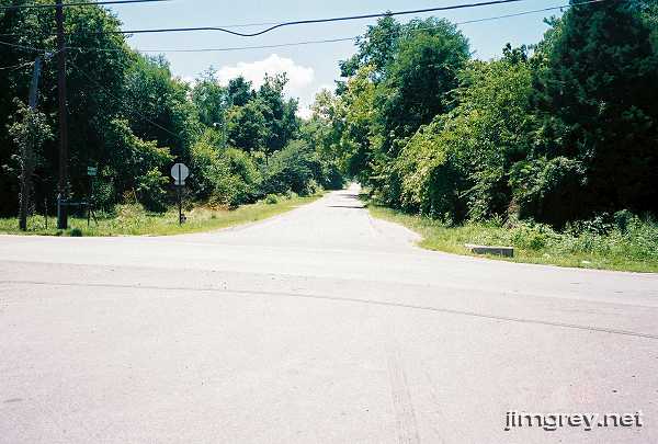
Here's the westbound outlook. This segment seems kind of narrow (though some of that could be due to grass and weeds growing over the road's edge); we wondered how long ago this was US 40.
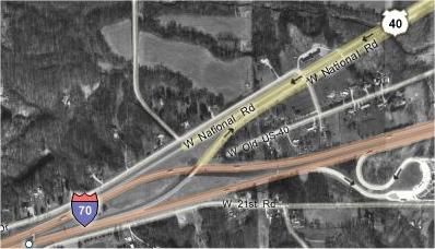
I'm not sure how long this stretch was, but the only longer stretch was Indiana 340. The map shows how this segment dead ends right into the merger of current US 40 and I-70. But notice how, if you backtrack from the dead end to the first crossroad, then cross over current 40, and then turn left, you end up on a road that eventually runs on the same line as this segment.
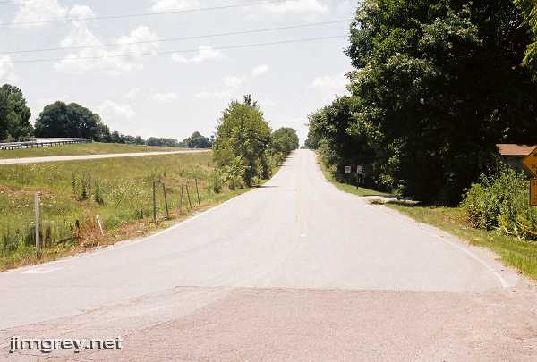
We first explored the dead end. Based on that nearly 20-year-old warning, I was feeling pretty skittish about driving too close and getting out of my car to take a photo, so I hung back and took a photo through my windshield. The road appeared to disintegrate into the grass.
Then we doubled back and crossed over to that road on the other side of US 40. We could see on the map that this road becomes US 40 in Illinois, so we felt confident that we were on the right track. As soon as we crossed over US 40 and made that left, we were immediately rewarded to see a Historic National Road sign. Unfortunately, the sign is hard to see in the photo. Follow the right edge of the road until you see two signs next to each other. A speed limit sign is on the right and the Historic National Road sign is on the left. The road's stripes were faded, but the road was otherwise in fine condition.
It seems likely that this road was built at the same time as current US 40 just to link to the old road that resumed where the US 40 and I-70 multiplex drifted south enough to allow it. That road is on the same line as the Toad Hop segment, after all. We wonder whether this small stretch was ever actually the National Road. |
||||
|
||||
|
Created July 2006. Last update 29 February 2008. |
||||