US 50 in Indiana |
||||
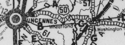
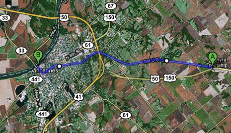
Knox CountyUS 50 has had three major alignments in Knox County. The first ran considerably north of US 50's current path. (From a 1927 Indiana State Highway Commission map.)
Then US 50 was moved south to what I believe was mostly a new-terrain road (but don't cite me on it). It was a much straighter and smoother path at any rate. US 50 still follows this path, at least until it gets to Vincennes, which it now bypasses. That's the third alignment of which I speak.
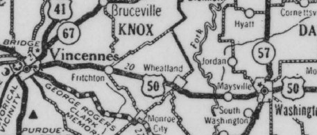
When the US 50 expressway was built, it bypassed tiny Wheatland.
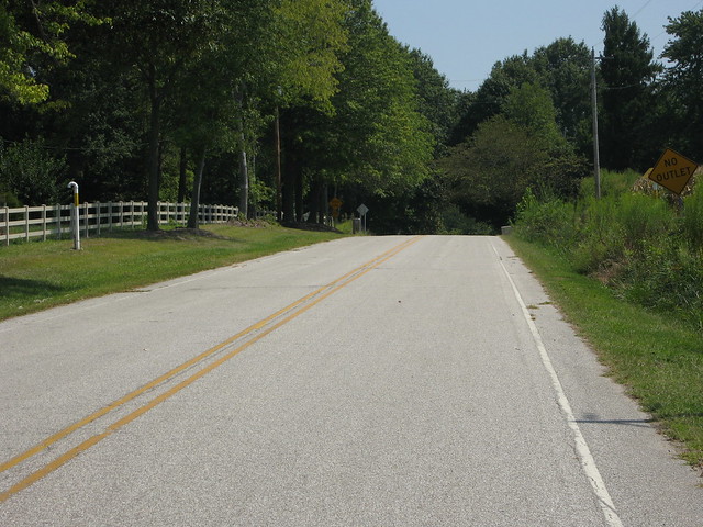
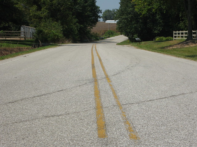
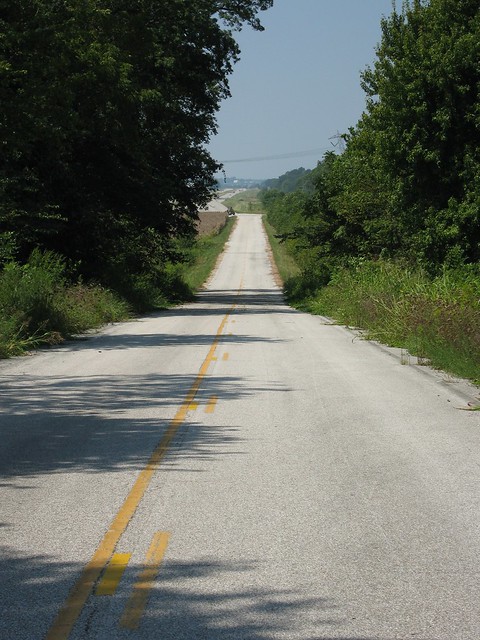
I turned off US 50 on the first available side road as I drove westbound. This was the eastbound scene on old US 50...
and the westbound.
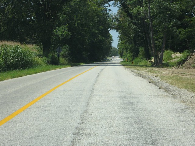
I passed through Wheatland, of which there is not much, and soon the end of the road was in view.
I drove to the end, because that's what I do.
And then I made my way to Vincennes. Can you imagine Revolutionary War soldiers marching down US 50 to save Vincennes, Indiana? They did. Well, sort of. Vincennes was founded in 1732. You just don’t find European settlements any older than that in Indiana. And it’s not like the French, the first Europeans to settle here, came up with the idea on their own; the area had been populated for thousands of years by American Indians. So it was the Indians first and then the French, and then the British took control in 1763, and finally the Americans took Vincennes in 1778 during a Revolutionary War campaign. It’s no mistake people settled here; it’s where an ancient buffalo migration route met the Wabash River. What buffalo had tramped smooth, man liked to follow, and so the Buffalo Trace was the most major road in what would become Indiana. American troops in that Revolutionary War campaign followed it to Vincennes. It became an important settlement route, leading Indiana Territory governor William Henry Harrison to order it improved in 1804 and the new state government to order it improved again in the 1830s (at about the same time the Michigan Road was built). Young Abraham Lincoln and his family, in their journey out of Indiana, joined the Buffalo Trace to reach Vincennes and cross the Wabash River into Illinois. In the early 20th century, the first alignment of US 150 from New Albany to Vincennes was laid more or less along the Buffalo Trace’s corridor. US 150 has, of course, been straightened, widened, and outright moved many times since then and bears little resemblance to the Buffalo Trace’s original path. But since this segment of US 150 is the Buffalo Trace’s direct descendant, efforts are underway to honor it as a National Scenic Byway. US 50 is part of this story because it joins US 150 from the east at Shoals. The modern US 50 expressway barely touches Vincennes, but the old road splits off east of town and makes a beeline for downtown.
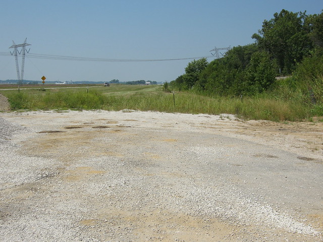
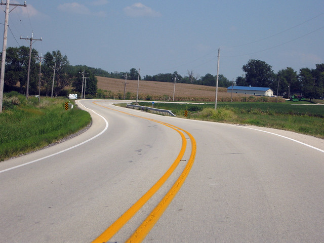
Where the old road splits off, the scene is typical rural Indiana. Dig that crazy single center stripe. It seems to be colloquial to Knox County roads.
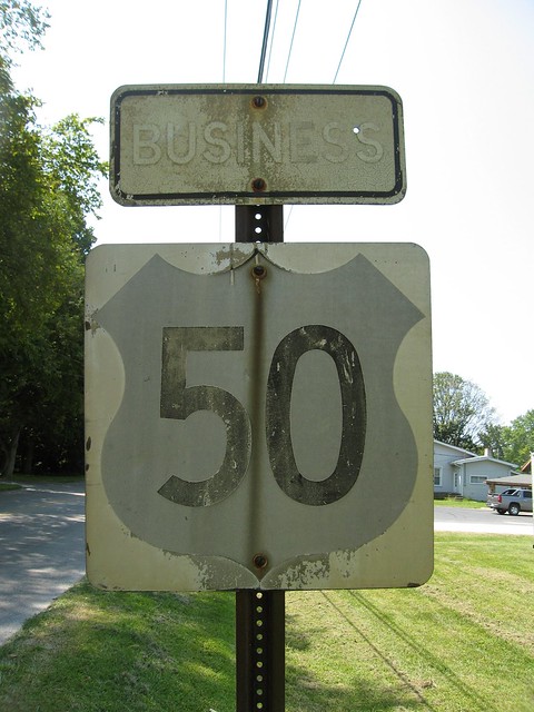
Inside Vincennes, I found one remaining nod to this road’s former glory – this US 50 sign. I puzzled over the white/gray/black scheme on this sign – I’d never seen anything like it, not even in old road photographs. So I visited the AARoads forum, which is the largest concentration of road-sign fans on the Internet. I posted this photo and asked about it. Consensus is that the white portion around the shield faded from black, and that the gray shield would look white if the black border hadn’t faded. After browsing the AARoads Shield Gallery for a while, I decided that this sign dates to the 1960s, maybe as early as 1961. If I’d been standing out in the weather for more than 40 years, I’d look pretty faded, too.
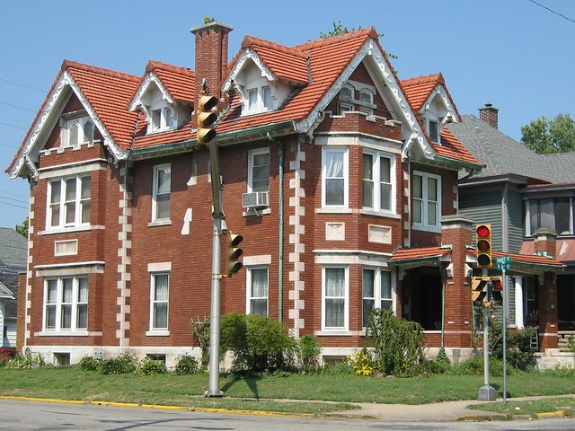
Plenty of great old homes stand on Old US 50 as it makes its way to downtown Vincennes. This is a great example.
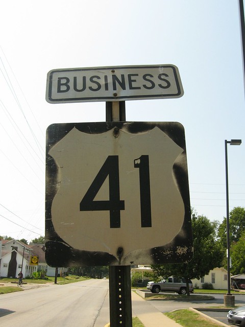
I don't think this US 41 sign (which once ran concurrently with US 50 through the heart of town) is as old as the US 50 sign I found earlier, but it's still no spring chicken.
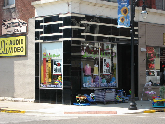
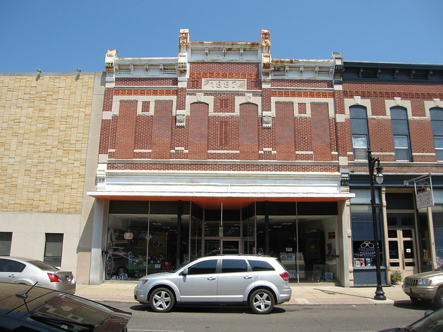
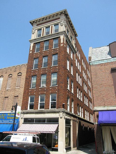
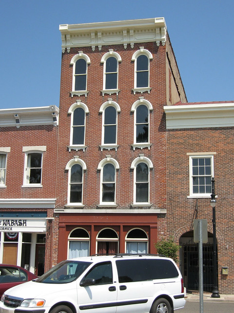
The old road also passes by at least one old neon sign and a few former service stations converted to various purposes. And then it reaches Main Street, where it hangs a right on its way to the Wabash River. But before it gets there, it passes by five blocks of downtown lined with great old buildings, some of which date to the middle and late 1800s. Many buildings appear to be in good original condition or restored.
The Pantheon Theatre at 5th and Main looks solid from the outside, but signs on the windows seek donations to have the interior restored.
This corner is covered in Vitrolite, a type of glass paneling.
I snapped a lot of photos on Main Street, with my dog in tow on the leash. It seemed like everywhere I looked, there was a great old building dripping with character.
I imagine this building, which hearkens to Greek times, was once a bank.
I like this building's confidence.
I don't know if these windows are original, but if they're not, my hat's off to the owner for replacing them with windows that actually fit the opening. It's expensive to have windows custom made, so very often old windows are replaced with standard-sized windows that ruin the building's charm -- or are simply bricked in.
Shortly my dog and I reached the end of Main Street.
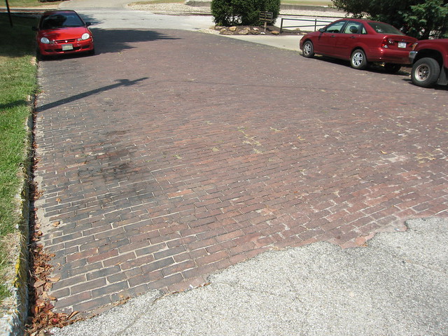
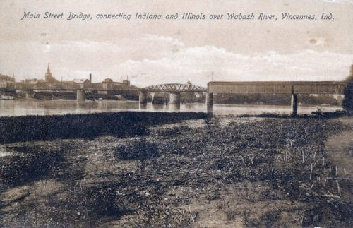
Main Street and old US 50 in Vincennes ends at the Wabash River today, but until the early 1930s a bridge over the Wabash River connected Vincennes to Illinois. I found brick pavement (dating probably to the 1920s) in the last block leading up to the river.
I also found postcard images of the bridge that once connected Main Street to
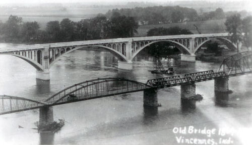
Illinois. The old bridge itself was quite a contraption. At its center was a
swing bridge which
pivoted 90 degrees to allow boats to pass. Originally, wooden covered bridges
connected the swing bridge to both shores. In researching this bridge at my
favorite bridge site, bridgehunter.com,
I found these postcard images that show how the bridge evolved.
This postcard image from the Illinois side shows the covered bridge better.
The Lincoln Memorial Bridge was completed one block to the south (and US 50 was rerouted onto it) in 1932, but this image suggests that the old bridge stayed in service for a while. By this time, the bowstring arch spans on the swing bridge had been replaced by Pratt pony truss spans, and the covered bridge on the Illinois side by Parker through truss spans. (Pratt and Parker are kinds of trusses; they differ primarily in that Pratts are flat on top and Parkers appear curved on top. Pony trusses are open on the top; through trusses have connecting members across the top.)
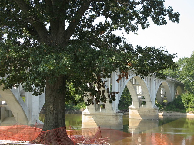
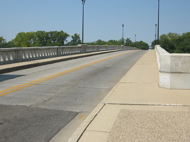
The Lincoln Memorial Bridge still stands, though it hasn’t carried US 50 in some time.
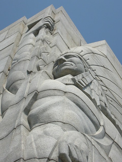
At the end of this bridge in Illinois, a great monument stands commemorating the crossing of young Abraham Lincoln and his family into Illinois. If you stop to see the monument, you can see that the old highway leading away from where the old bridge once stood remains on the Illinois side as well. It, too, is brick. (I wrote about that road here.) The Lincoln Memorial Bridge is about my favorite bridge in Indiana, and the Indians carved into the columns at its entrance are no small part of why.
Here's the view as the bridge takes you into Illinois.
I regret not walking across this bridge into Illinois. But I felt a little pressed for time, and I still had the original alignment of US 50 to follow back to Washington. I made my way back the way I came. At about where I found the old US 50 sign, I turned off Old US 50 and made a couple turns to reach Old Wheatland Road – Old Old US 50. This is the route I followed, which is my best guess at the route in the 1927 map segment I showed at the top of this page. The overall shape is right, but it's possible I didn't get a couple details right.
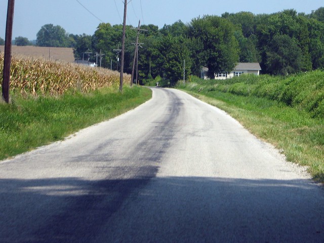
In no time flat, I was back in the country.
After I posted these photos to my Flickr space, a fellow who follows me there and who grew up in Vincennes confirmed for me that this was US 50's original route.
After a bit more than eight miles, Old Wheatland Road reached State Road 550. Actually, it's pretty clear that SR 550 follows Old Wheatland Road from this point.
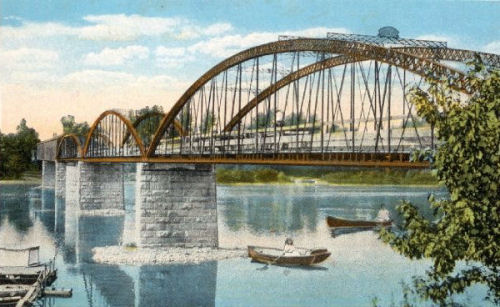
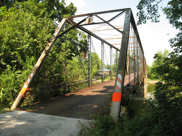
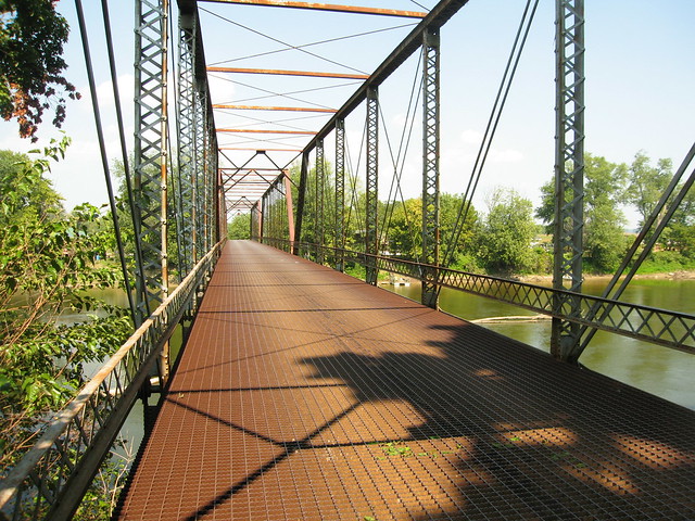
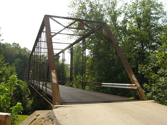
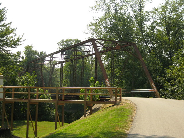
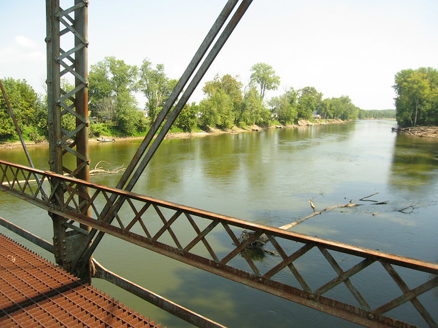
SR 550 passes through Wheatland, but Old Old US 50 turns left onto Green St., which becomes CR SE 700 S. Soon enough, Old Old US 50 comes upon this beautiful old bridge that spans the White River.
I can't decide whether my favorite part of this trip was the super long old alignment in Jackson and Lawrence Counties or this alignment that spans Knox and Daviess Counties. But I do know for sure that my time on this bridge was the most peaceful on any part of this trip.
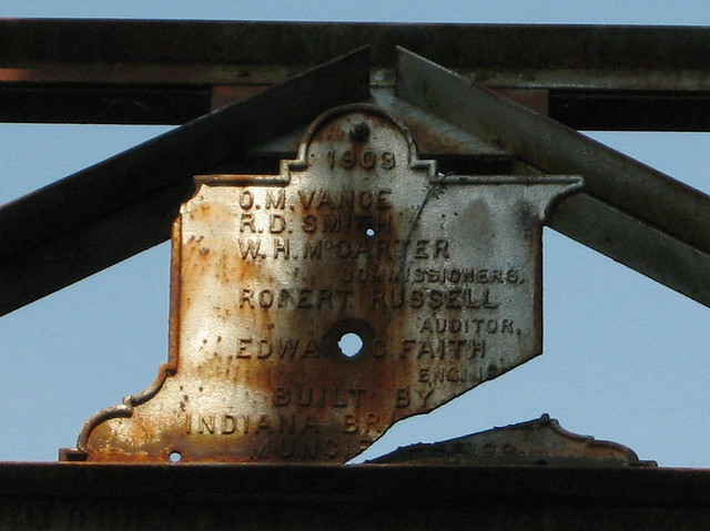
This three-span Pratt through truss bridge was built in 1909 and rehabilitated, including replacing its original wooden deck with a steel deck, in 2006.
It is listed on the National Register of Historic Places.
I spent a lot of time on this bridge and never encountered another car. Several houses stand (on stilts) next to this bridge and I felt a little jealous of the families who live in them, as they get to enjoy both that peace and this bridge every day.
Really, this whole drive was peaceful and quiet. It was a warm, still day, so I had been driving with all my windows down. Country scents of crops and livestock wafted in and out of my car, and drivers of the few trucks I encountered all waved as we passed.
I kept enjoying these things as I pushed on from here to Washington, where my summertime exploration of US 50 came to an end. And I have Elias Conwell to thank. |
||||
|
||||
|
Created 2 January 2011 |
||||