The Michigan Road |
||||
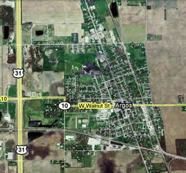
Marshall CountyMuch of northeastern Indiana, including what is now Marshall County, was purchased from the Potawatomi Indians via treaty in 1832. Marshall County was formed on July 20, 1836. It was named for Supreme Court Chief Justice John Marshall, who died the previous year. The Michigan Road came to Marshall County by 1838. Sources: Argos has roots to 1833 when Sidney Williams bought some land here and built a tavern and an inn and even helped build some of the Michigan Road. A town eventually built up around Williams's land and was named Sidney after him in 1851. In 1856, an adjoining town called Fremont was organized. In 1859, the towns were consolidated and named Argos. The town was incorporated in 1869. Argos, which remains a small town, was hard hit when US 31, which had formerly followed the Michigan Road, was moved to bypass the town. This map shows that current US 31 is very close to Argos. Source:
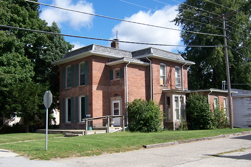
This old house stands near Argos's southern edge. I like its arched windows and door.
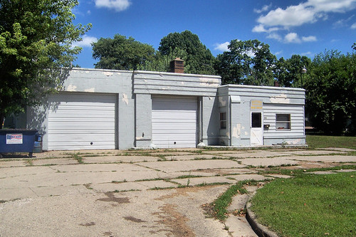
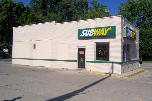
This was probably once a service station. Notice how the second bay, on the left, was added sometime after the original bay and office were built.
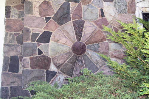
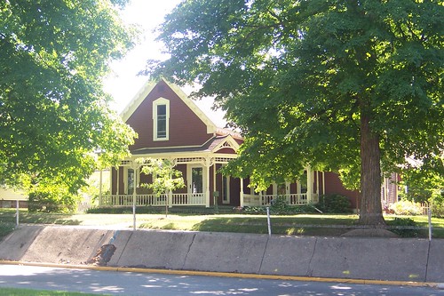
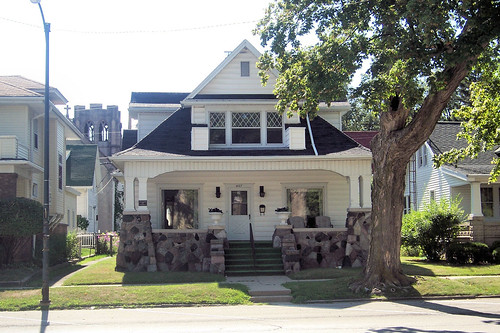
This house is quite a hodgepodge. It looks like the original part of the house was built in about the 1850s, and that the front part with the stone work was added in the early 1900s, perhaps as late as the 1920s. The stone work is by a local fellow named Foker who did similar stone work throughout the area. There's a lot of it on display on the Michigan Road in Argos.
Wheels and stars were common themes in Foker's work.
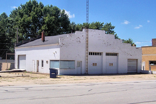
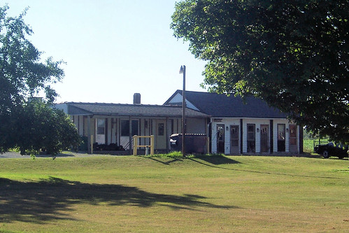
This may be an old automobile repair garage.
Another former service station on the south edge of downtown.
In downtown Argos, this State Road 10 sign is well past its time for replacement. Notice the non-standard typeface for the 10.
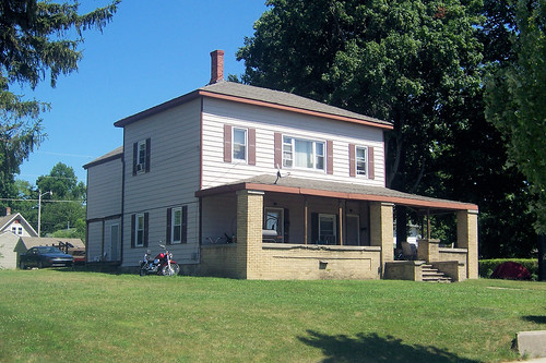
This house, which probably was built in the 1840s, is said to have served as an inn during the Michigan Road's early years. The two-story section in the middle of this structure is probably the original house; the porch and rear section came later.
An old theater, formerly named the Princess and also the Lido, stands next to the old service station in downtown Argos.
A faded Kreamo Bread advertisement has faded on the side of this building, but its slogan, "America's Finest," can still be made out.
The whitewashed building used to be an opera house. I'm told it was a dime store in the 1980s.
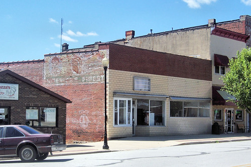
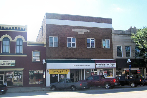
This, the 1883 W. D. Corey building, was once Holland's Hardware but is now mostly vacant after a fire. The white storefront still operates as a bar.
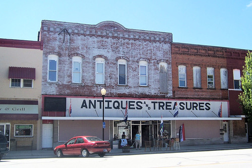
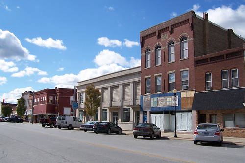
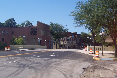
Downtown Argos shows every sign of a town hard hit when its major highway left.
Just north of downtown, two homes on the National Register of Historic Places face each other. This one is from 1890.
This one is from 1892.
This northbound shot from in front of the 1890 house shows the road in Argos's northside residential district.
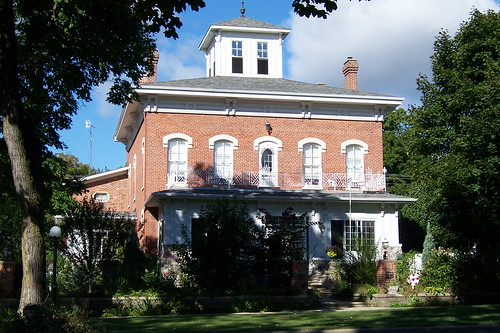
The man who founded Argos built his home on this spot. The rectangular two-story portion of this house may be that house, and if so, it was built in the 1830s. Everything else would have been added later, probably in the early 1900s.
Another Argos house with Foker stonework.
This house probably dates to the 1840s; logs may lurk behind that siding.
The vacant Fuller Baptist Church building, built in about 1860, stands on the northeast corner of Church St.
Just up the street is the Argos Wesleyan Church building.
On the northern outskirts of town stands Beamer's Drive-In, which had closed the day before I took this photo, so there was no chocolate malt for me.
An old schoolhouse, converted into a residence, lurks behind the trees. I normally don't include buildings so hidden, but this was such a colorful shot and it captured the beauty of this day perfectly.
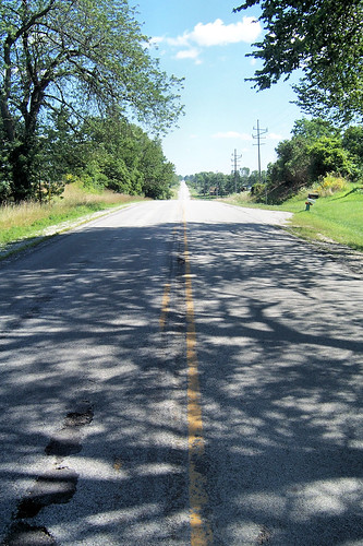
Northbound from the converted schoolhouse, the road tracks perfectly straight.
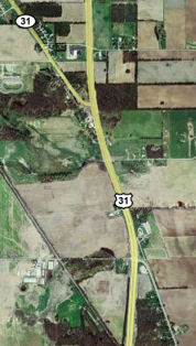
Shortly, the road curves to meet current US 31. The Michigan Road follows US 31's path for about ¾ mile. (The map incorrectly labels the Michigan Road as State Road 31 in the upper left corner.)
This southbound shot shows where the road curves to meet US 31 at a right angle.
Northbound from the same spot, this stub of the Michigan Road is left behind. I've driven by here hundreds of times in my lifetime and it seems like trailers are always parked here.
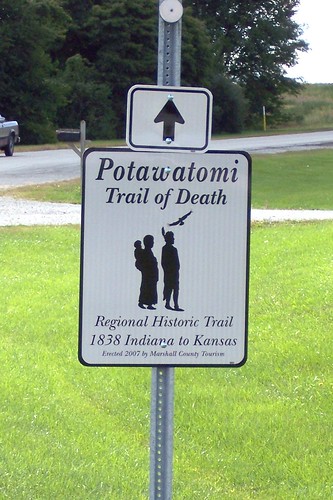
The northernmost Potawatomi Trail of Death marker on the road appears here.
The Michigan Road follows US 31's current path only very briefly. This shouthbound shot shows a stub of the original road.
Travelers make a left onto a brief four-lane modern alignment of the road, however.
The modern alignment shortly curves to follow the original alignment, as this photo from the stub shows.
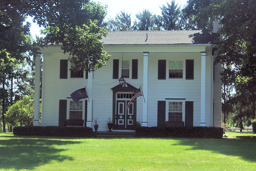
Almost as soon as the road curves to its original alignment, it passes this, the Tabor House, home of the first white settlers in Marshall County. If you don't know it's there, you will probably not see it.
Just south of Plymouth, this house was originally an inn on the Michigan Road. It also served some government purposes, elections and council meetings and such, in Marshall County's early days, given that it was at the time the only quasi-public building in the county.
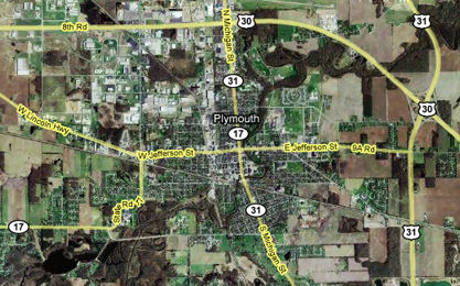
William Polke, Michigan Road surveyor and commissioner, is said to have been the driving force behind locating Plymouth where the Yellow River and the Michigan Road intersect. He even named the town, although it's not clear why he chose the name. Plymouth was incorporated as a town in 1851 and as a city in 1873. This map shows the town, the Michigan Road its main street, in the context of its current and former highways. US 31 bypasses it to the east and US 30 to the north, but at one time these two roads intersected downtown at Michigan and Jefferson Sts. Jefferson St. is the 1928 alignment of the Lincoln Highway. Sources:
Oak Hill Cemetery stands on Plymouth's south side.
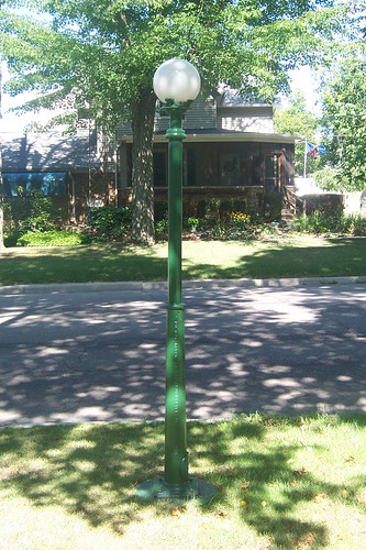
Plymouth's Michigan St. is rich with 19th-century homes -- so much so that to keep this already-long page within reason, I created a separate page for most of Plymouth's old homes. To see the old homes on the Michigan Road in Plymouth, follow this side trip. These light posts line Michigan St. in the residential districts north and south of downtown. They're original. Look closely at the base, which reads "DO NOT HITCH TO THIS POST CITY OF PLYMOUTH."
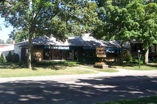
Felke Florist has a great neon sign, which I've seen brilliantly lit when I've driven through Plymouth in the evening. One day I'll have my camera with me on such a night.
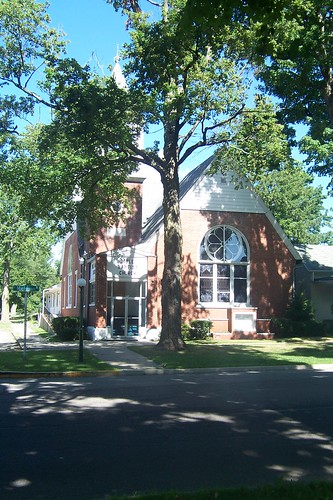
The Bible Baptist Church.
The main building of the Trinity United Methodist Church, which was formerly the United Brethren Church, is from 1926.
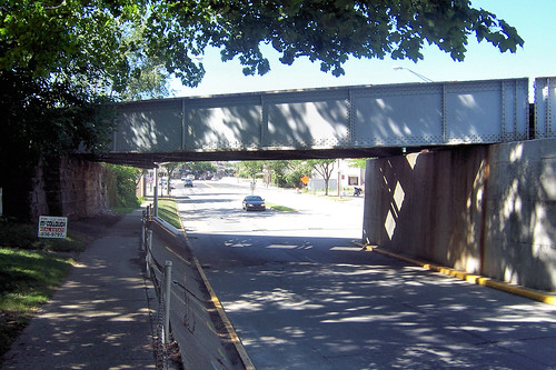
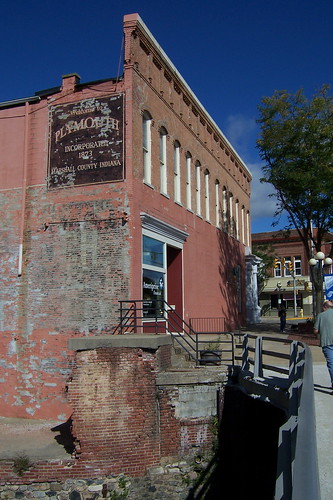
The fellow who lives in, and is slowly restoring, this 1850s house gave me a personal tour of his town (and of Argos and Rochester, too), and pointed out the most interesting homes along the way. This house is just south of the railroad viaduct and downtown. The road was lowered when the viaduct was built; hence the concrete retaining wall.
The viaduct from the retaining wall.
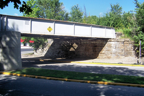
Check out that stone abutment.
Don't tell anybody, but we climbed onto the viaduct to get a few shots. This long shot is southbound.
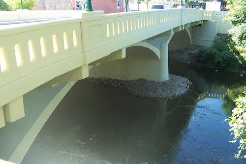
I zoomed in tightly to frame downtown and the newly restored Luten bridge in this northbound shot.
Here's the same scene from the ground.
The rail is new in the restoration, but is sympathetic to those built during the time this bridge was new. Before the restoration, a steel guardrail kept cars out of the drink.
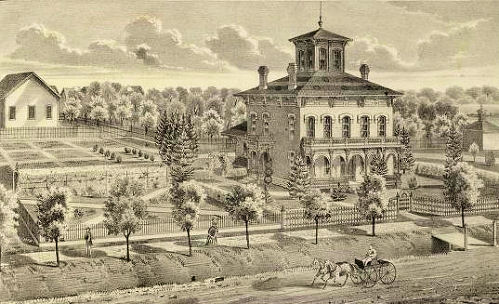
The Marshall Co. Trust and Savings Co building stands on the river.
Here's the same building from the northeast.
This northbound shot is from the Trust and Savings Co. corner. That's another former bank building on the opposite corner.
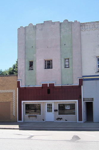
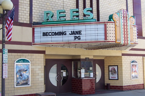
Across Michigan St. from that former bank is the 1939 Rees Theater, restored not long ago to its Art Moderne glory.
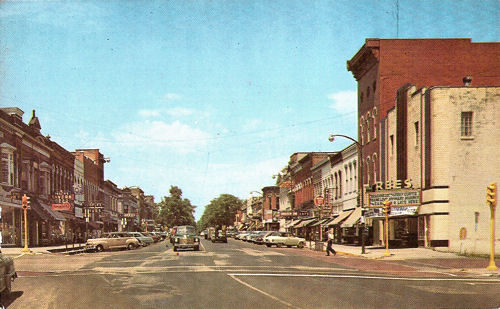
This postcard photo from probably the mid 1950s shows the Rees marquee in its context.
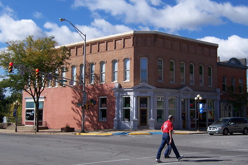
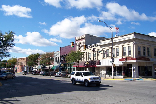
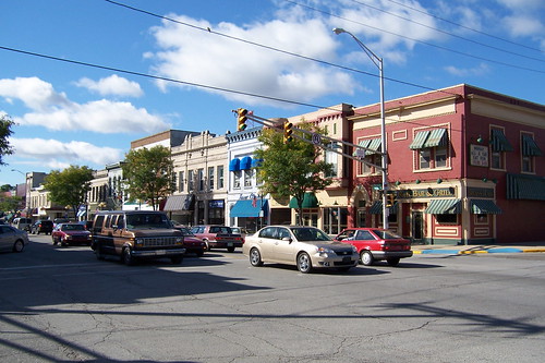
Downtown Plymouth is remarkably vibrant. It is one of the gems of the Michigan Road. Greensburg is the only other similarly-sized Michigan Road town with a downtown that competes. This photo is southbound from Garro St.
Plymouth must have been quite the financial center in its day, because here's another bank building, on the northwest corner of Garro St.
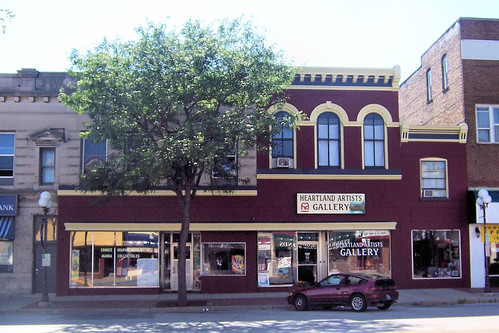
This colorful building from 1884 stands on the northeast corner of Garro St.
The maroon building with three second-story windows is the Bergman building, built in about 1856.
Its neighbor was once the Rialto Theater.
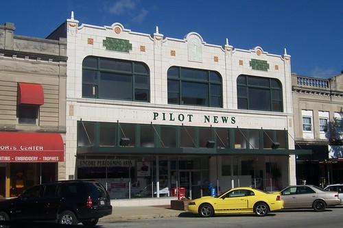
Across the street, the Plymouth Pilot-News occupies what was the first Montgomery Ward retail store in the nation. I'm told this building housed J. C. Penney in the 1980s.
A southbound photo from Washington St.
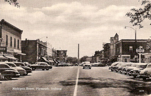
Here's a straight southbound shot from the early-to-mid 1950s from just north of Washington St.
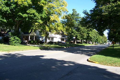
North of downtown, Plymouth becomes heavily residential again. That fellow Foker brought his stonework into Plymouth, as well, but it's not as common on the Michigan Road here as it is in Argos.
This former service station stands on the northeast corner of Jefferson St., which is a former alignment of the Lincoln Highway.
This looks like it was once simply a house, but now the First Assembly of God meets here.
Horace Corbin, a lawyer, came to Marshall County in about 1852. He became a judge and a land officer, and when the town of Plymouth became a city in 1873, its first mayor. He and his wife lived here until 1903. The house has been restored in the past ten years, and my hat is off to the current owners for the effort and expense involved in keeping this link to the city’s history alive.
The house is in a typically dense neighborhood today, but that was not always so. I'll bet that when Corbin built it, it was out in the sticks! Here's what the house looked like in 1876. It’s from the David Rumsey map collection.
This is what the neighborhood around the Corbin house looks like today. Northbound.
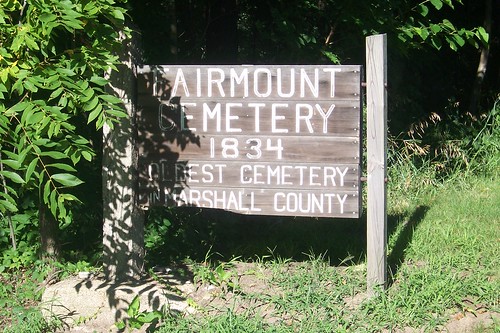
North of Plymouth lies Fairmount Cemetery, Marshall County's oldest, from 1834.
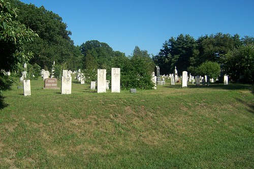
Many of the graves show markers typical of the period.
North of the cemetery is the Tri-Way Drive-In Theatre, so named because it is near US 31, US 6, and US 30.
Here's its great neon sign in action. Many thanks to the fellow who honked as he passed me, causing me to come out of my skin.
The Michigan Road merges with US 31 north of Plymouth.
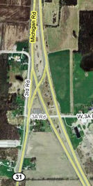
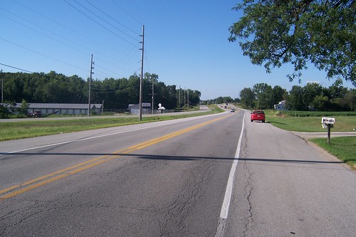
Here's the northbound view from the ground. Notice the road on the left, labeled 3rd Rd. on the map. Where it curves slightly west is where that road becomes the Michigan Road and the road on the right ceases to be the Michigan Road. But then if you follow the non-Michigan Road, you will soon merge with US 31 northbound. I'm pretty sure the Michigan Road follows modern US 31's southbound lanes.
Here's a shot of the Michigan Road (3rd Rd.) showing where it used to go straight across that median.
In the foreground is the southbound ramp that connects US 31 to Old US 31 and the Michigan Road. The northbound ramp flies over current US 31 as it curves away to bypass Plymouth.
The scene from two photos ago is right behind the first light post and the bush that's behind it. In the winter, when the leaves are off the trees, you can see how US 31 once flowed directly into what is now 3rd Rd. Southbound.
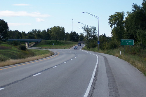
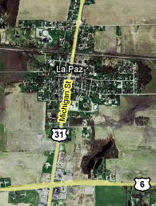
Soon US 31 meets US 6, just north of which lies little La Paz, which was organized in 1873.
This is most of the town.
This is probably a former bank because the door opens to the corner and because the First Source Bank branch is across the street. I've seen many new bank buildings locate close to the ones they replace in little towns. I wonder what's behind the vinyl siding.
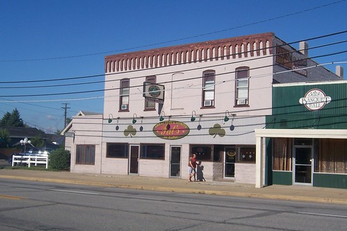
Pat's, a bar, which has been there as long as I can remember.
I wonder if the railroad built these little houses south of the tracks.
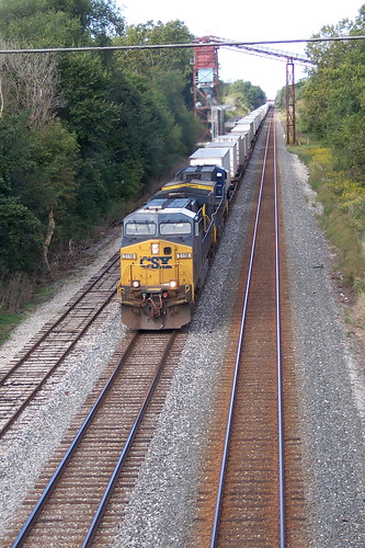
The tracks on La Paz's northside are still in regular use.
A southbound look at La Paz from the railroad overpass.
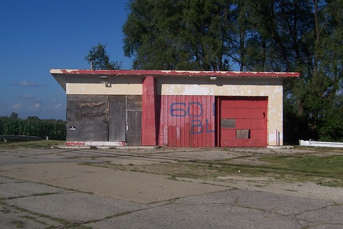
This former service station stands just north of the tracks.
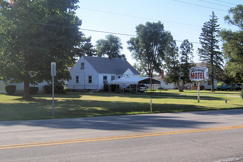
Across the street from the empty service station stands the Birchwood Motel sign.
The motel itself is hard to see from the road. I walked onto the property a bit to snap this shot of the tiny motel, which does not appear to have been used as such in years.
|
||||
|
||||
|
Created 28 January 2009. Updated 28 March 2009, 2 January 2012. |
||||